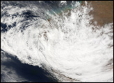
Tropical Cyclone Glenda formed off the northwestern coast of Australia on March 27, 2006. The storm quickly built into a powerful and well-defined cyclone during the next day. Powerful winds have whipped up surf along the coastline of Western Australia’s Pilbara region, and the storm also brought heavy rain to the islands off the Kimberly coast. As of March 28, 2006, the storm had reached Category 4 status and was expected to build power and reach the maximum, Category 5, rating during the next day.
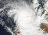
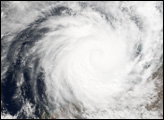
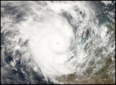
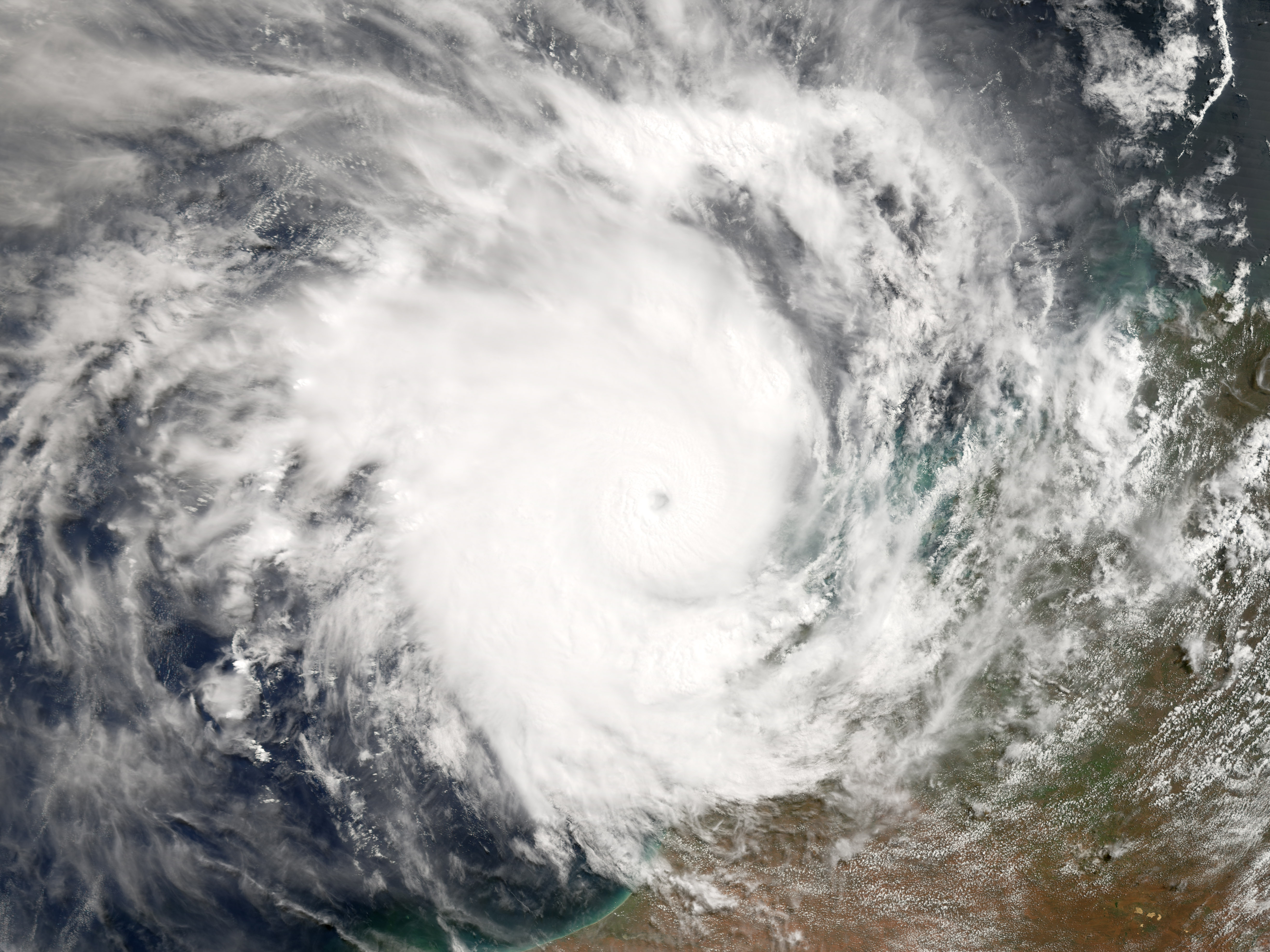
This natural-color image was acquired by the Moderate Resolution Imaging Spectrometer (MODIS) on the Terra satellite on March 28, 2006, at 10:00 a.m. local time (02:00 UTC). It shows Cyclone Glenda as a well-developed storm, sitting 180 kilometers (150 miles) north of Broome. The storm was already large enough that Broome was covered by the edge of the cyclone. Sustained, peak winds in the storm system were roughly 165 kilometers per hour (105 miles per hour) at this time.
The cyclone had been traveling roughly parallel to the coastline, putting the entire coastal area on alert. The area includes not only major pearl-diving operations and beaches that attract tourists, but it is also home to the Northwest Shelf, one of Australia’s major oil fields. The oil fields are located off the coast near Dampier. According to news reports, operators were not expressing concern about the oil field but were planning for necessary shutdowns for safety.
NASA image created by Jesse Allen, Earth Observatory, using data provided courtesy of the MODIS Rapid Response team.