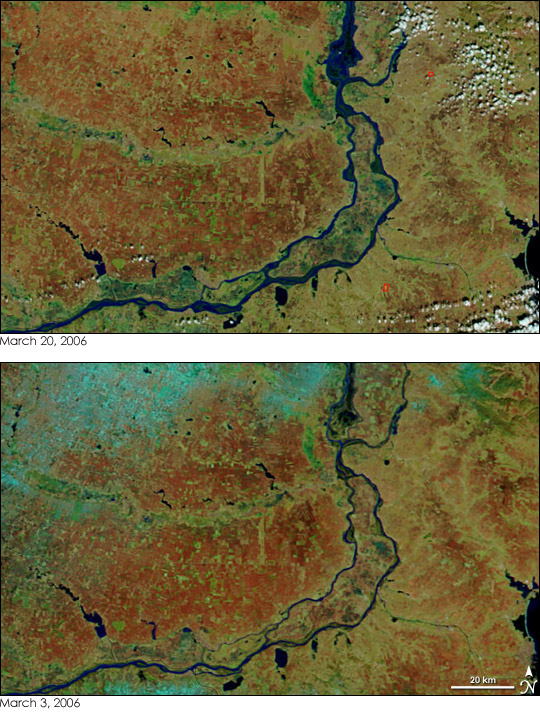
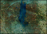
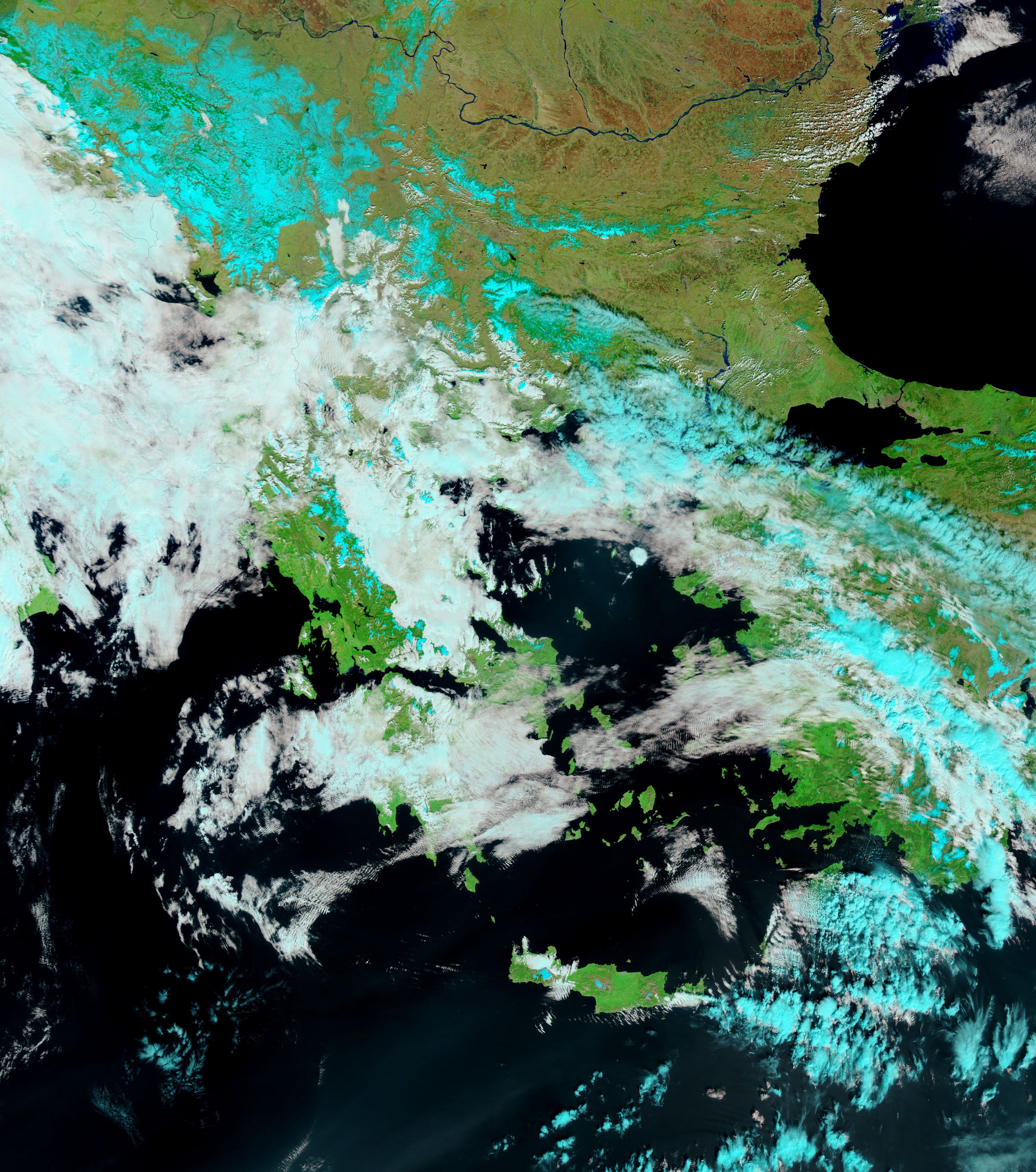
Devastated by floods in 2005, Romania once again faced widespread springtime flooding in March 2006. Reuters reported that as much as 75 percent of the country may be flooded under the combined onslaught of rain and snow falling on saturated ground. These images show a section of the Danube River in Romania as observed by the Moderate Resolution Imaging Spectroradiometer (MODIS) on NASA’s Terra satellite. The top image was taken on March 20, 2006, and shows a river that has swollen considerably since March 3, when the lower image was taken. On March 3, snow dusted the region along the top edge of the image. The snow appears blue in this false-color image. It had melted by March 20, and may have contributed to the floods. The land to the north and west of the river is marked by multi-colored squares formed by agricultural land. Much of the land is brick-red, indicating that it is probably charred from agricultural burning. On March 20, MODIS detected two fires, outlined in red, to the west of the river.
The large images provided above have a resolution of 250 meters per pixel. Daily images of southeastern Europe are available from the MODIS Rapid Response Team.
NASA images courtesy the MODIS Rapid Response Team at NASA GSFC.


