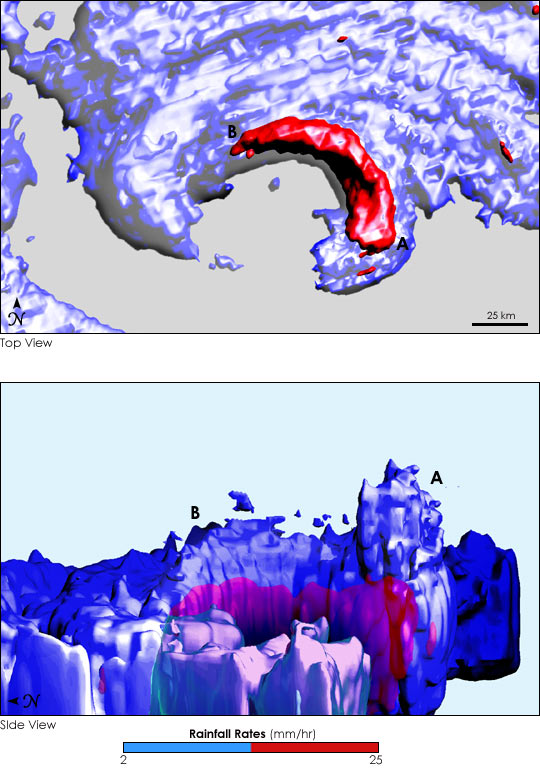
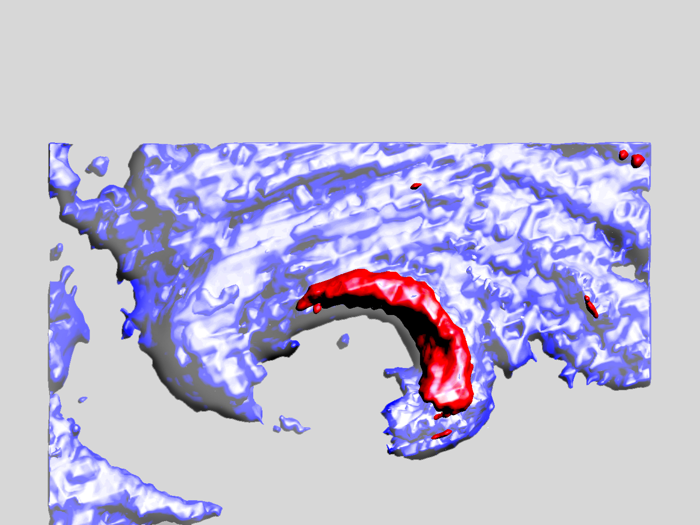
The Tropical Rainfall Measuring Mission (TRMM) satellite looked into the heart of Hurricane Ivan at 05:09 UTC (1:09 AM EDT) on September 15, 2004. This satellite overflight happened approximately one day before Ivan made landfall in Alabama and before Ivan was within range of the National Weather Service’s weather radars. The TRMM Precipitation Radar captured this view of the heavy rain in the eyewall that surrounds the quiet eye of the storm. Unlike the eye, the eyewall is the portion of the hurricane with the most violent surface winds and with strong convective rainfall. Scientists believe that particularly tall regions of rain in the eyewall are associated with increases in the intensity of the surface winds—and wind intensity is particularly difficult to forecast.
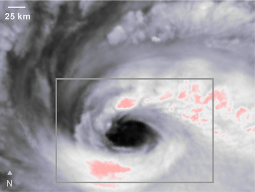
In the top view of the storm, there is a heavy arc of rain between the Points A and B. In the side view of the storm, it becomes clear that the tallest region of rainfall is near Point A. In both cases, the blue three dimensional volume contains all regions where there is light rainfall (at least 2 mm/h) as measured by the TRMM Precipitation Radar. The red volume contains all regions of heavy rainfall (at least 25 mm/h). In the side view, the rain region near Point A is approximately 12 km (7.5 miles) high. The vertical dimension has been stretched to make it easier to see the structure of the storm.
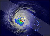
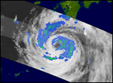
The height of the cloud top is not necessarily the same as the height of the region of rain inside the clouds. In fact, the TRMM instruments show a dramatic difference between cloud height and rain height around the eye of Hurricane Ivan. While the TRMM Precipitation Radar saw the heaviest rain to the northeast of the central eye, TRMM infrared data show a pair of very tall cloud tops to the north and south of the eye. In the infrared image, dark gray indicates warm clouds that are therefore low and white and pink indicate cold clouds that are therefore higher up. The gray rectangle locates the position of the Precipitation Radar image shown above.
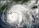
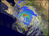
While it was still a day before Hurricane Ivan’s eye reached Alabama, Ivan’s outer rain bands were already brushing past Florida. The large-scale rain features of Hurricane Ivan can be seen in this composite that uses data from the TRMM Microwave Imager (TMI). The gray rectangle indicates the position of the TRMM infrared image. TRMM is a joint mission between NASA and the Japanese Aerospace Exploration Agency (JAXA). For more information, visit the TRMM homepage.
NASA image and caption courtesy Owen Kelley, NASA’s Tropical Rainfall Measuring Mission at Goddard Space Flight Center.


