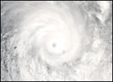
Heta meandered northwest of Samoa over the weekend before turning south and passing just west of the islands on Monday, January 5, 2004. Winds up to 105 miles per hour buffeted the islands knocking out power, uprooting trees, and causing extensive roof damage. After passing Samoa, Heta continued southeast and intensified with sustained winds estimated at 133 miles per hour and gusts of up to 185 miles per hour as it was headed for the tiny island nation of Niue.
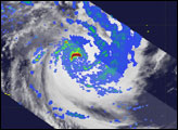
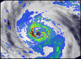
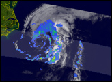
The Tropical Rainfall Measuring Mission (TRMM) satellite captured these impressive images of Cyclone Heta as it was passing just west of Samoa. The images were taken at 6:08 UTC on January 5, 2004.
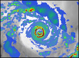
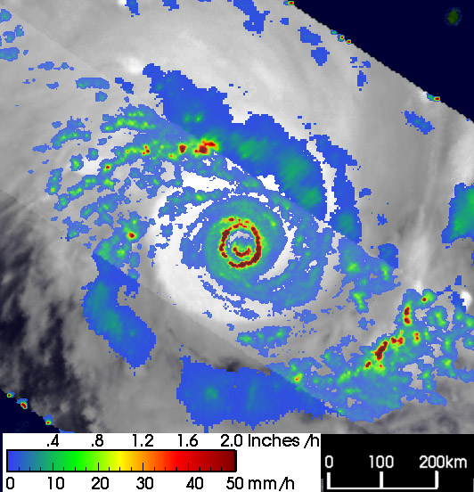
This image shows the horizontal distribution of rain rates as seen from above by the TRMM satellite. Rain rates in the center swath are from the TRMM Precipitation Radar (PR), the first precipitation radar in space, while rain rates in the outer swath are from the TRMM Microwave Imager (TMI). The rain rates are overlaid on infrared (IR) data from the TRMM Visible Infrared Scanner (VIRS).
TRMM reveals that Heta has a double eyewall structure, which can sometimes occur in mature, intense tropical cyclones. The outer eyewall, the intense band of heavy, 2-inch-per-hour rain rates shown by the dark red circle completely surrounds a partial inner eyewall shown by the smaller dark red semicircle. Tropical cyclones act as large heat engines. When water vapor condenses into the cloud droplets that form the precipitation, heat, known as latent heat, is released and drives the storm. Generally, the more heat that is released, the more powerful the storm will become. This heating is also most effective near the center of the storm as is the case with Heta.
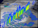
The second image shows a vertical cross section through the eye of the storm from the TRMM PR.
TRMM is a joint mission between NASA and the Japanese space agency NASDA.
Images produced by Hal Pierce (SSAI/NASA GSFC) and caption by Steve Lang (SSAI/NASA GSFC)