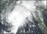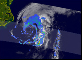
The Tropical Rainfall Measuring Mission (TRMM) satellite captured several snapshots of Tropical Storm Bill, the second named storm of the Atlantic hurricane season, as it got organized in the Gulf of Mexico earlier this week. Bill was first named as a tropical storm at 11:00 a.m. EDT on Sunday June 29th, 2003, by the National Hurricane Center while over the south-central Gulf of Mexico.
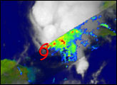
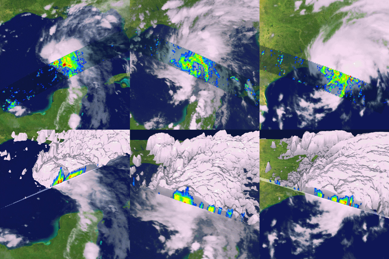
Taken a little over an hour before then, the first TRMM overpass (left column of images) shows a weakly organized center with most of the heavier rain (shown in red) on the east side of Bill. A vertical cross section (bottom image) captured by the TRMM Precipitation Radar (PR) shows a deep convective tower known as a "chimney cloud" penetrating to over 17 kilometers just to the west of the center of Bill. These clouds can be a sign of further storm strengthening.
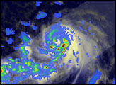
Six and a half hours later, the next TRMM overpass at 4:13 p.m. shows Bill to be slightly more organized as it headed northward towards the Louisiana coast (middle column). Bill slowly strengthened as it approached the coast with maximum sustained winds of 60 mph but never became a hurricane.
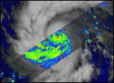
The last TRMM overpass shows Bill coming ashore just east of Morgan City, Louisiana (right column). Most of the heavy rain remained on the eastern side of the center as depicted by the PR.
TRMM is a joint mission between NASA and the Japanese space agency NASDA. For more information on TRMM, please visit the TRMM Website.
Images were generated by Hal Pierce (SSAI/NASA GSFC), story by Steve Lang (SSAI/NASA GSFC).