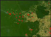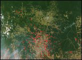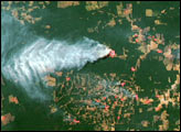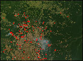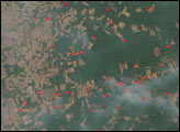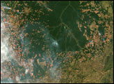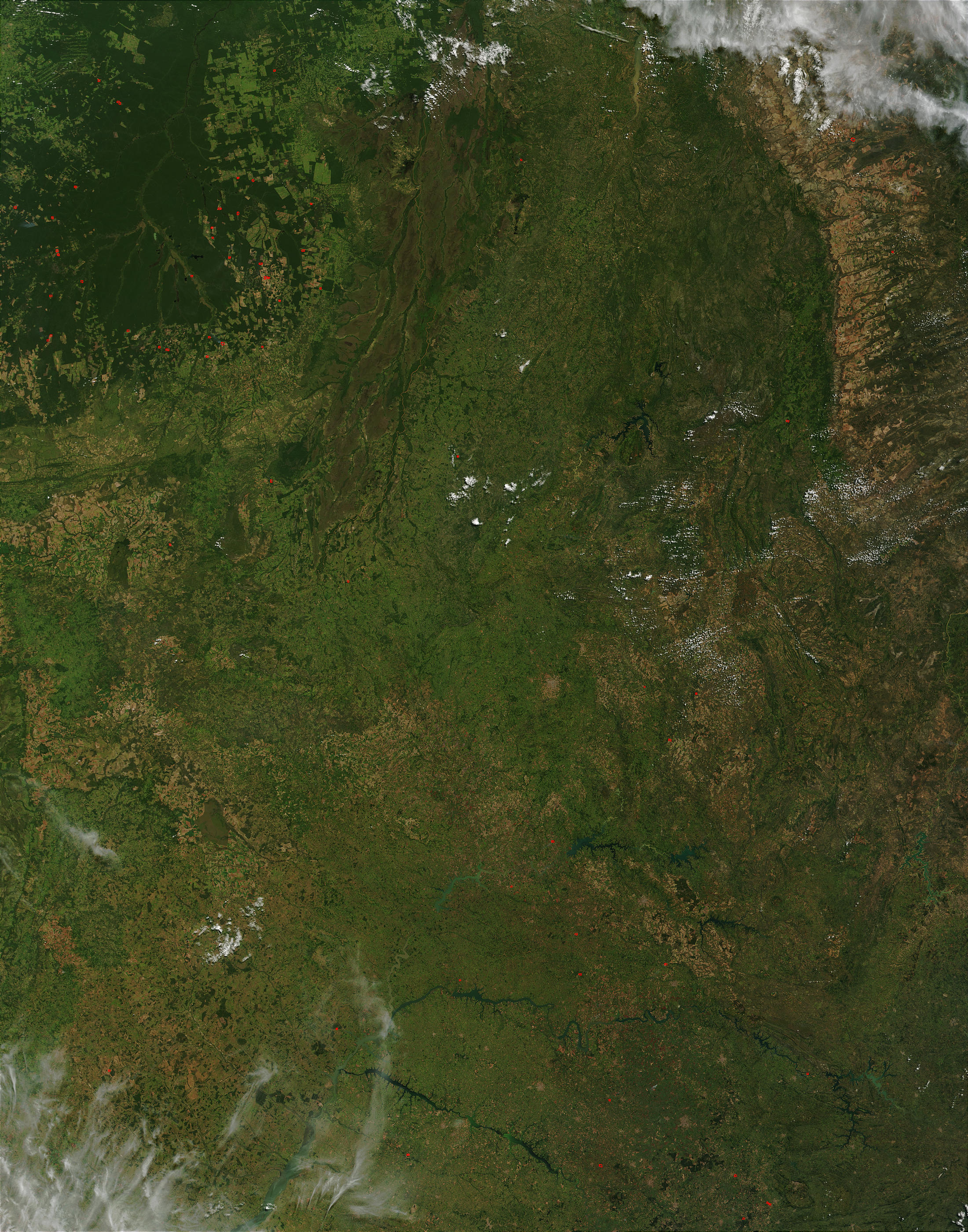
In central Brazil, the headwaters of the Xingu River have become a National Park that is also an indigenous peoples reserve, where several different tribes try to maintain a traditional lifestyle in the shrinking Amazon Rainforest. This true-color Moderate Resolution Imaging Spectroradiometer (MODIS) highlights the pressure on the reserve. Along the perimeter of the reserve, which appears as an intact patch of solid green forest, there are numerous rectangular clearings and rows of lines which show large-scale farming and ranching, which often competes with the smaller farms maintained by some tribes. Fires such as those detected by MODIS in this image from April 28, 2003, are often used to clear land or prepare already cleared land for new planting. These fires, marked in red, can get out of control and burn into the rainforest.
At right in the image are the Ilha do Bananal Wetlands along the Araguaia River. The Xingu flows northward to meet up with Amazon, and the Araguaia flows northward to meet up with Tocantins River.The high-resolution image provided above is 500 meters per pixel. The MODIS Rapid Response System provides this image at MODIS’ maximum spatial resolution of 250 meters.
Image courtesy Jacques Descloitres, MODIS Rapid Response Team at NASA GSFC