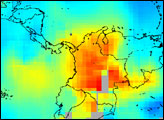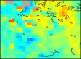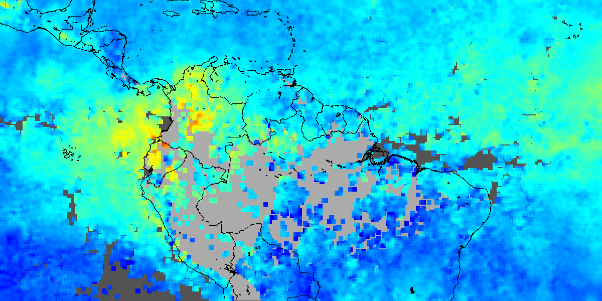
The fires currently burning across northern South America are producing a significant amount of pollution, as indicated by enhanced levels of carbon monoxide in the region. This false-color image shows the concentrations of carbon monoxide (CO) at an altitude of roughly 3 km (700 millibars) in the atmosphere. The data were taken by the Measurements Of Pollution In The Troposphere (MOPITT) instrument aboard NASA’s Terra satellite for the period February 24-March 4, 2003. The colors represent the mixing ratios of carbon monoxide in the air, given in parts per billion by volume. The large grey areas in the center of the image show where no data were collected, either due to persistent cloud cover or gaps between satellite viewing swaths. The regions of high carbon monoxide correlate well with observations of the source fires by the Moderate Resolution Imaging Spectroradiometer (MODIS).
Carbon monoxide is produced as a result of incomplete combustion during burning processes, and is important due to its impact on chemistry in the lower atmosphere. It is a good indicator of atmospheric pollution, and its presence adversely affects the atmosphere’s ability to cleanse itself. Because carbon monoxide is persistent for several weeks, it clearly shows the propagation of pollution plumes from the region of the fires over Columbia and Venezuela westward out into the atmosphere over the Pacific Ocean. The high levels of carbon monoxide in the right of the image over the Atlantic Ocean result from pollution plumes that have traversed the Atlantic from the fires that are currently burning in western Africa.
Image courtesy the NCAR and University of Toronto MOPITT Teams