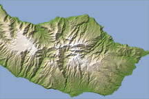
This topographic map of the Portuguese Island of Madeira helps illustrate why population centers on the island are prone to flooding.
Published Feb 24, 2010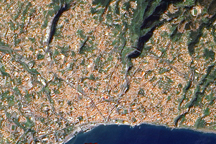
This detailed image, taken by the Advanced Land Imager on NASA’s EO-1 satellite on March 7, 2007, illustrates how the steep mountains and deep ravines contributed to a flooding disaster in February 2010.
Published Feb 24, 2010