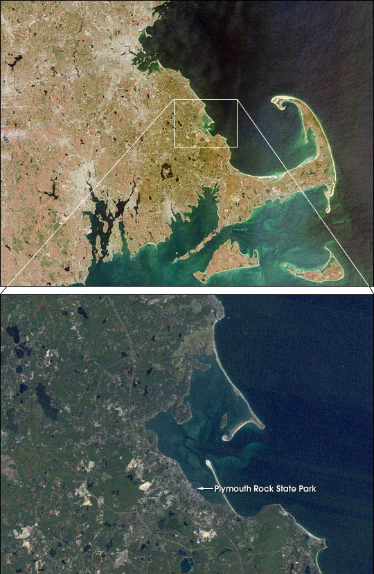
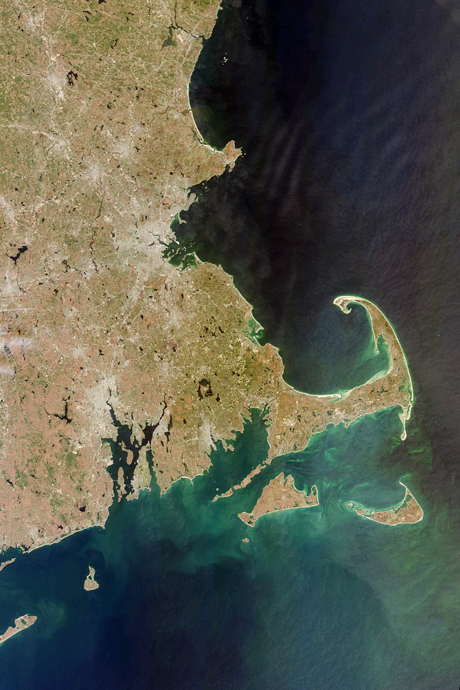
Each year in late November the United States observes the Thanksgiving holiday, commemorating the harvest festival celebrated by the Plymouth colonists and the Native Americans who helped them survive the devastating winter of 1620. Plymouth, Massachusetts, where the Mayflower Pilgrims landed, is located on the west side of Cape Cod Bay, shown in this MISR vertical-viewing (nadir) camera image (top image--view large [414kb]). This nearly cloud-free picture was acquired on April 13, 2000, during Terra orbit 1708.
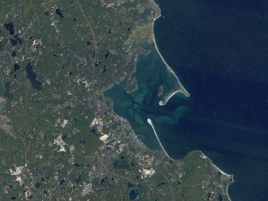
Using Landsat 5 data, we can zoom in to see more precisely the location of Plymouth Rock, where the Mayflower Pilgrims landed (bottom image--view large [430kb]). The area is now a state park, maintained by Massachusetts. This true-color scene was produced at a resolution of 30 meters per pixel.
South of the distinctively-shaped Cape Cod peninsula are Nantucket Island and Martha's Vineyard (top image). On the mainland, Providence and Boston appear as gray patches. Jutting out from the Massachusetts coastline northeast of Boston (visible in the large image), is Cape Ann, location of the city of Gloucester, which was settled soon after the Pilgrim's arrival in Plymouth. Gloucester is the oldest fishing port in the eastern United States.
MISR was built and is managed by NASA's Jet Propulsion Laboratory, Pasadena, CA, for NASA's Office of Earth Science, Washington, DC. The Terra satellite is managed by NASA's Goddard Space Flight Center, Greenbelt, MD. JPL is a division of the California Institute of Technology.
Landsat 5 image by Robert Simmon, NASA GSFC, based on data received from the EarthSat and Stennis Space Center Scientific Data Purchase


