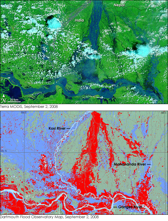
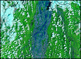
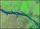
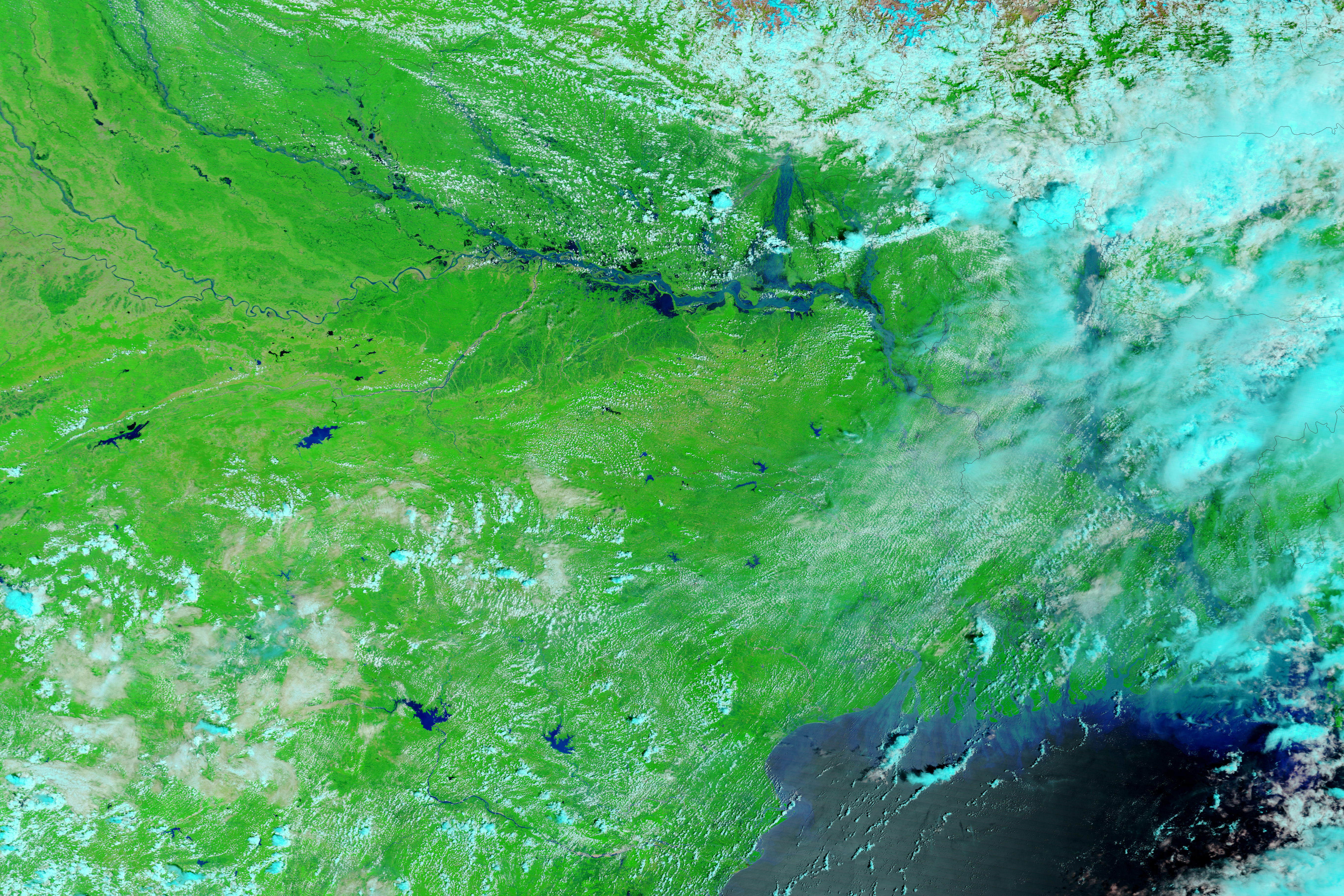
Standing on the ground, it is impossible to gauge the full scope of a disaster the size of the Kosi River floods in northeastern India. On August 18, 2008, the river, swollen with monsoon rains, burst through an embankment into an old channel. By September 2, the river’s course still took it over populated land that had not been prone to flooding in the past. To grasp the full extent of this flood, you need the view from space. The Moderate Resolution Imaging Spectroradiometer (MODIS) on NASA’s Terra satellite acquired this image of the flood on September 2, 2008. The image was made with both infrared and visible light to make water stand out clearly against the land. The dark blue water of the Kosi River spreads in braided streams over the bright green plant-covered land. Clouds are pale blue and white.
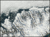
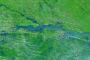
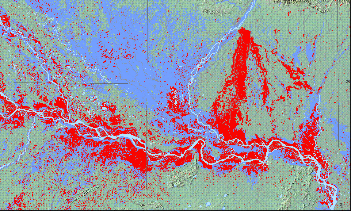
Though the most dramatic flooding is along the Kosi River, it is not the only river that is flooded in this image. The Ganges and its tributary the Manhananda are also swollen. The extent of the flood compared to normal water levels is illustrated in the map, lower image.
Robert Brakenridge at the Dartmouth Flood Observatory created this flood map based on the September 2 image. Flooded areas are red. The rivers’ normal extents are illustrated in pale blue, while previous floods are shown in a darker shade of blue. Maps such as these are valuable to government and relief agencies who use the maps to help plan a response. Not only does the map show the full extent of the flooding in relation to populated areas, but it also shows which routes into affected areas may be accessible. Additional flood maps of Bihar, India, including the locations of affected cities, are available from the Dartmouth Flood Observatory.
In addition to forcing more than three million people from their homes, the floods shown here destroyed 100,000 hectares of crops in this highly cultivated region, said the USDA Foreign Agricultural Service. More than half of the state of Bihar was underwater.
Listen to Dr. Brakenridge as he discusses flood mapping with EarthSky: A Clear Voice for Science. To read more about flood mapping, see High Water: Building a Global Flood Atlas on the Earth Observatory.
NASA Terra MODIS image courtesy the MODIS Rapid Response Team at NASA GSFC. Flood map courtesy Robert Brakenridge and Christopher Farmer, Dartmouth Flood Observatory. Caption by Holli Riebeek.


