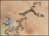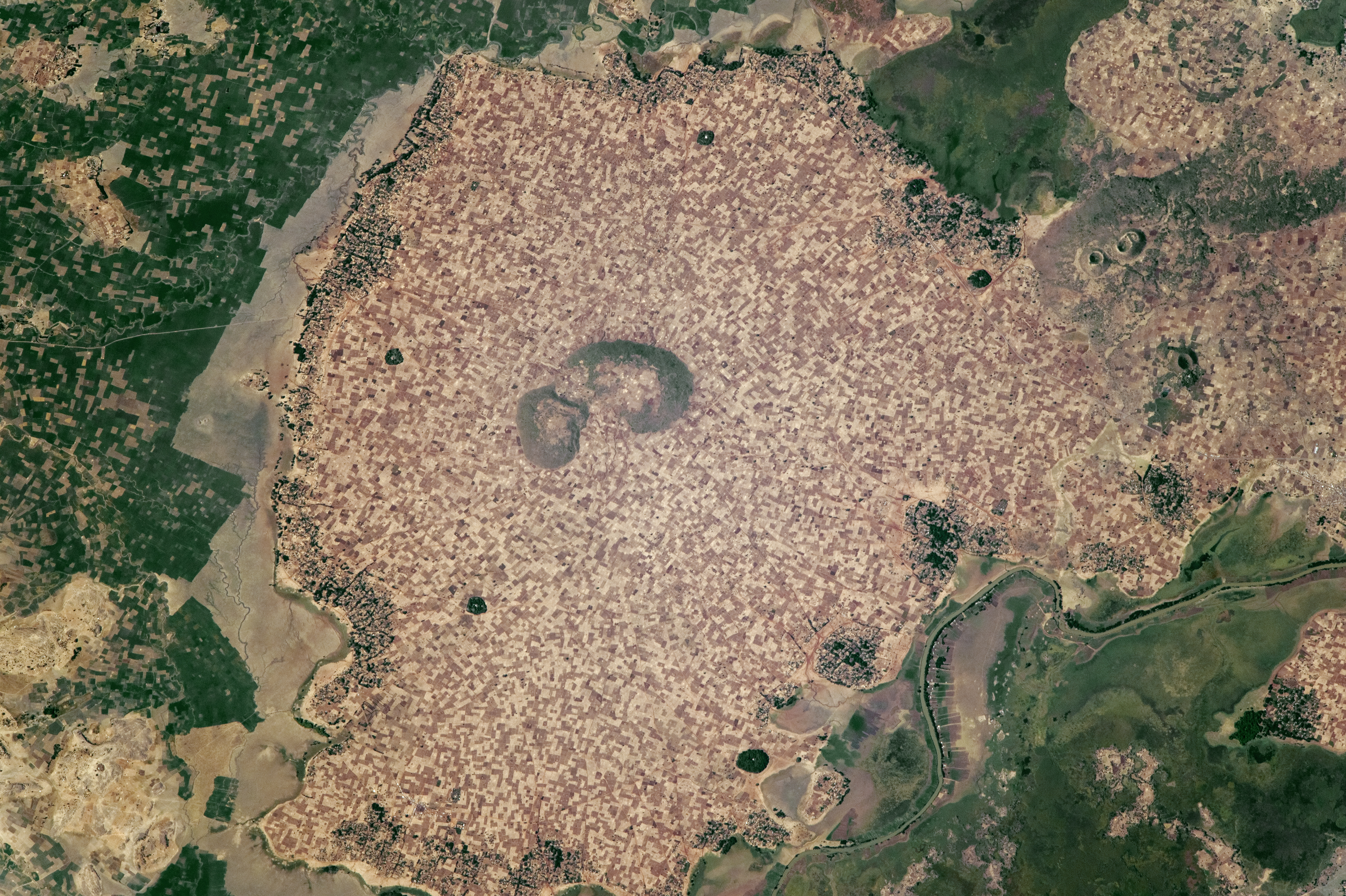
An astronaut aboard the International Space Station centered this photograph on numerous, densely packed agricultural fields that occupy the slightly higher ground in the center of the image (about 8 kilometers in diameter). Taken at the end of the dry season, the photograph shows fallow, rain-fed fields (brown and tan)—except around the margins, where forested villages have access to river water. The largest village in the scene is Sciovele.
Thin river channels run through long floodplains that arc around the fields. These floodplains are part of a wide, low-lying wetland system that supports both swamp vegetation and another set of fields where crops thrive through the dry season. Farmers in the lower wetlands take advantage of flood-recession agriculture, where wet-season rainwater drains more slowly and is available for plant growth even in the middle of the dry season.
The wetlands are part of the complex coastal zone of Lake Tana, which lies just outside the top of the image. Individual fields and angular margins at the floodplain (left) are indicative of the human use and modification of the wetlands. The Gilgel Abbay River is lined with very narrow fields that give the greatest number of farmers access to the water.
Forests occupy parts of the wetlands; they also stand on a few patches of higher ground, such as the hill in the center of the image and five small circular patches dispersed among the fields. Some of these forests surround monasteries that are characteristic of the region.
The relatively high rainfall in the Ethiopian Highlands makes the region suitable for growing coffee, oilseeds, and grains (especially subsistence crops such as wheat and sorghum). However, a recent years-long drought is threatening Ethiopia’s food supply. The United States and the Ethiopian Governments are planning aid for as many as 10 million people who could face food shortages.
Astronaut photograph ISS050-E-30105 was acquired on January 2, 2017, with a Nikon D4 digital camera using an 1150 millimeter lens, and is provided by the ISS Crew Earth Observations Facility and the Earth Science and Remote Sensing Unit, Johnson Space Center. The image was taken by a member of the Expedition 50 crew. The image has been cropped and enhanced to improve contrast, and lens artifacts have been removed. The International Space Station Program supports the laboratory as part of the ISS National Lab to help astronauts take pictures of Earth that will be of the greatest value to scientists and the public, and to make those images freely available on the Internet. Additional images taken by astronauts and cosmonauts can be viewed at the NASA/JSC Gateway to Astronaut Photography of Earth. Caption by Andi Hollier, Hx5 LLC, and M. Justin Wilkinson, Texas State University, JETS Contract at NASA-JSC.