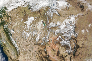
An atmospheric river has been flooding California and other parts of the western United States with rain and snow for nearly a week. Precipitation could be measured in feet rather than inches in some locations, and rivers and valleys filled with some of the worst flooding since 2005. According to meteorologists, the deluge is not over as more storms are predicted through January 12, 2017.
Stretching tens to hundreds of kilometers wide, atmospheric rivers are literally jet streams of moist air. According to the National Oceanic and Atmospheric Administration, the most potent atmospheric rivers can carry an amount of water vapor equivalent to 7.5 to 15 times the flow at the mouth of the Mississippi River. Between 30 and 50 percent of the annual precipitation in the western U.S. comes from just a few atmospheric river events.
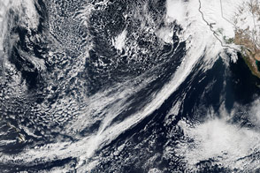
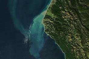
Off the West Coast of the U.S., an atmospheric river is often referred to as a “pineapple express,” as the storm systems and moisture often flow from the tropical Pacific near Hawaii. The flow of moist air runs into low-pressure weather systems and can deliver bursts of precipitation for days at a time.
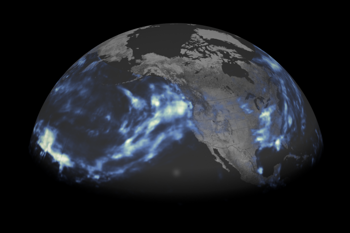
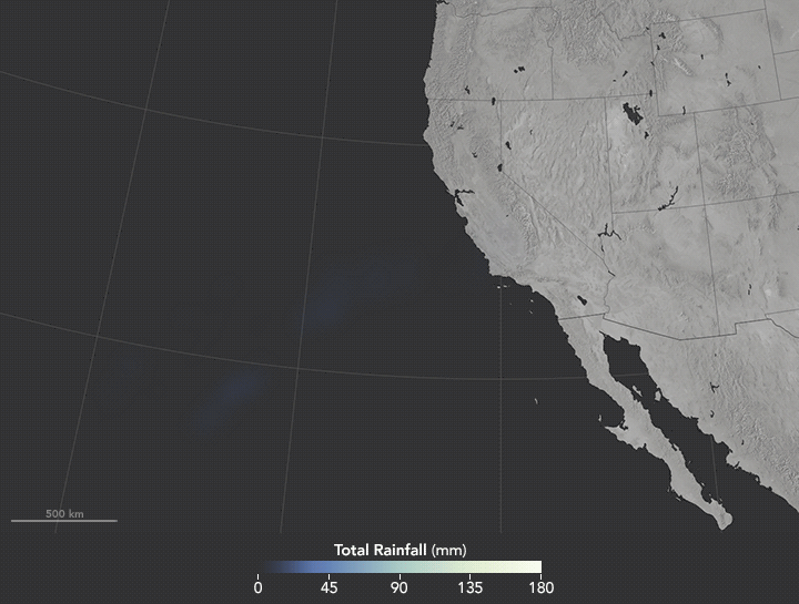
The animation above shows satellite-based measurements of rainfall as it accumulated over California and the western U.S. Specifically, it shows rainfall accumulation every 30 minutes from 4:30 p.m. Pacific Standard Time on January 7 to 4:30 p.m. on January 10. These rainfall totals are remotely-sensed estimates, and local amounts can be significantly higher when measured from the ground. (The data here do not reflect snowfall amounts.) Note how fingers of moisture stretch across the Pacific Ocean and then accumulate over California.
The data come from the Integrated Multi-Satellite Retrievals for GPM (IMERG), a product of the Global Precipitation Measurement mission. The GPM satellite is the core of a rainfall observatory that includes measurements from NASA, the Japan Aerospace Exploration Agency, and five other national and international partners.
From January 6 through January 11, 180 inches (4.6 meters) of snow fell on California’s Mammoth Mountain, with 133 inches at Kirkwood and 122 inches at North Star Ski Resort, according to National Weather Service reports. Mount Rose in Nevada was blanketed with 116 inches. At lower elevations in California, rainfall totals reached 15.4 inches (39.1 centimeters) at Alpine Meadows, 12.6 inches at Three Peaks, and 22 inches (56 centimeters) in Homewood (56 centimeters). San Francisco has seen more rain in the first two weeks of 2017 than it did in the entire year of 2013.
News media have reported power outages in Oregon and Northern California. At least five deaths have been attributed to the rain, snow, mudslides, and floods, according to The Weather Channel. Lake Tahoe saw its first blizzard warning in nine years, and a small tornado touched down near Sacramento. Parts of the Sierra Nevada recorded sustained winds of hurricane force, and one wind gust at Squaw Valley, California, reached 173 miles (278 kilometers) per hour.
Flooding has been reported along the Truckee, Napa, Russian, and Merced rivers in California, as well as in Yosemite Valley and Napa Valley. On January 9, flood gates were opened for the first time in 11 years on the Sacramento River.
NASA Earth Observatory map by Joshua Stevens, using IMERG data provided courtesy of the Global Precipitation Mission (GPM) Science Team's Precipitation Processing System (PPS). Caption by Mike Carlowicz.