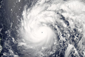
In July 2016, Super Typhoon Nepartak became first major storm of the season to make landfall in the northeast Pacific. The storm battered Taiwan with sustained winds of 113 knots (210 kilometers per hour), leaving more than 545,000 households without power. It then moved ashore in southeastern China after losing some of its strength. Nepartak brought torrential rain and flash flooding in the region, where 18 workers in Gutian county were trapped in an iron factory before emergency workers rescued them.
As it does with many major storms, NASA monitored Nepartak from above, providing immediate data for forecasters and long-term insights for scientists who study and model tropical cyclones. Beyond natural-color imagery, satellites offer several different ways to analyze the movement of heat, wind, and water.
You can think of the hurricane like an oversized vacuum cleaner, sucking water and heat from the surface of the ocean, said Michael Garay, a researcher at NASA’s Jet Propulsion Laboratory. The warm, moist air is pulled up into the atmosphere, condensing into liquid as it cools in the atmosphere. Even higher up, that moisture freezes into ice.
Or picture the storm as an inverted tea kettle. Instead of using energy to boil water and release steam as a kettle does, the storm releases energy as it rapidly cools down warm, moist air. In the process, it generates hurricane-force winds.
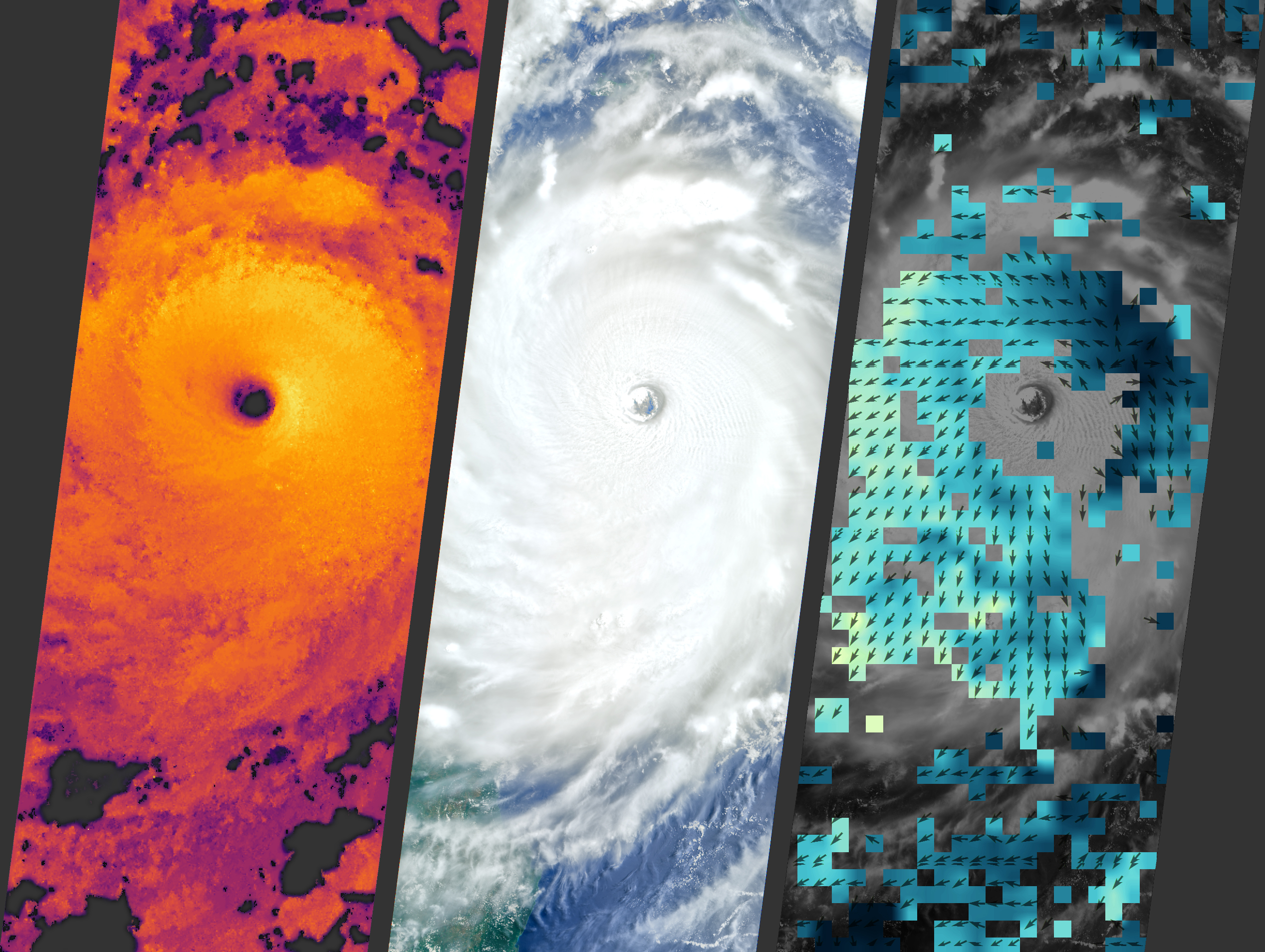
That’s where the Multi-angle Imaging SpectroRadiometer (MISR) comes in. The instrument uses nine cameras to create a snapshot of the storm over the course of seven minutes. The cameras capture information in stereo—by calculating the space between objects and using simple geometry, scientists can create a stereoscopic image. The imager functions a bit like human eyes, using information gathered from two slightly different vantage points to determine an object’s depth.
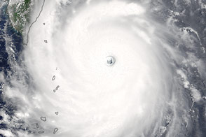
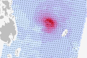
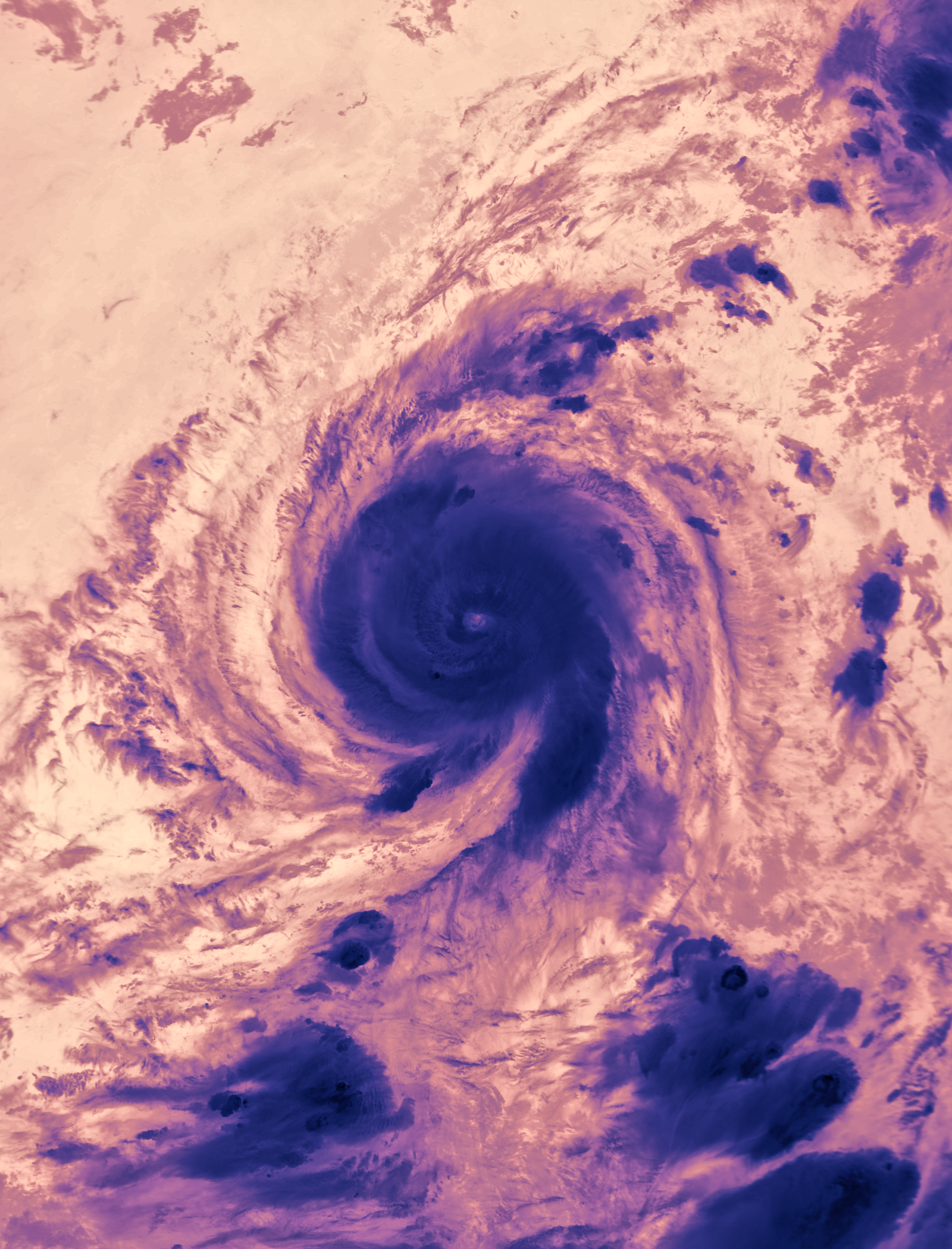
The images at the top of this page reveal how MISR can peer into the heart of a storm. The top left image depicts cloud heights; the middle image is a stereoscopic, natural-color view; and the top right image reveals wind speeds and directions in the atmosphere. The well-defined eye (the cloudless area at the center of the vortex) indicates that Nepartak was “pretty well-organized,” Garay said.
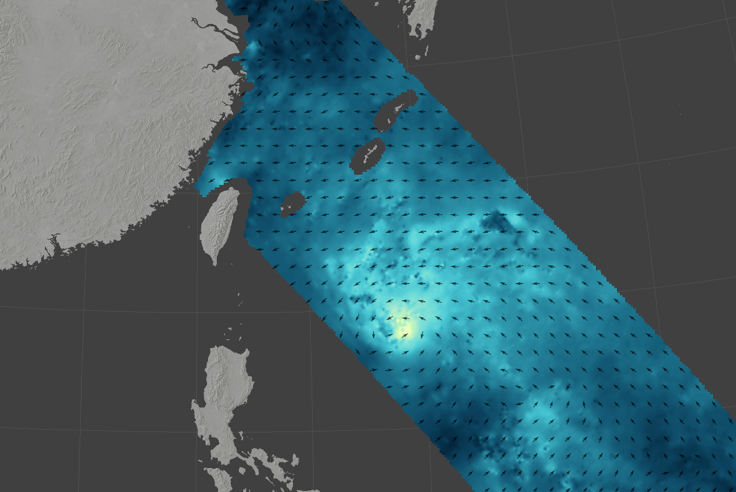
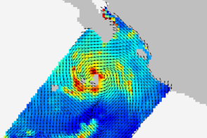
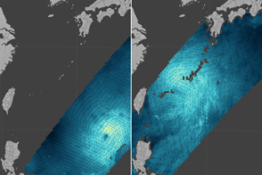
The RapidScat instrument complements MISR by giving a picture of conditions close to the ocean surface. The image above shows wind conditions as Nepartak approached Taiwan on July 8. Arrows show the direction of near-surface winds, with shades of blue indicating the range of wind speeds.
RapidScat sends out microwave pulses that reflect off the ocean surface. Stronger winds make the water choppier, and larger waves return a stronger signal to RapidScat. From that information about the waves, scientists can derive wind speed and direction. This offers a complementary view to the one that MISR retrieves from higher in the atmosphere.
The Moderate Resolution Imaging Spectroradiometer (MODIS) on NASA’s Aqua satellite provides a thermal view (below) of the storm. Temperatures taken at very high altitudes at the center or eye of a hurricane can help researchers understand how hurricanes change intensity. The false-color image below was acquired on July 7.
NASA Earth Observatory image (top) by Joshua Stevens and Jesse Allen, using data provided by the NASA/GSFC/JPL, MISR Team. NASA image (middle) by Jeff Schmaltz and Joshua Stevens, LANCE/EOSDIS MODIS Rapid Response. NASA Earth Observatory image (bottom) by Joshua Stevens, using RapidScat data from the Jet Propulsion Laboratory. Caption by Pola Lem.