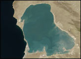
Water levels on the Caspian Sea—a body of water that was once connected to the ocean but now fits the definition of a lake—have risen and fallen markedly over the past century. In 1920, the average water level was about 26 meters (85 feet) below sea level. By 1977, the water level had dropped by about 3 meters (10 feet). Then, it rose over the next two decades flooding infrastructure, causing large amounts of economic damage, and forcing tens of thousands of people to move. Then in the mid-1990s, the Caspian Sea began dropping again. The water level now stands at about 27 meters below sea level.
With global climate change looming in the coming decades, researchers are attempting to understand all the factors that control the water level on the Caspian. Key factors include: how much rain falls; how much water gets diverted into reservoirs for human use; how much water evaporates before reaching the lake; how do tectonic activity and oil extraction change the height of the land.
New research suggests that dust storms may have an effect as well. A study by scientists from the Abdus Salam International Centre for Theoretical Physics and from Istanbul Technical University details how airborne dust affects the region’s climate and water cycle in several ways. For instance, dust particles absorb sunlight, so a cloud of dust can change the distribution of heat in the atmosphere. Specifically, dust clouds warm the atmosphere and cool the water surface below. Such changes reduce the amount of evaporation at the water surface, make the atmosphere less turbulent, and reduce convection (heat rising in the atmosphere). Together, these changes reduce the likelihood of rain.
The researchers concluded that dust storms over the Caspian Sea likely reduce lake surface temperatures by 1 to 2 degrees Celsius (1.8 to 3.6 degrees Fahrenheit), while increasing evaporation by about 0.5 millimeters (0.02 inches) per day. This can lead to a drop in lake levels equivalent to 10 millimeters (0.4 inches) per year. In their model, the researchers used observations of dust collected by several satellites sensors, including the Moderate Resolution Imaging Spectroradiometer (MODIS) on the Terra and Aqua satellites, the Multi-angle Imaging SpectroRadiometer (MISR), and the Sea-Viewing Wide Field-of-View Sensor (SeaWIFS).
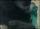
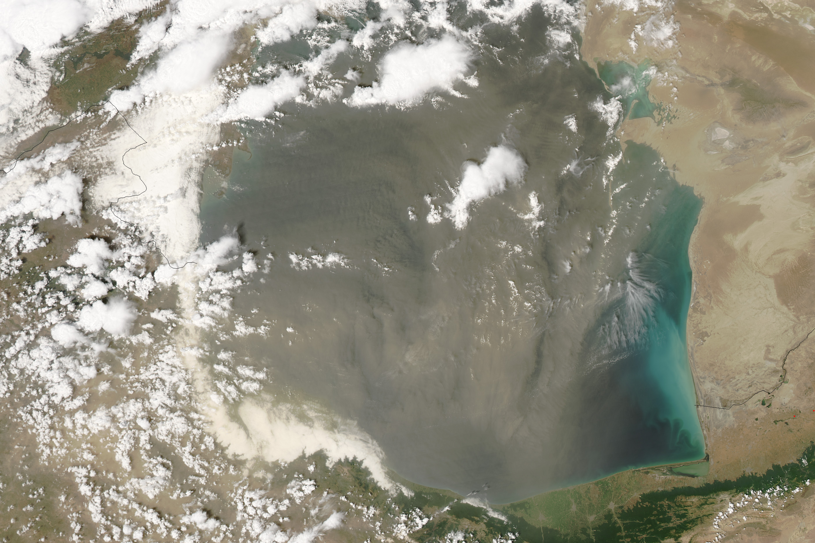
On June 6, 2016, the MODIS instrument on NASA’s Aqua satellite captured this image of a thick layer of dust over the southern Caspian Sea. Notice how the dust has almost completely obscured the water. The dust particles absorb heat from the Sun rather than allowing it to heat the water surface. Dust storms like this are common over the Caspian in spring and summer.
NASA images by Jeff Schmaltz, LANCE/EOSDIS Rapid Response. Caption Adam Voiland.