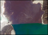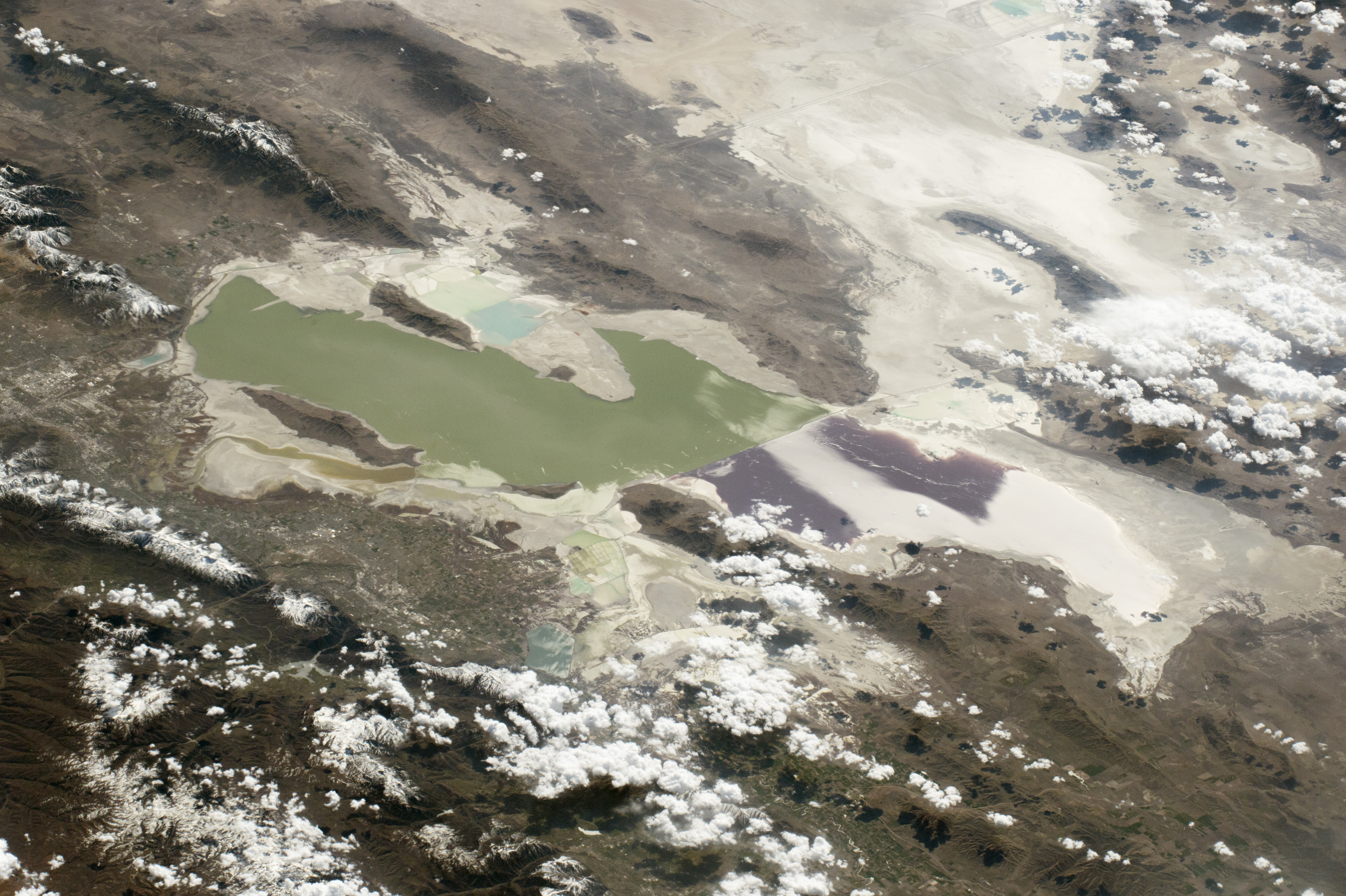
While passing over the Rocky Mountains, an astronaut aboard the International Space Station took this photograph of the Great Salt Lake and the Bonneville Flats. As seen from orbit, the lake is unique because its two halves are different colors and because the railroad causeway that divides it is aligned exactly east-west.
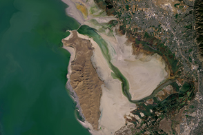
Cities are hard to detect in daylight views from space, and so Salt Lake City is almost invisible. (Compare it to this night view.) The small rectangular patterns on both sides of the lake are evaporation ponds, from which various salts are collected in commercial operations.
The construction of the railroad causeway completely altered the original circulation of this shallow desert lake, and only two small culverts now join the two halves. As a result, the waters on either side have different salt concentrations and temperatures—an effect that becomes apparent in the color difference. The north basin (right) is saltier, and the salt-loving algae color the water shades of red. The south basin (left) is less salty and typically contains algae that color the water green.
From space, astronauts can see the Great Salt Lake as a remnant of a much larger body of water that used to cover the entire Bonneville Flats and other valleys in Utah. Water would have covered most of the view shown here except for the Wasatch Mountains and a few isolated peaks that would have appeared as islands. Ancient Lake Bonneville, as it has been named, was nearly as large as Lake Michigan and existed from 32,000 to 14,000 years ago. It formed during the last ice age when meltwater from numerous glaciers filled the basin and evaporation rates were much lower.
The white, salt-encrusted floor of the ancient lake has been used by racing enthusiasts for decades; the faint outlines of Bonneville Speedway appears near the top right. These flats are where many land speed records have been set.
Astronaut photograph ISS043-E-123891 was acquired on April 4, 2015, with a Nikon D4 digital camera using a 170 millimeter lens, and is provided by the ISS Crew Earth Observations Facility and the Earth Science and Remote Sensing Unit, Johnson Space Center. The image was taken by a member of the Expedition 43 crew. The image has been cropped and enhanced to improve contrast, and lens artifacts have been removed. The International Space Station Program supports the laboratory as part of the ISS National Lab to help astronauts take pictures of Earth that will be of the greatest value to scientists and the public, and to make those images freely available on the Internet. Additional images taken by astronauts and cosmonauts can be viewed at the NASA/JSC Gateway to Astronaut Photography of Earth. Caption by M. Justin Wilkinson, Texas State U., Jacobs Contract at NASA-JSC.