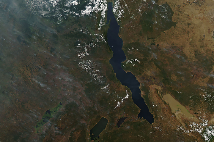
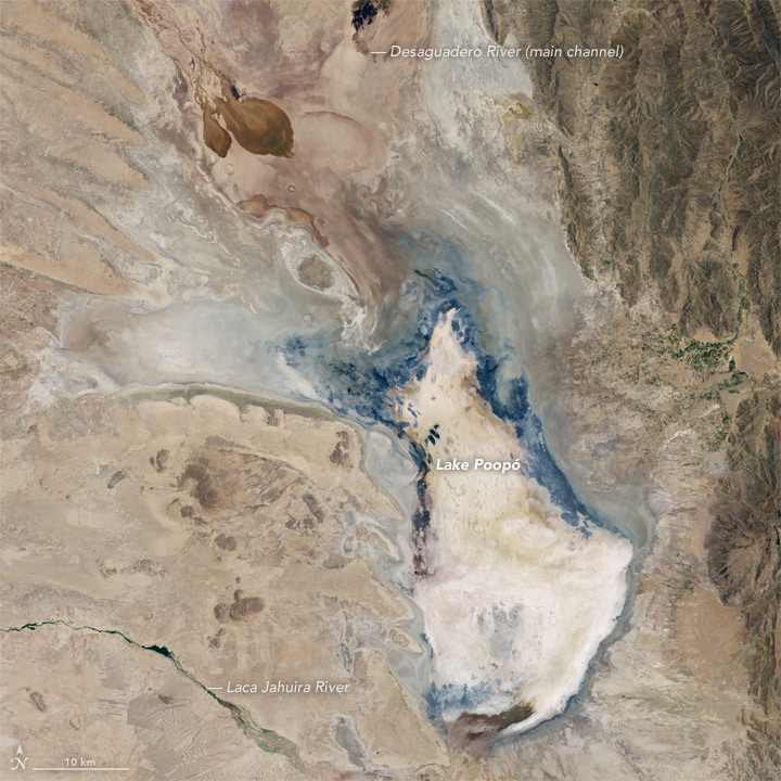
Lake Poopó—once Bolivia’s second-largest lake and an important fishing resource for local communities—has essentially dried up. News reports blame recurrent drought and the diversion of the lake’s water sources for mining and agriculture.
The top image, acquired by the Operational Land Imager (OLI) on Landsat 8, shows the lake in April 2013 when it still held water. OLI acquired the second image in January 2016, by which time the lake had dried up. Turn on the image comparison tool to see the change.
In a typical year, rainfall during the wet season (December through March) recharges the lake directly and via increased inflow from the Desaguadero River. But more than a month into the 2015-16 wet season, drought persists.
This is not the first time that Poopó has evaporated; the lake last dried up in 1994. In that case, it took several years for water to return, and even longer for ecosystems to recover.
At times, Lake Poopó has spanned an area approaching 3,000 square kilometers (1,200 square miles). Sitting high in the Bolivian Andes, the saline lake is particularly vulnerable to fluctuations because it is shallow—typically no more than 3 meters (9 feet) deep. Photographs from the International Space Station show how small changes in precipitation can affect the lake’s depth and area.
NASA Earth Observatory images by Jesse Allen, using Landsat data from the U.S. Geological Survey. Caption by Kathryn Hansen.