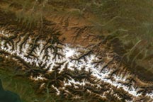
The Urals rise like a long and narrow spine across western Russia, forming a natural divide between Europe and Asia. The mountain range spans 2,500 kilometers (1,550 miles) passing through Arctic tundra to the north and through forested and semi-desert landscapes to the south.
Continental collisions gave rise to the Urals between 250 and 300 million years ago, making them among the oldest mountains on Earth. (For comparison, the very old Appalachians started to form about 480 million years ago, while the younger Himalayas started to form about 40 to 50 million years ago). For such an ancient range, it reaches some relatively high elevations.
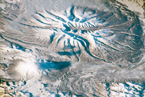
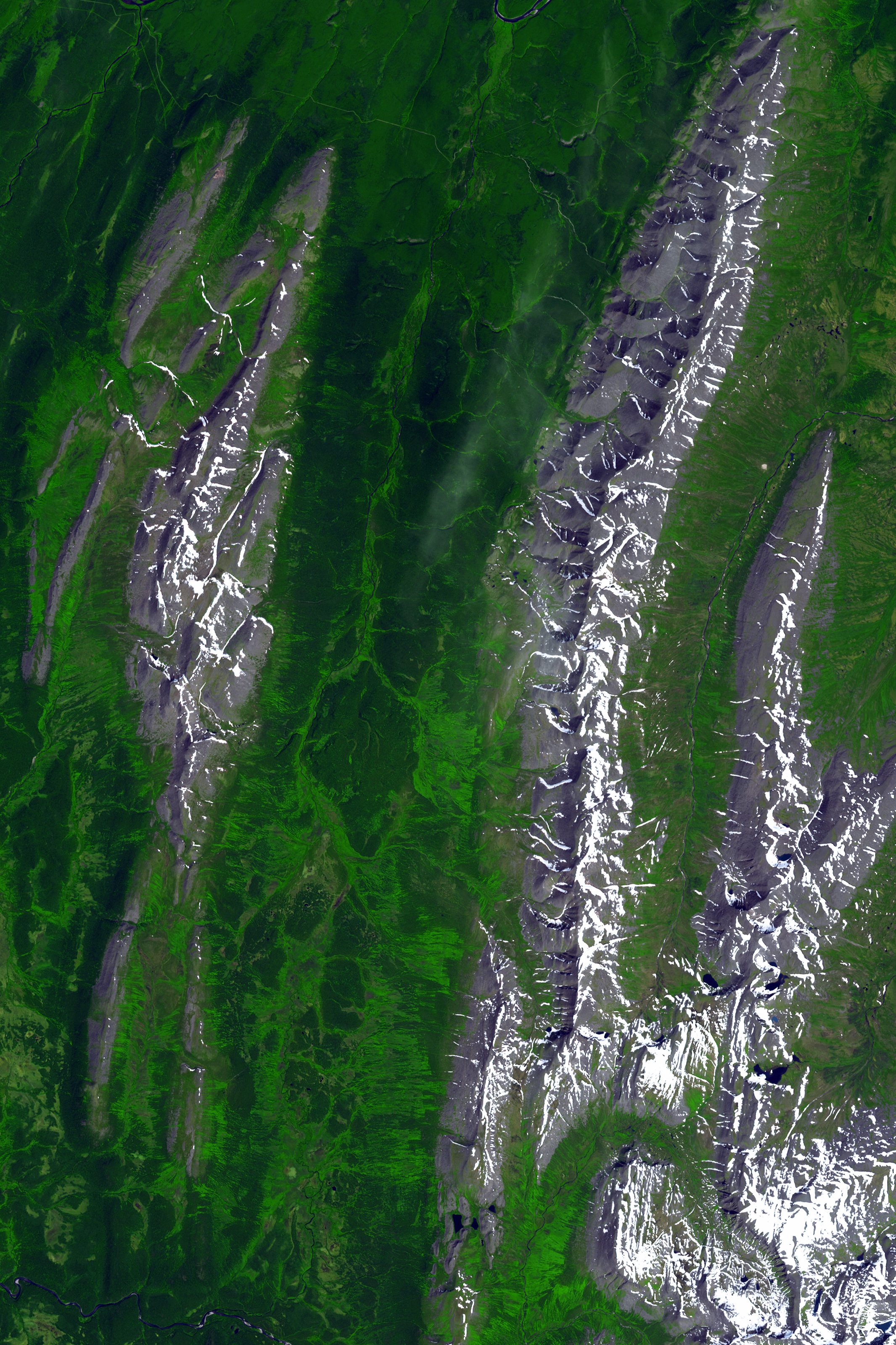
The highest elevations are found in the Nether-Polar Urals, the second-northernmost section of the range’s five segments. On July 13, 2011, the Advanced Spaceborne Thermal Emission and Reflection Radiometer (ASTER) on NASA’s Terra satellite acquired this view of the northern part of the Nether-Polar Urals. The scene extends from the northern boundary and ends just short of Mount Narodnaya—1,895 meters (6,217 feet)—the highest point in the entire range.
The Nether-Polar Urals are an alpine environment. At the higher elevations, glaciers sit amid the rocky ridges. At elevations below 500 meters, snow and ice give way to green forests. The forests become denser heading south toward the Northern Urals. Yugyd Va National Park, for example, contains the Virgin Komi Forests, one of the most extensive areas of virgin boreal forest remaining in Europe.
As a whole, the Urals are extremely rich in minerals. More than 1,000 types of minerals can be found here, and many of them are commercially useful.
NASA Earth Observatory image by Jesse Allen, using data from NASA/GSFC/METI/ERSDAC/JAROS, and U.S./Japan ASTER Science Team. Caption by Kathryn Hansen.