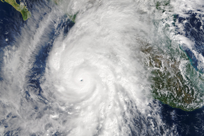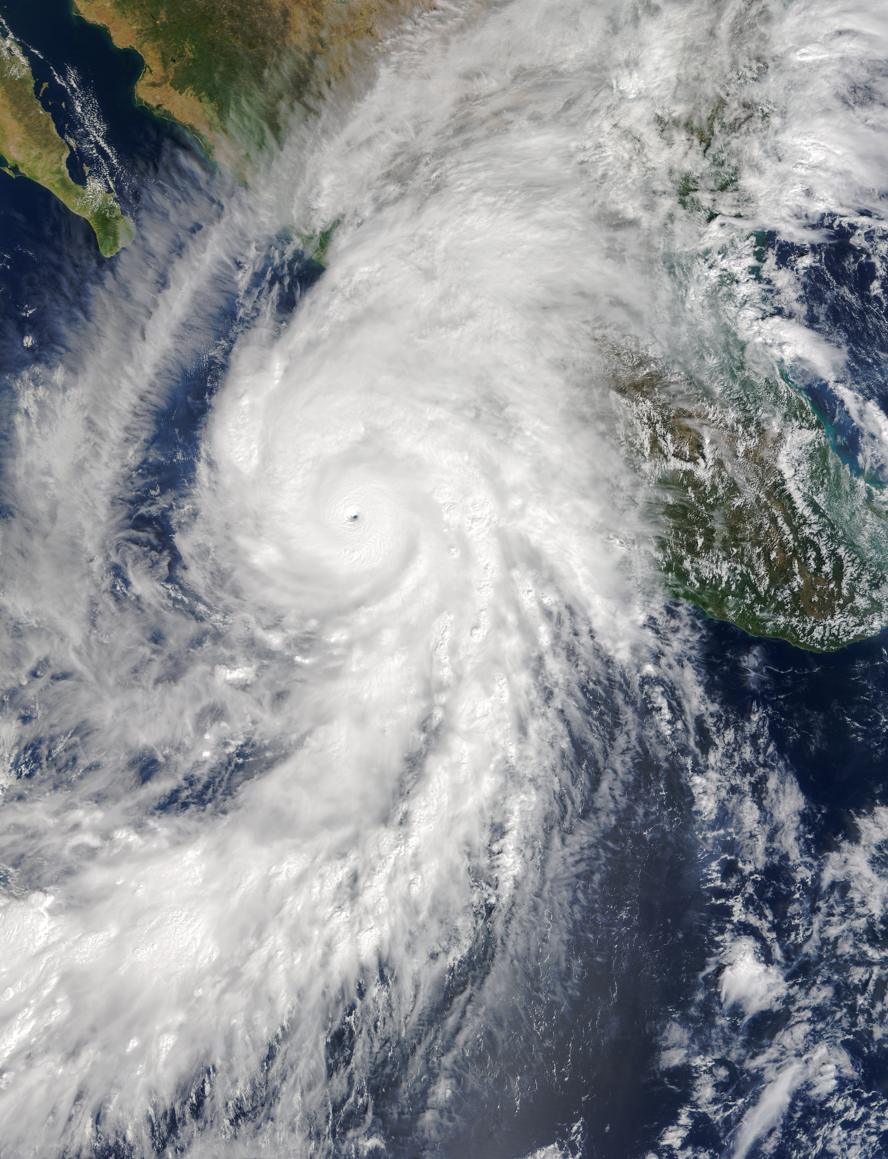
Hurricane Patricia is expected to make landfall in southwestern Mexico as an “extremely dangerous” category 5 storm on the evening of October 23, 2015. According to the National Hurricane Center (NHC), Patricia is the strongest hurricane ever recorded by the agency, which is responsible for monitoring the Atlantic and eastern Pacific oceans.
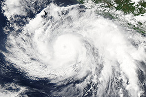
At 17:30 UTC (11:30 p.m. Central Daylight Time) on October 23, the Moderate Resolution Imaging Spectroradiometer (MODIS) on NASA’s Terra satellite acquired the top image of Hurricane Patricia over the eastern Pacific Ocean. When this image was acquired, the hurricane was a category 5 storm with maximum sustained winds of 325 kilometers (200 miles) per hour. Its center was located about 140 kilometers (85 miles) southwest of Manzanillo, Mexico.
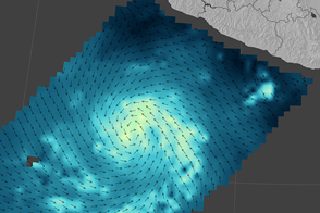
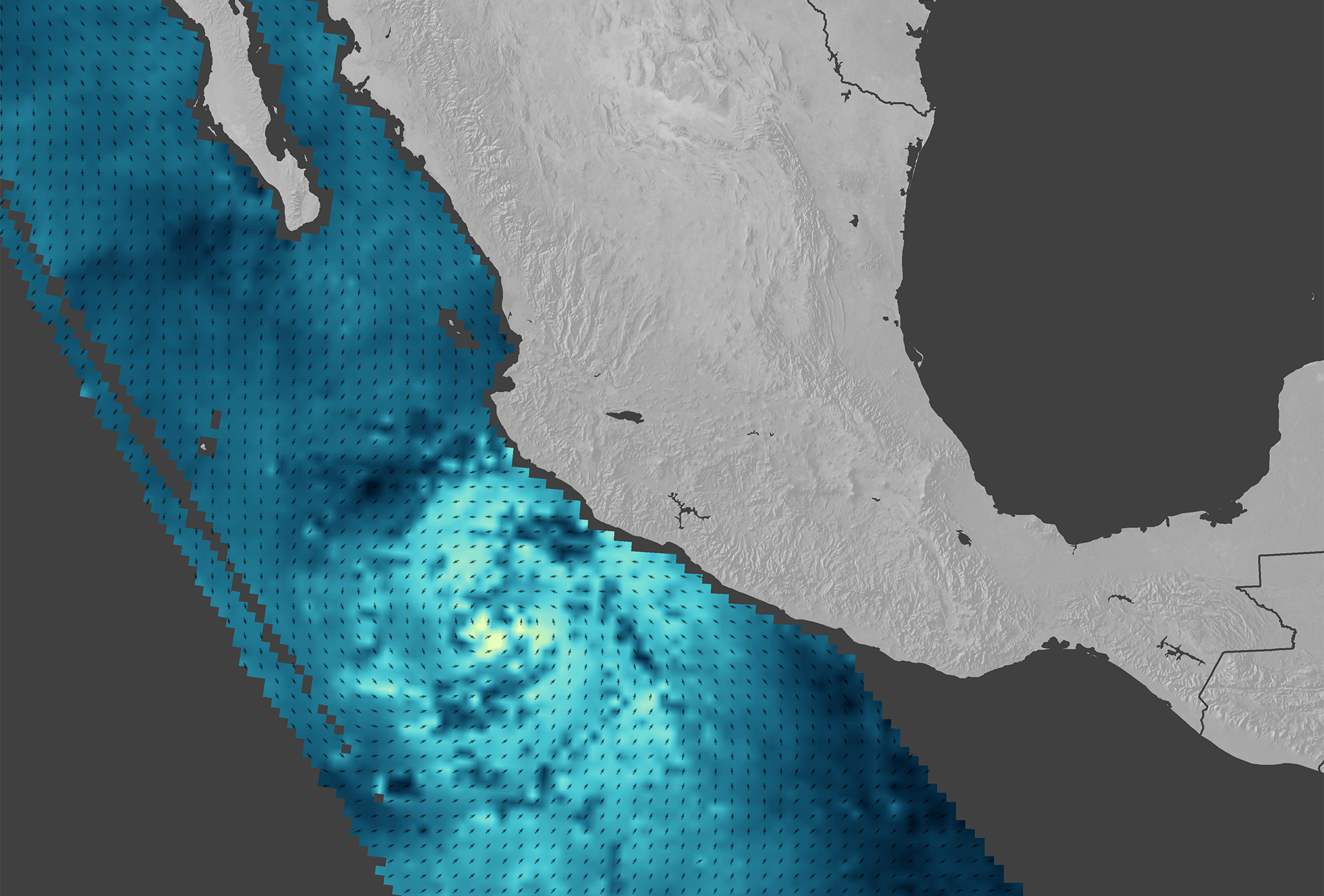
The second image shows wind speed and direction near the ocean surface, as measured on October 23 by the International Space Station-Rapid Scatterometer (ISS-RapidScat). Brighter shades of blue represent stronger surface winds. A photograph of the storm was captured from the space station by NASA astronaut Scott Kelly.
Meteorologists were impressed by the rate at which Patricia intensified, growing from a tropical storm to a category 5 hurricane in just 24 hours, the NHC reported in a discussion on October 22. As the forecasters noted: “This is a remarkable feat, with only Linda of 1997 intensifying at this rate in the satellite era.”
After making landfall in southwest Mexico, the storm was expected to move north-northeast and quickly weaken as it reaches the mountainous interior. Still, flooding and landslides were a concern for the Mexican states of Nayarit, Jalisco, Colima, Michoacan, and Guerrero.
Patricia is the ninth hurricane in the eastern Pacific to reach category 4 or 5 status during the 2015 season, which runs from mid May through November. The season in the North Pacific has been a busy one that has been at least partly fueled by a strong El Niño.
NASA image (top) by Jeff Schmaltz, LANCE/EOSDIS Rapid Response. NASA Earth Observatory map (bottom) by Joshua Stevens, using RapidScat data from the Jet Propulsion Laboratory. Caption by Kathryn Hansen.