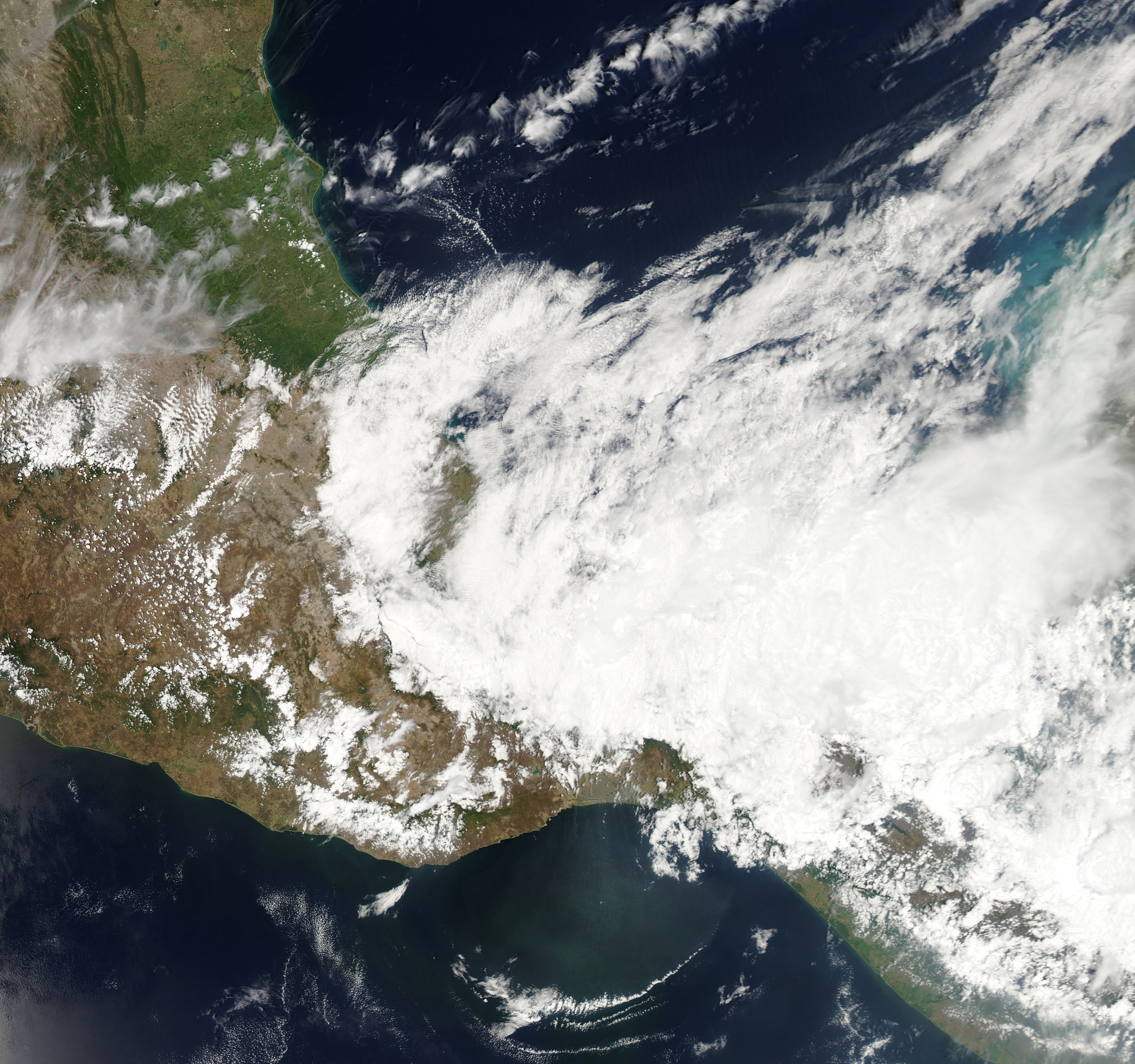
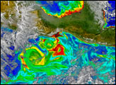
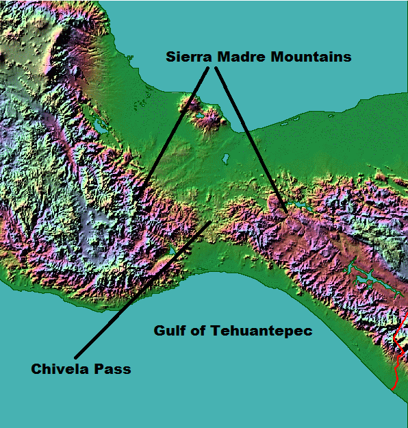
Cool air often follows storm systems passing through North America in the winter and early spring. In some cases, the cool air surges as far south as Mexico, where it encounters the Sierra Madre Oriental Mountains, a long chain oriented roughly parallel to Mexico’s Atlantic coast. The mountains behave like a wall, funneling winds to the south until they reach Chivela Pass, a gap in the range on the Isthmus of Tehuantepec.
At the gap, pressure differences between cool, dry air from the north and warm, moist air from the south cause winds to rush toward the Pacific Ocean. Northerlies that last for more than a day are known as Tehuano winds. Such winds can be extremely strong, reaching gale or even hurricane force on the Beaufort wind scale.
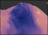
The Moderate Resolution Imaging Spectroradiometer (MODIS) on the Aqua satellite captured this image on April 8, 2014, when Tehuano winds carried dust over the Gulf of Tehuantepec. A thin arc cloud marked the leading edge of this pulse of wind.
Read this blog post from the Cooperative Institute for Meteorological Satellite Studies (CMISS) to learn more about the event and to see a sequence of images showing the wind front fanning outward over time.
NASA image courtesy, LANCE/EOSDIS MODIS Rapid Response Team at NASA GSFC. Caption by Adam Voiland.


