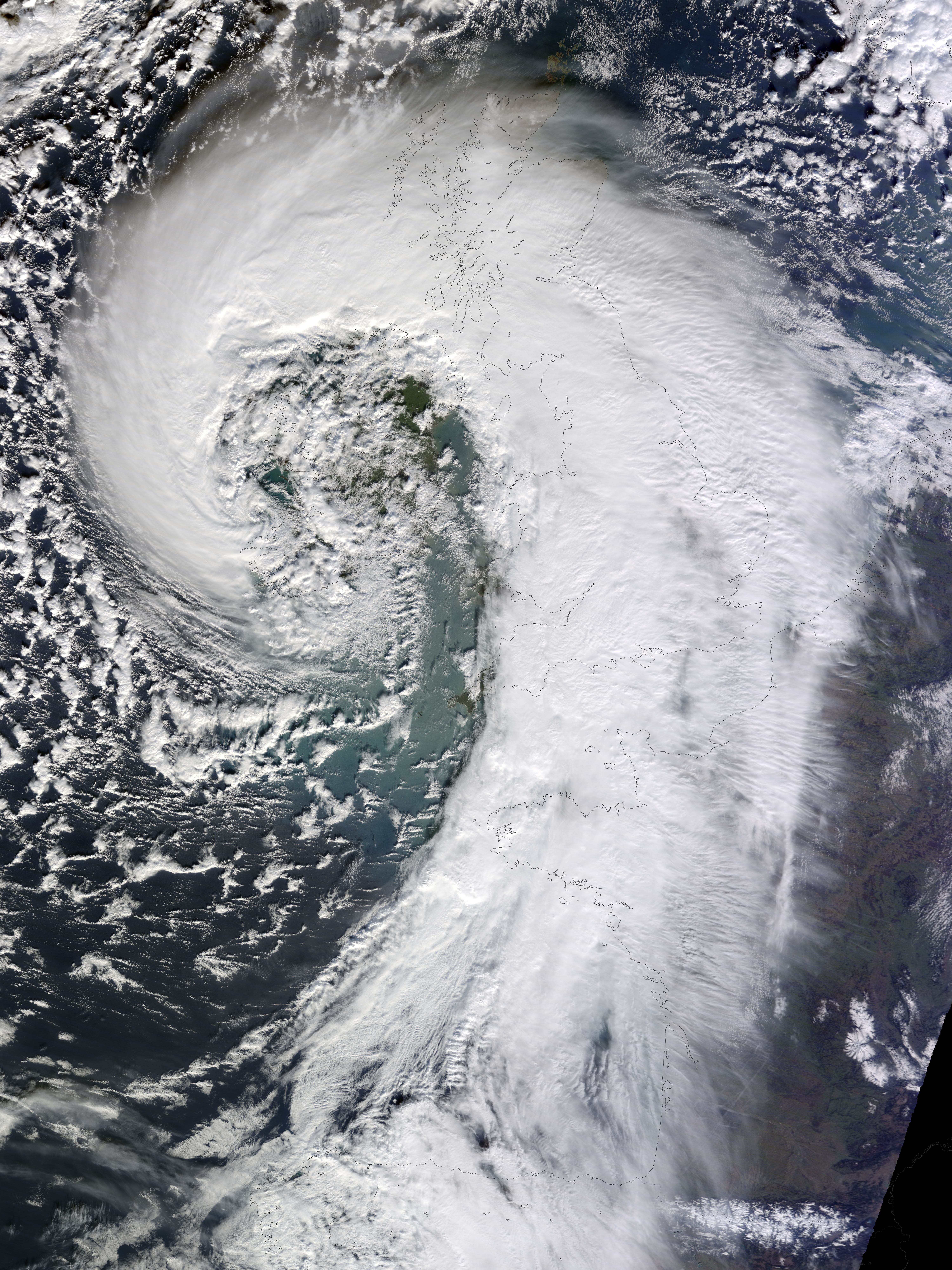
Soggy winters are not unusual in the United Kingdom, but this winter has been in a category of its own. UK Met Office meteorologists had just declared January 2014 the wettest month on record for parts of southern Britain when another series of storms swept across the area in early February.
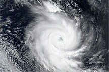
The Moderate Resolution Imaging Spectroradiometer (MODIS) on NASA’s Terra satellite captured this image of an extratropical cyclone bearing down on the United Kingdom on February 12, 2014. Mature extratropical cyclones often feature comma-shaped cloud patterns that are the product of “conveyor belt” circulation. While heavy precipitation is often present near the low-pressure head of the comma, a slot of dry air usually trails the west side of the tail.
The storm brought the United Kingdom yet another round of heavy rain, as well as winds that exceeded 160 kilometers (100 miles) per hour. It snarled traffic, disrupted train service, and caused power outages for more than 700,000 people. The also exacerbated severe flooding in southern England. More than 5,800 homes have flooded since early December, according to media reports. Authorities have deployed thousands of soldiers to towns and cities in southern England to help with flood recovery.
Meanwhile, the Met Office was forecasting more of the same. They warned that another system bearing heavy rain and winds was lining up to push into the United Kingdom from the southeast on Friday morning.
NASA Earth Observatory image by Jesse Allen, using data from the Land Atmosphere Near real-time Capability for EOS (LANCE). Caption by Adam Voiland.