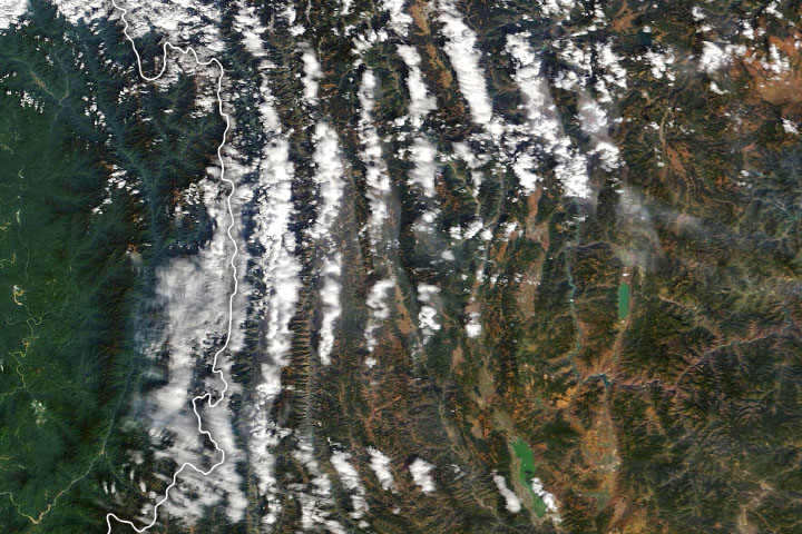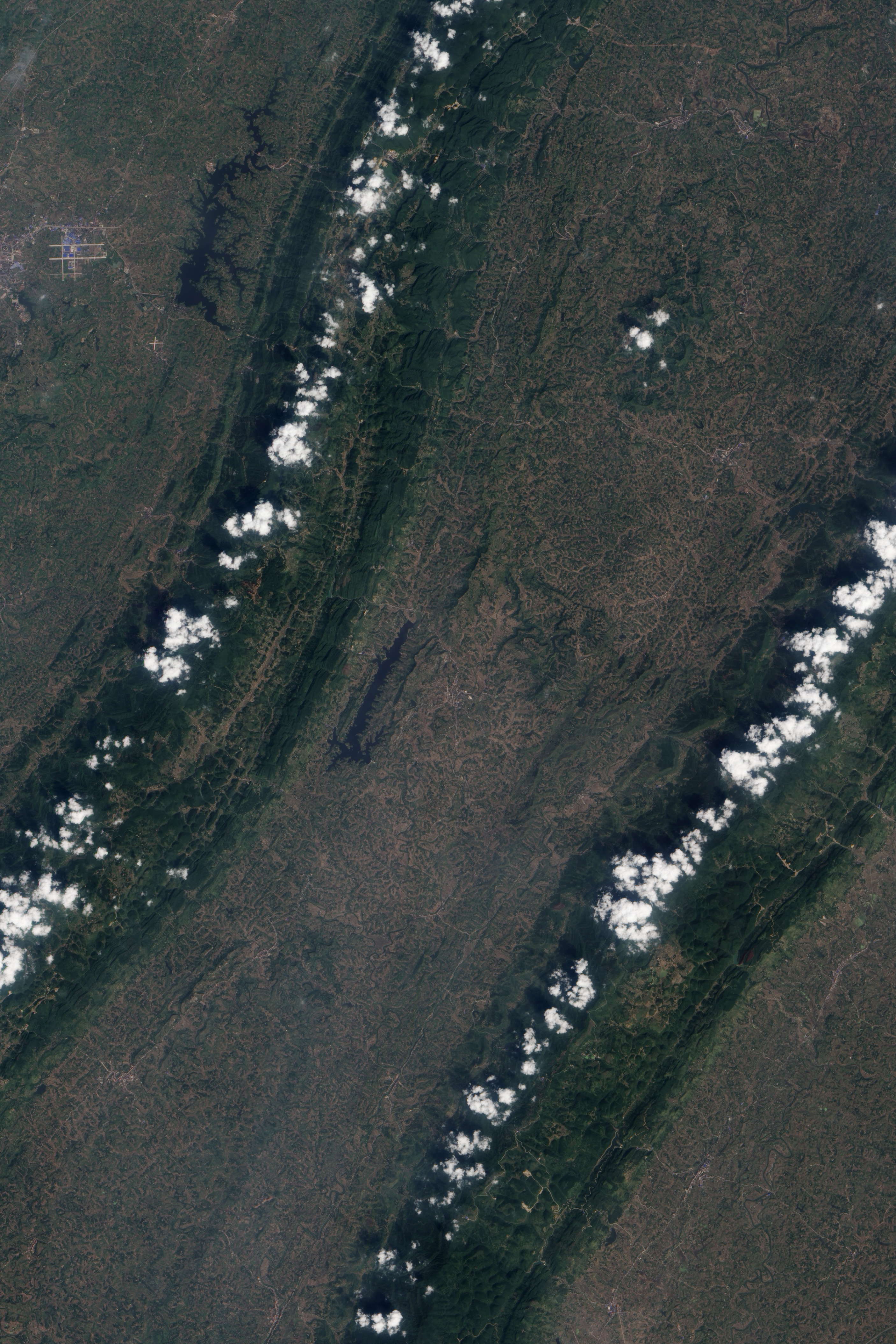
A series of long, parallel ridges cut through the plains in the northeastern portion of China’s Sichuan Basin. The ridges barely reach 1,000 meters (3,300 feet) in most places, making them small in comparison to the rugged mountains that surround the basin. They have a southwestern-northeastern orientation, with many ridges stretching roughly from Chongqing to Dazhou.
Despite their modest size, the ridges are readily visible from space. In the satellite image above, the ridges appear dark green because they are covered by evergreen broadleaf forests. The intervening valleys are lighter green with patches of brown, as they are dominated by farmland, mainly rice paddies and wheat fields. The Sichuan Basin has some of the most fertile soils in China and enjoys a moist climate with mild winters and warm summers. The dark blue feature near the center of the image is the Tongxinqiao Reservoir. The Advanced Land Imager (ALI) on NASA’s Earth Observing-1 (EO-1) satellite captured this image on September 24, 2011.
In addition to the ridges, ALI captured another interesting feature as it passed over: long lines of clouds directly above the ridges. It’s not a coincidence that the clouds lined up so well, as they are orographic clouds—a type that forms when the shape of the landscape (in this case, hills) forces moist air up to altitudes where the water vapor cools and condenses. Orographic clouds can take many shapes and forms, but they move slowly and often appear stationary because their formation is so dependent on topography.
NASA Earth Observatory image by Jesse Allen and Robert Simmon, using EO-1 ALI data from the NASA EO-1 team. Caption by Adam Voiland.