
When the office of Alaska’s lieutenant governor distributed a press release in September 2013 stating that North America’s tallest mountain—Denali—was 83 feet (25 meters) shorter than earlier measurements suggested, mountain climbers and the media took notice.
Yet contrary to some reports, the mountain is not shrinking. In fact, the mountain is growing by about 1 millimeter (.04 inches) per year due to the ongoing collision of the Pacific and North American plates. The newly-circulated elevation number says as much about differences in measuring techniques as it does about the actual height of the mountain.
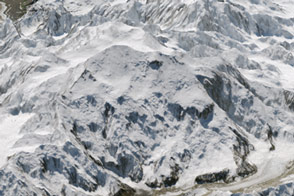
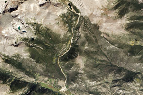
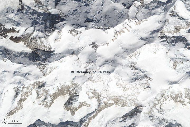
The Operational Land Imager on the Landsat 8 satellite captured this image of Denali, or Mt. McKinley, on June 16, 2013. The mountain, composed primarily of granite, is located in the heart of the Alaska Range and has two significant summits that rise above the Denali Fault. The South Peak is the taller of the two. As seen in the lower image, a number of glaciers slide from its slopes into surrounding valleys, including Ruth, Kahiltna, and Peters glaciers.
The renewed interested in Denali’s height stemmed from an
In 2013, the USGS and partners, including the State of Alaska, added 5-meter Interferometric Synthethic Aperture Radar (InSAR) data into the National Elevation Dataset. The new data, which aircraft collected over large portions of Alaska in 2010, was fed into a digital elevation model (DEM) that calculated Denali’s maximum elevation as 20,237 feet (6,168 meters).
It is tempting to compare this number to an earlier measurement of Denali’s height. In 1952, USGS records indicate that surveyors climbed the mountain and concluded its highest point was 20,320 feet (6,193 meters). But that is an apples to oranges comparison, USGS cartographer Kari Craun explained to National Geographic.
The airborne InSAR data reported the average height for a 269-square-foot (25-square-meter) area around the summit—not Denali’s very highest point. Unlike the 1952 measurements, the more recent measurements were not intended to provided an extremely accurate measurement from the summit, according to Craun.
In the meantime, the authors of the USGS report said this: “while the DEM produced from the raw InSAR data show a somewhat significant drop in elevation from the 1952 survey, the USGS takes no position in favor of either elevation.”
NASA Earth Observatory image by Jesse Allen and Robert Simmon, using Landsat data from the U.S. Geological Survey. Caption by Adam Voiland.