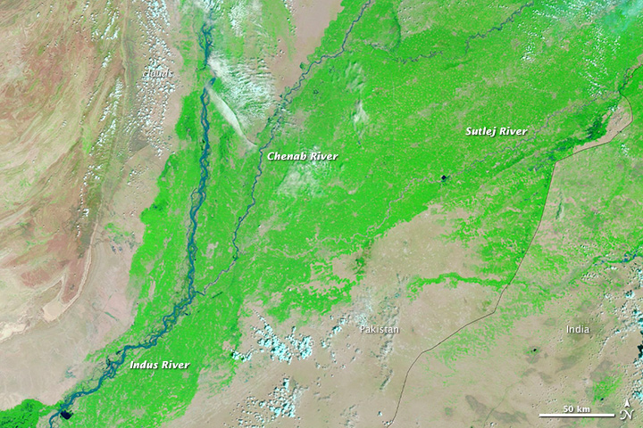
Each summer, monsoon rains sweep across southwestern Asia, soaking India and Bangladesh. In nearby Pakistan, the rains are usually less intense, more intermittent, and centered in the northeast.
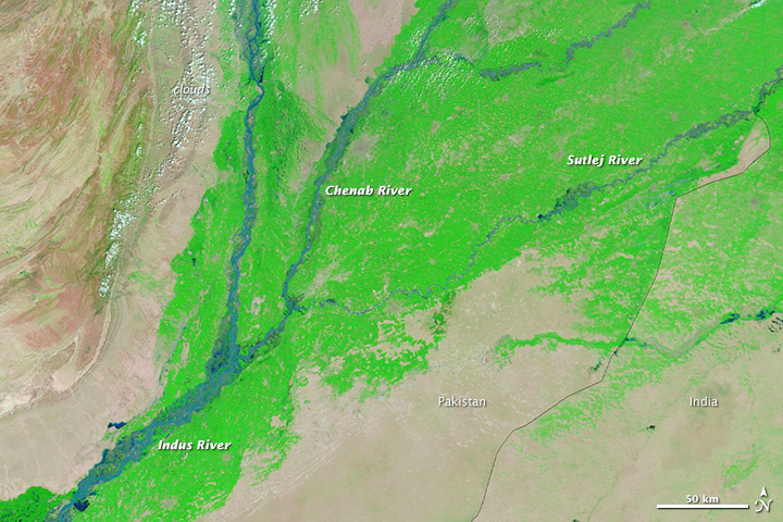
However, August 2013 brought abnormally heavy rains to Pakistan, particularly the eastern provinces of Punjab and Sindh. Many towns received two to three times the normal amount of precipitation, according to statistics complied by the Pakistan Meteorological Department. The rain triggered flooding along the Indus, Chenab, and Sutlej Rivers.
While not as severe or widespread as the destructive floods that struck the area in 2010, the 2013 floods still caused significant damage. According to the Pakistan’s National Disaster Management Authority, the floods affected 1.5 million people, killed more than 200, and forced tens of thousands from their homes. High water destroyed 21,000 homes and swamped more than a million acres of farmland.
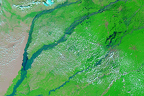
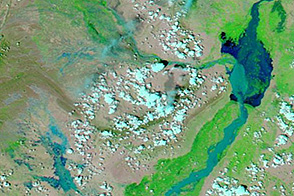
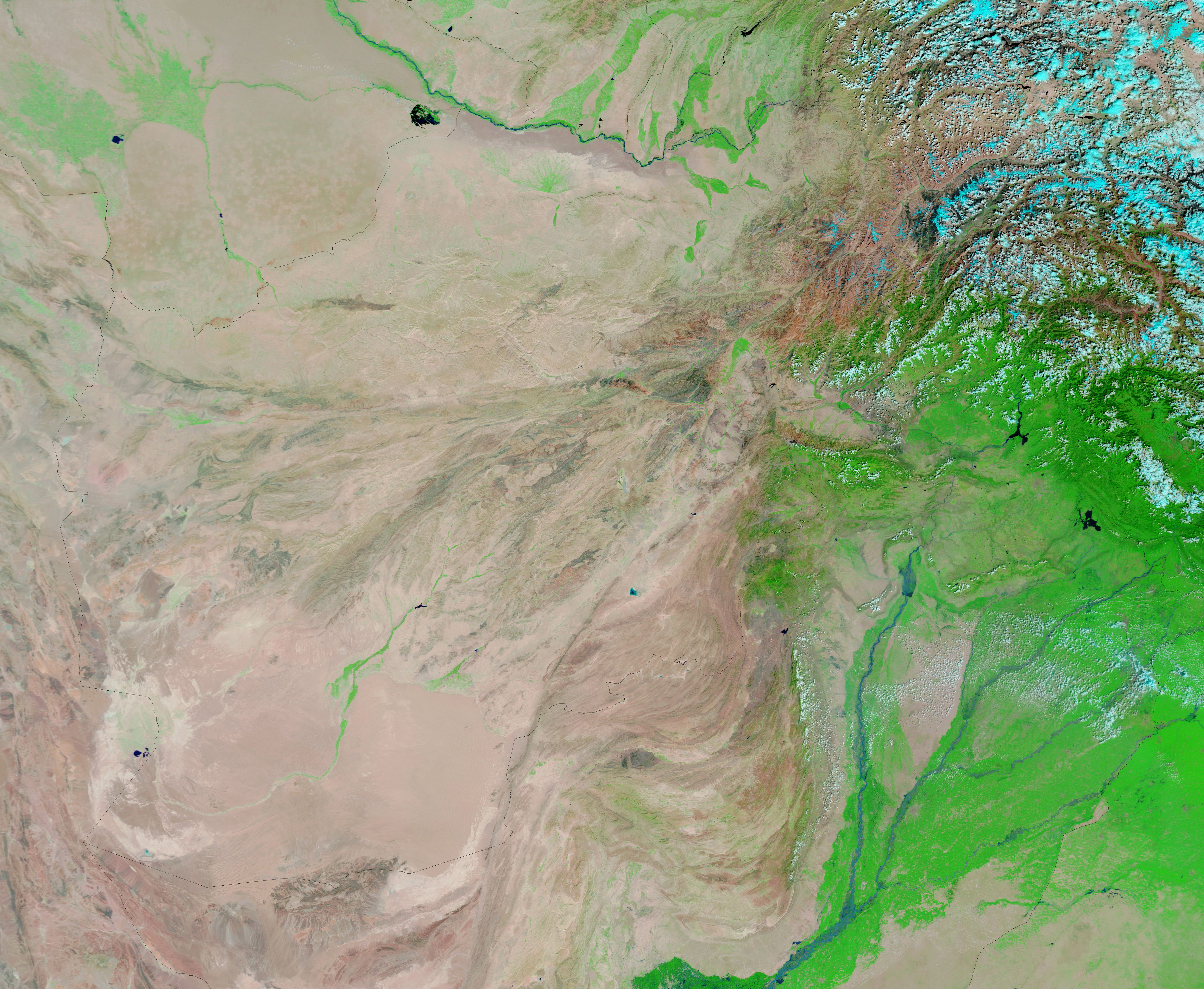
The clouds cleared on September 4, 2013, when the Moderate Resolution Imaging Spectroradiometer (MODIS) on NASA’s Terra satellite acquired a false-color image (top) made from shortwave-infrared, near-infrared, and red light. In this type of image, water is black or dark blue; sediment-laden water or muddy ground is pale blue; plant-covered land is green; and bare earth is tan.
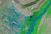
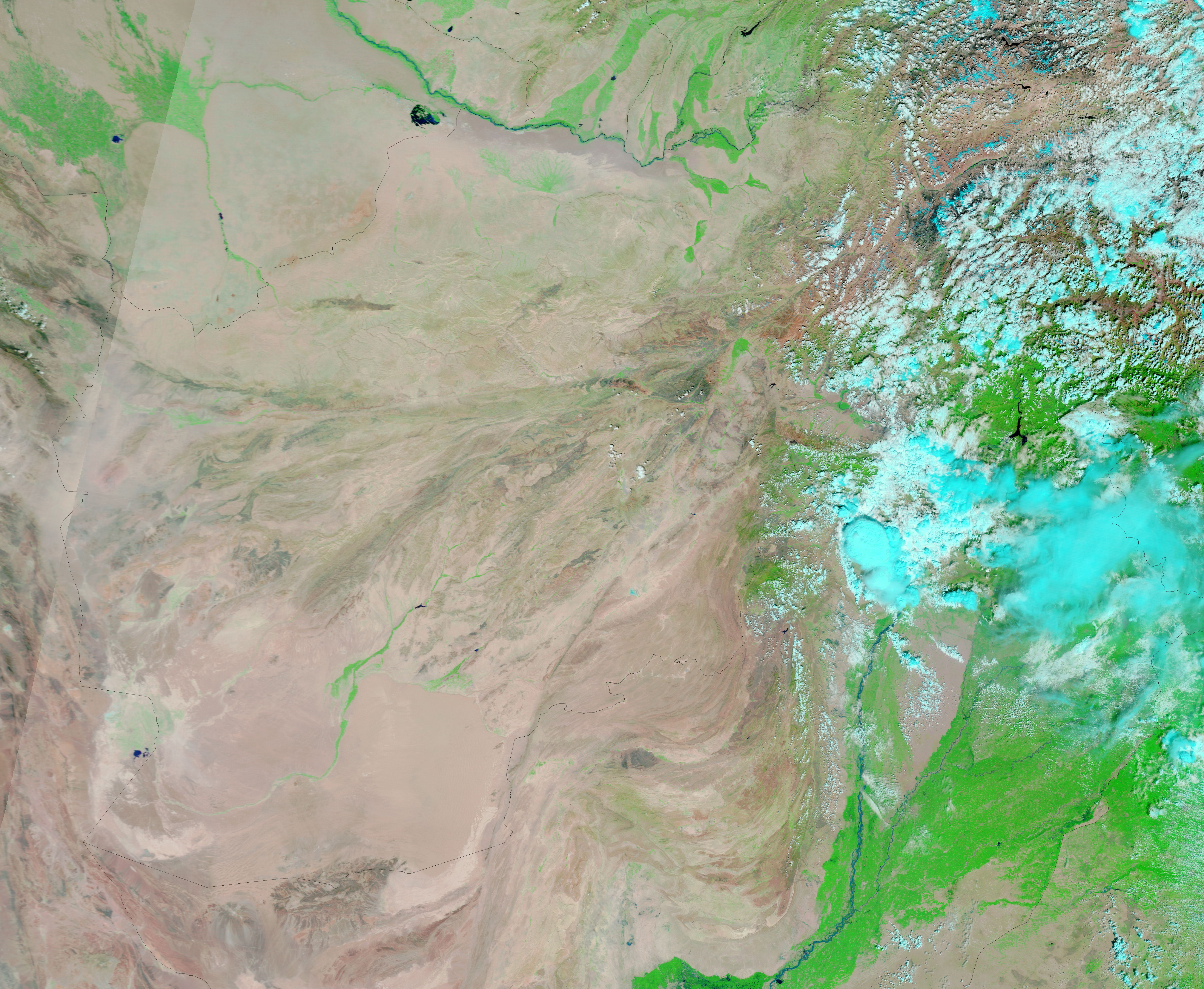
The lower image, taken on September 3, 2012, shows the river at more typical seasonal conditions. Turn on the image comparison tool to see the extent of the flooding. By September 3, the Chenab and Sutlej Rivers were no longer officially at flood stage, but the Indus River was still swollen and flooding.
NASA image courtesy the LANCE/EOSDIS MODIS Rapid Response Team at NASA GSFC. Caption by Adam Voiland.