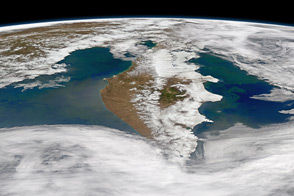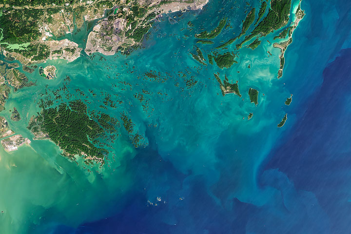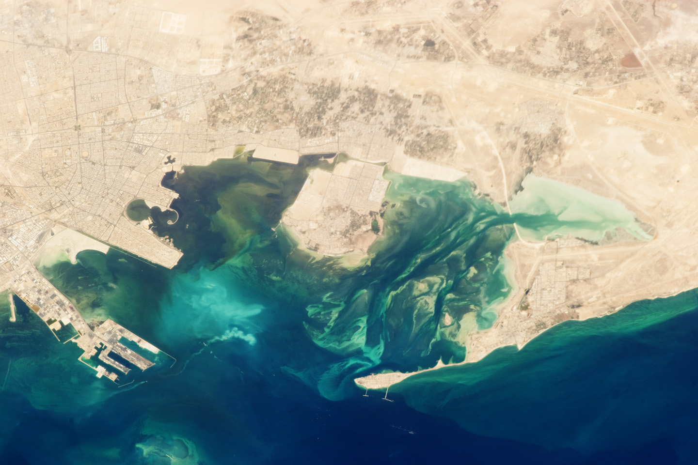
Tarut Bay (also spelled Tarout or Tarot) is located along the coastline of the Arabian Gulf (also known as the Persian Gulf). The bay surrounds one of the largest islands in the Arabian Gulf—Tarut—which has an area of approximately 70 square kilometers (27 square miles). Archeological evidence suggests that the island has been continuously inhabited for more than 5,000 years. Today, the island hosts both suburban development and fishing industries. It is linked to the mainland city of Qatif to the west by two causeways that cross a narrow channel of the bay. (Note that north is to the left in this image.)
The Ras Tanura peninsula, which forms the northern boundary of Tarut Bay, is occupied by residential compounds and industrial facilities owned by Saudi Aramco, one of the largest and most valuable oil companies in the world. In addition to the facilities along the natural shorelines and islands of the bay, numerous drill rigs and docking facilities have been constructed to support the activities of the petroleum industry. One striking example is the King Abdulaziz Seaport complex, located to the south of Tarut Bay in the Arabian Gulf. The port complex is essentially a small, self-supporting city with housing for employees, medical and support services, and water treatment plants.
Green to turquoise ribbon-like features in the waters of Tarut Bay are likely a combination of phytoplankton and sediments moved by nearshore currents. Green areas near the city of Qatif include both farms and numerous fruit trees—such as date palms—which hearken back to the region’s history as an oasis.
Astronaut photograph ISS036-E-2458 was acquired on May 18, 2013, with a Nikon D3S digital camera using a 400 millimeter lens, and is provided by the ISS Crew Earth Observations experiment and Image Science & Analysis Laboratory, Johnson Space Center. The image was taken by the Expedition 36 crew. It has been cropped and enhanced to improve contrast, and lens artifacts have been removed. The International Space Station Program supports the laboratory as part of the ISS National Lab to help astronauts take pictures of Earth that will be of the greatest value to scientists and the public, and to make those images freely available on the Internet. Additional images taken by astronauts and cosmonauts can be viewed at the NASA/JSC Gateway to Astronaut Photography of Earth. Caption by William L. Stefanov, Jacobs/JETS at NASA-JSC.