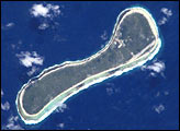
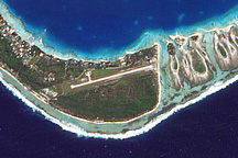
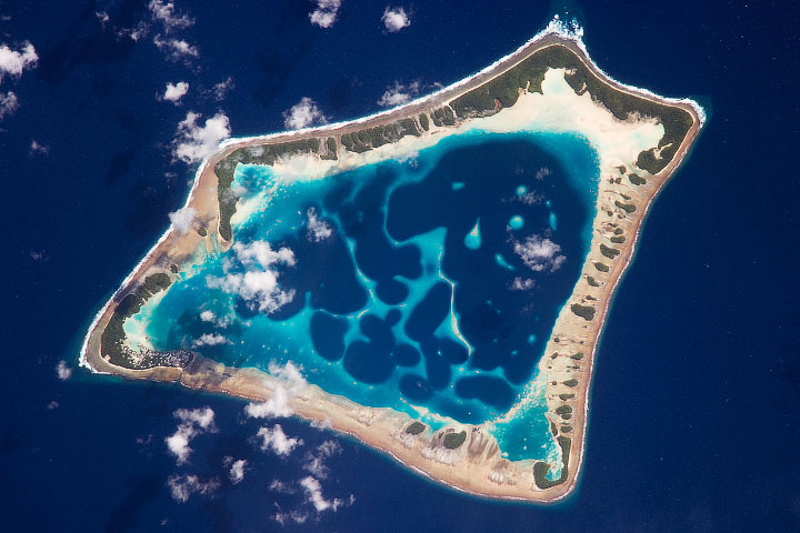
In the Republic of the Marshall Islands, in the western Pacific Ocean, lie two atolls—coral islands encircling lagoons. NASA’s Landsat 7 satellite acquired this image of Majuro and Arno Atolls on May 16, 2000. Both atolls appear as meandering lines of delicate white against a darker ocean background. Areas of shallow water near the shore appear iridescent blue, especially in the southwest portion of each atoll and off the northwest tip of Arno Atoll. Overhead, tiny white clouds dot the sky.
Majuro Atoll is 40 kilometers (25 miles) in circumference, and it partially encloses a lagoon of nearly 300 square kilometers (115 square miles). The lagoon is far bigger than the atoll itself, whose land area is less than 10 square kilometers (4 square miles); walking from the lagoon side to the ocean side of the atoll takes only minutes. Neighboring Arno Atoll encloses three lagoons: two “pinched lagoons” in the northeast and northwest, and a main lagoon of nearly 340 square kilometers (130 square miles). Arno’s total land area is just 13 square kilometers (5 square miles).
Scientists have long understood that coral atolls develop around volcanic islands and remain there after those islands have eroded away. To what extent the final shape of an atoll is influenced by wind and ocean wave activity, however, remains a topic of debate. Landsat data helped researchers examine these questions in the Maldives in the Indian Ocean.
You can download a 28.5-meter-resolution KMZ file of Majuro and Arno Atolls suitable for use with Google Earth.
NASA image created by Jesse Allen, using Landsat data provided by the University of Maryland’s Global Land Cover Facility.