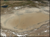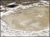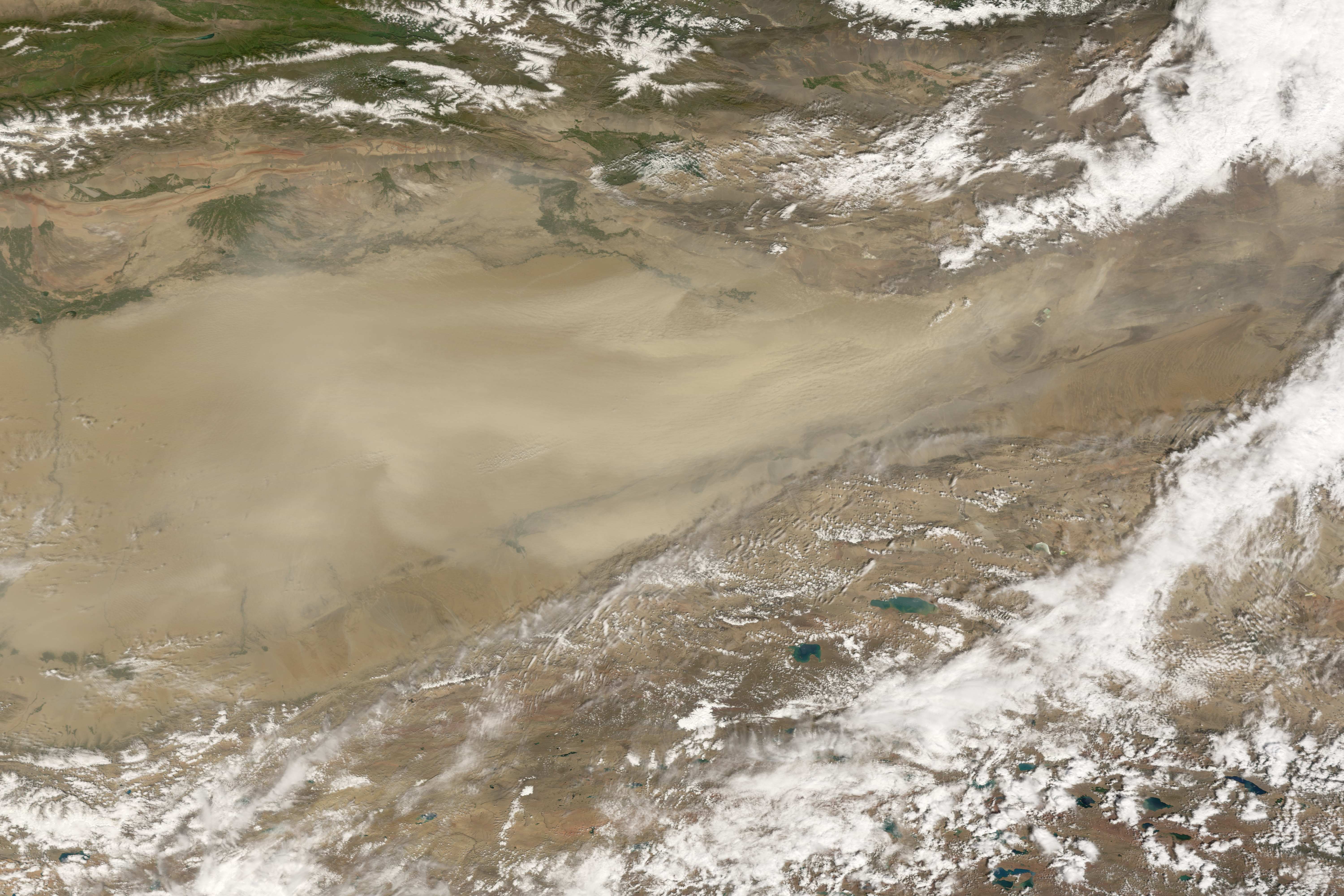
Dust blew eastward out of the Taklimakan Desert on August 22, 2007. The Moderate Resolution Imaging Spectroradiometer (MODIS) on NASA’s Terra satellite took this picture the same day, capturing beige dust plumes snaking their way out of the desert basin as bright white clouds hover overhead. The dust plumes mirror the color of the underlying desert basin. In contrast, the rugged topography of the surrounding mountains is darker. Mountains in the north sport green vegetation and even some snow cover, which forms a dendritic pattern compared to the billowy clouds.
One of the world’s largest sandy deserts, the Taklimakan (or Takla Makan) lies in the Tarim Basin, sandwiched between the Tien Shan Mountains to the north and Kunlun Mountains to the south. A vegetation-lined river flows from the Tien Shan Mountains southeastward into the northern part of the basin. Water flowing into the basin finds no outlet, and over the years, water-deposited sediments have steadily accumulated. In some places, the sand cover is as much as 300 meters (roughly 1,000 feet) thick. Opinions varied about the desert’s age, some dating it in the middle of the Pleistocene, less than a million years old. A 2006 study, however, concluded that sand dunes were shifting in the Taklimakan by 5.3 million years ago.
Home to little plant life, the Taklimakan sees a wide range in temperatures characteristic of sandy deserts. Summertime temperatures can soar to 38 degrees Celsius (100 degrees Fahrenheit), especially along the desert’s eastern edge. The dearth of vegetation and extreme heat create conditions in the lower atmosphere that increase the likelihood of dust storms.
NASA image created by Jesse Allen, using data provided courtesy of the MODIS Rapid Response team.