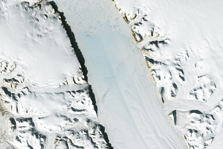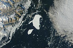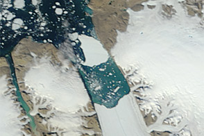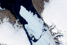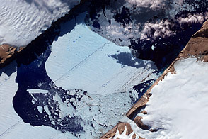
The Petermann Glacier grinds and slides toward the sea along the northwestern coast of Greenland, terminating in a giant floating ice tongue. Like other glaciers that end in the ocean, Petermann periodically calves icebergs. A massive iceberg, or ice island, broke off of the Petermann Glacier in 2010. Nearly two years later, another chunk of ice has broken free.
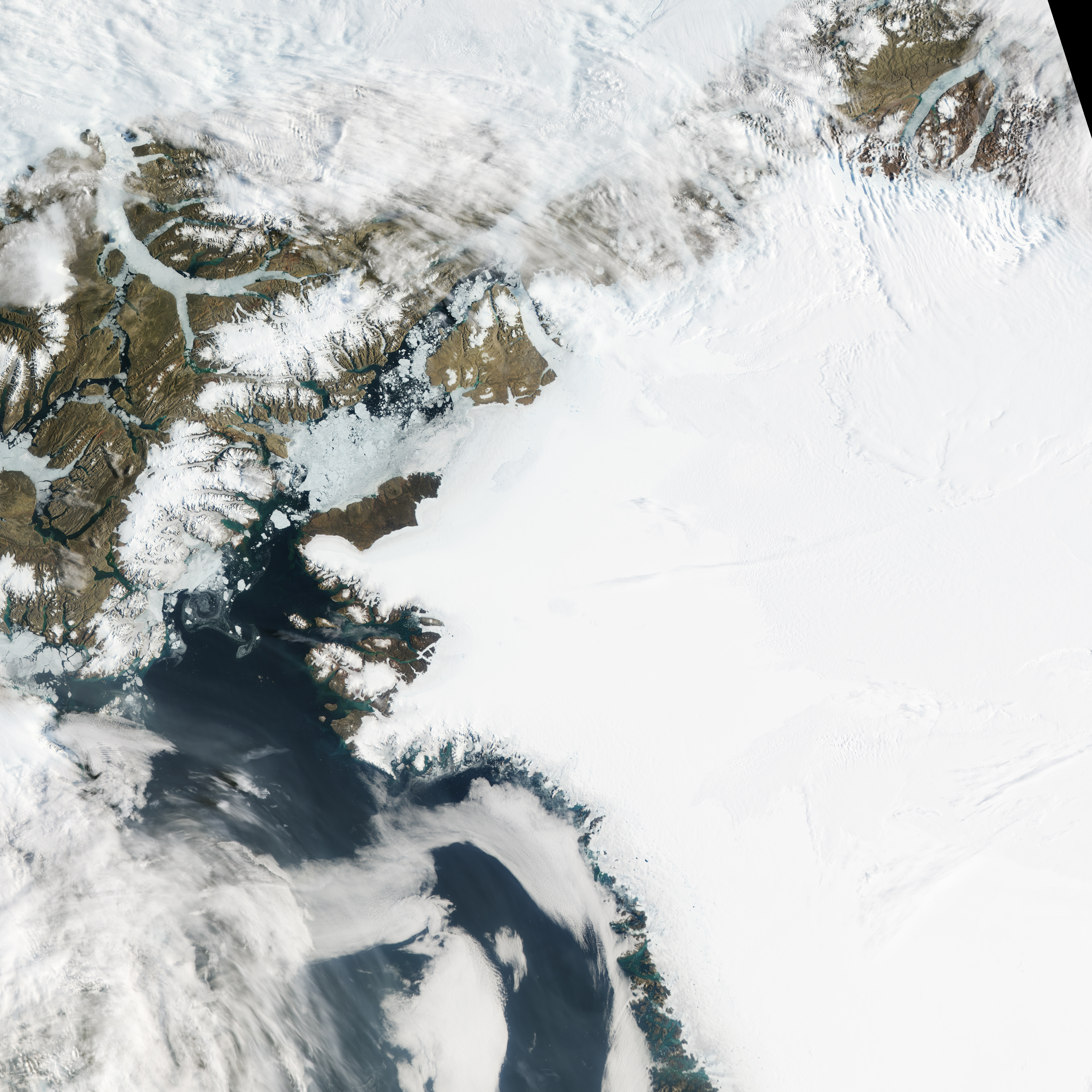
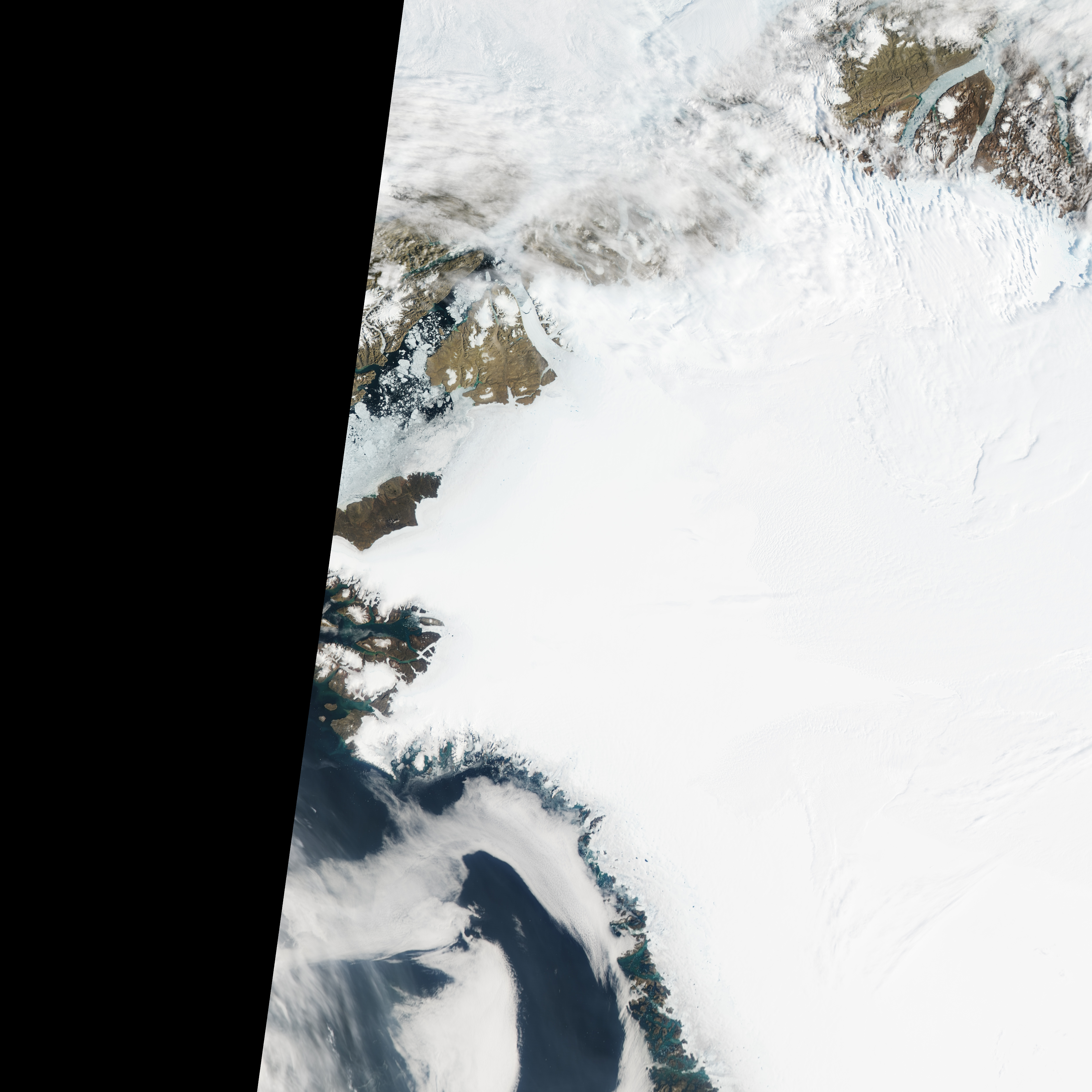
The Moderate Resolution Imaging Spectroradiometer (MODIS) on NASA’s Aqua satellite observed the new iceberg calving and drifting downstream on July 16–17, 2012. Because Aqua is a polar-orbiting satellite, it makes multiple passes over the Polar Regions each day. At 10:25 Coordinated Universal Time (UTC) on July 16 (top image), the iceberg was still close to the glacier. At 12:00 UTC that same day (middle), the berg had started moving northward down the fjord. Thin clouds partially obscure the downstream view.
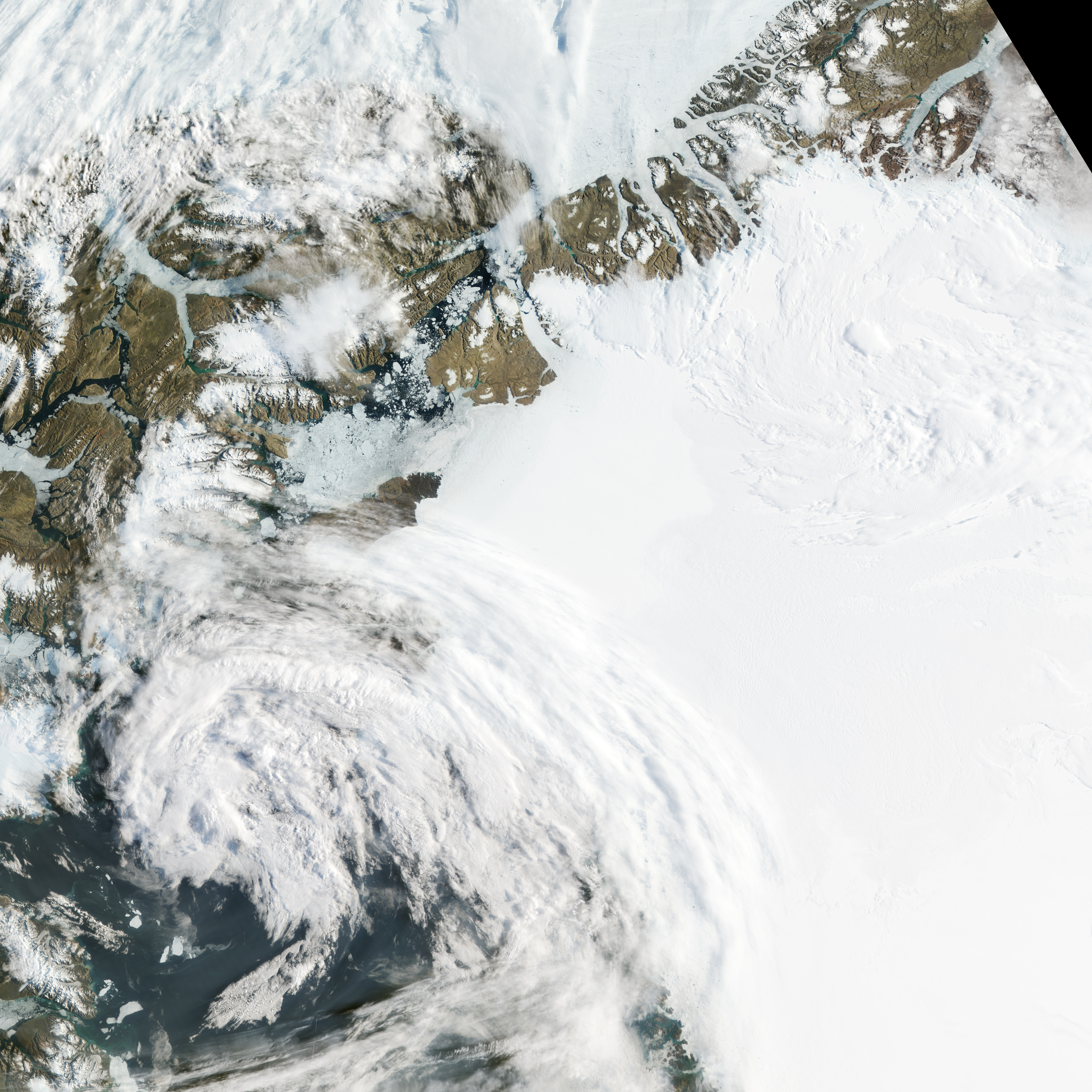
One day later, at 09:30 UTC on July 17, Aqua spied a larger opening between the glacier and the iceberg, as well as some breakup of the thinner, downstream ice. The iceberg appears to have made a slight counter-clockwise turn. “The floating extension is breaking apart,” said Eric Rignot of NASA's Jet Propulsion Laboratory and the University of California–Irvine. “It is not a collapse but it is certainly a significant event.”
Konrad Steffen, director of the Swiss Federal Institute for Forest, Snow, and Landscape Research WSL, estimated that this iceberg was roughly half the size of the ice island that calved off of Petermann in 2010.
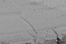
Ted Scambos, lead scientist at the U.S. National Snow and Ice Data Center, noted that this calving event marks a retreat of the Petermann Glacier “farther back than historical calving fronts.” A comparison of this event to the 2010 event shows that this iceberg broke off the glacier tongue farther upstream. The crack along the southern margin of this new iceberg, however, has been visible in satellite imagery for several years. That rift was first identified in 2001.
NASA Earth Observatory image by Jesse Allen, using data from the Land Atmosphere Near real-time Capability for EOS (LANCE). Caption by Michon Scott with information from Walt Meier and Ted Scambos, National Snow and Ice Data Center; and Konrad Steffen, Swiss Federal Institute for Forest, Snow and Landscape Research.