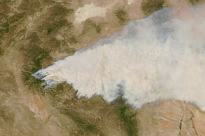
Researchers on NASA’s DC-8, a flying laboratory, have launched a six-week hunt for thunderstorms. They’re part of a team of 100 researchers from 29 organizations participating in Deep Convective Clouds and Chemistry (DC3), a field campaign based in Kansas sending aircraft to Alabama, Colorado, and Oklahoma to sample how storms affect the chemistry of the upper troposphere.
The preferred target: large multicell and supercell storms with powerful updrafts capable of lofting volatile pollutants and moisture-rich air nearly 12,000 meters (40,000 feet) up in the atmosphere, a height that pollutants wouldn’t reach without a boost from a storm. They are particularly interested in understanding how certain pollutants react with nitrogen oxides produced by lightning to generate ozone, a greenhouse gas that has a strong impact on the climate at this altitude.
Four days into the campaign, the researchers found just the sort of storm they were looking for developing southwest of Cheyenne over central Oklahoma. According to a summary of the flight posted on the campaign's website, the storm cell formed rapidly around 5:00 p.m., and by 5:45 p.m. the DC-8 and the National Center for Atmospheric Research and National Science Foundation’s Gulfstream-V had reached the storm's southern edge and started taking samples.
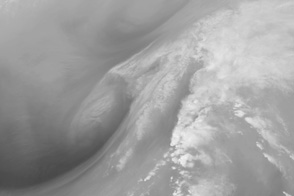
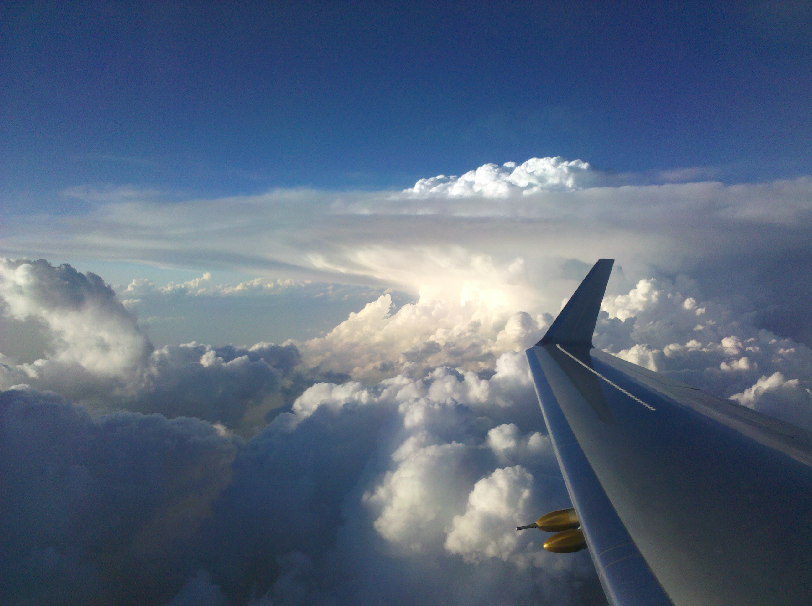
The image above, a photograph taken by DC3 Principal Investigator Chris Cantrell as the Gulfstream-V was approaching from the south, shows the structure of the storm cloud. Vigorous convection has created a strong updraft near the center of the storm where warm, moist air rises quickly upward, sometimes at speeds up to 160 kilometers per hour (100 miles per hour).
The flat bank of cirrus clouds spreading outward and forming the cloud’s anvil mark the edge of the tropopause. The tropopause is the boundary between the lowest layer of the atmosphere where most weather occurs and air often flows vertically (the troposphere) and a higher layer where air flow is mainly horizontal (the stratosphere).
The tropopause behaves like a wall, deflecting the updraft's rising air and causing it to spread outward in a way that molds the upper part of clouds into the distinctive anvil shape. However, convection sometimes pushes moisture past the top of the cloud and into the tropopause, creating bubbling protrusions called overshooting tops. These protrusions are usually short lived and wispy, but they tend to persist longer above severe storms like this one.
While the DC-8 was at a low altitude measuring air flowing into the storm, the Gulfstream-V measured the outflow near the top of the storm. The plane made two passes directly though the anvil and one above it. The instruments on the Gulfstream-V detected elevated levels of carbon monoxide and methane near the top of the storm, suggesting the updraft had lofted pollutants from the surface high into the atmosphere. Instruments on the DC-8, meanwhile, detected high levels of aerosols entering the storm, possibly smoke that had wafted to the area from fires in Mexico.
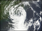
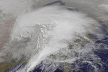
As the aircraft were sampling the storm, satellites were observing the broader scene from above. An imager on the geostationary GOES-East satellite captured the lower image at 7:15 p.m. on May 19, 2012. It shows the storm front stretching across Oklahoma and into Kansas. The dark specks that give texture to the front are overshooting tops. The approximate location of the aircraft when it observed the storm is marked with a circle.
Photograph courtesy of the DC3 team. NASA Earth Observatory image by Robert Simmon using data provided by the GOES team. Caption by Adam Voiland.