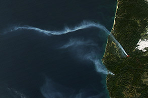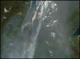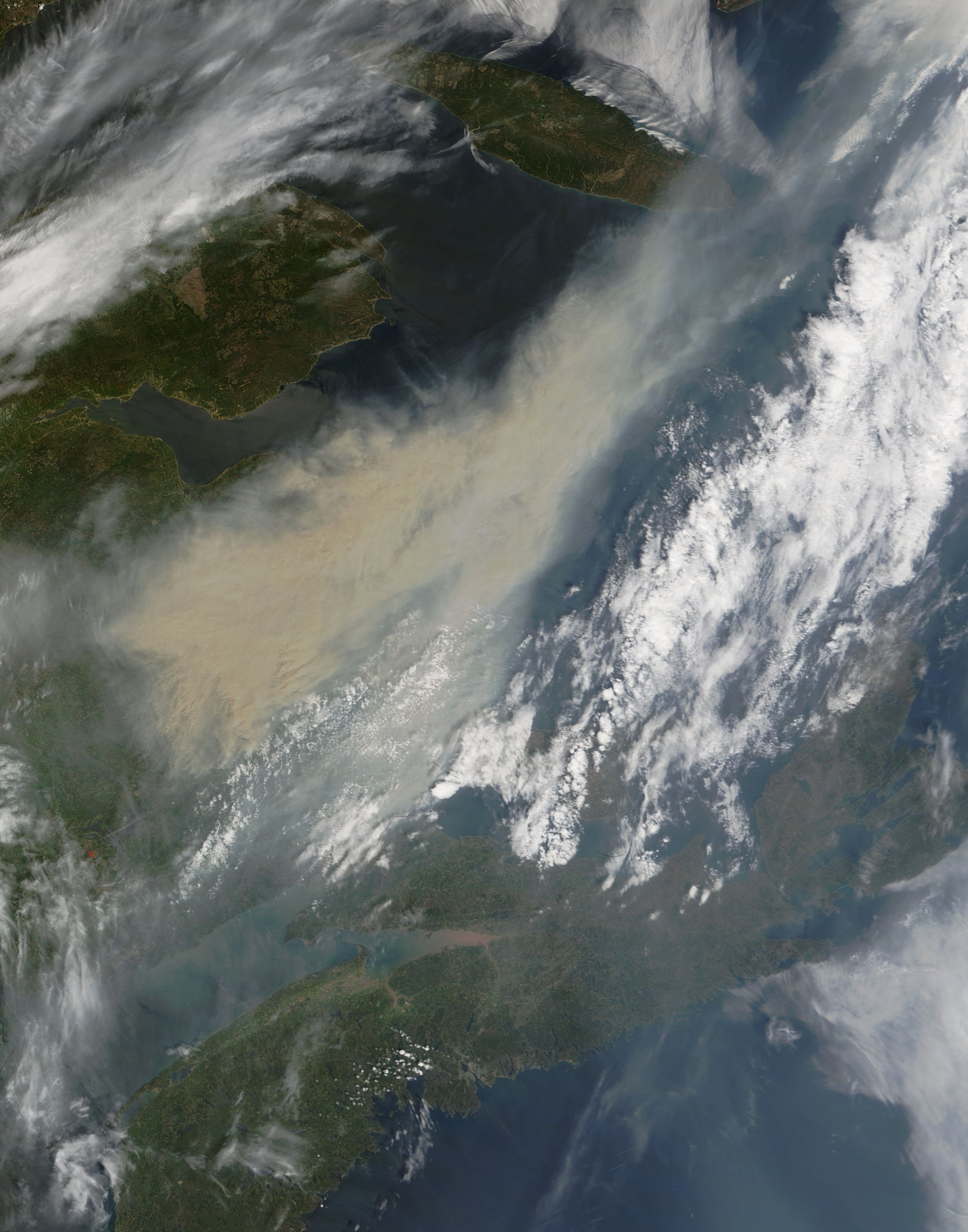
In late May, a massive smoke plume hundreds of kilometers across blew eastward over New Brunswick toward the Atlantic Ocean. On May 26, 2007, the Moderate Resolution Imaging Spectroradiometer (MODIS) on NASA’s Terra satellite captured this image at 11:40 a.m. local time. By the time MODIS took this picture, the smoke appeared to have completely detached itself from the source, a large fire burning in southwestern Quebec, beyond the western edge of this image.
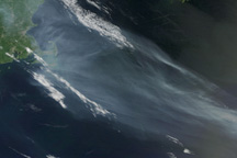
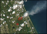
In this image, the smoke appears as a gray-beige opaque mass with fuzzy, translucent edges. The plume is thickest in the southwest and diminishes toward the northeast. Just southwest of the plume is a red outline indicating a hotspot—an area where MODIS detected anomalously warm surface temperatures, such as those resulting from fires. This hotspot, however, is not the source for this smoke plume. According to a bulletin from the National Oceanic and Atmospheric Administration, the southwestern Quebec fire (visible in this wider-area view as a semi-circular arrangement of hotspots at image left) was the source.
According to reports from the Canadian Interagency Forest Fire Centre on May 29, that fire was estimated at 63,211 hectares (156,197 acres), and it was classified as “being held.” At the same time, more than 20 wildfires burned in Quebec, news sources reported, and firefighters from other Canadian provinces and the United States had been brought in to provide reinforcements for the area’s firefighters.
NASA image by Jeff Schmaltz, MODIS Rapid Response Team, Goddard Space Flight Center.