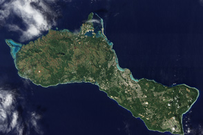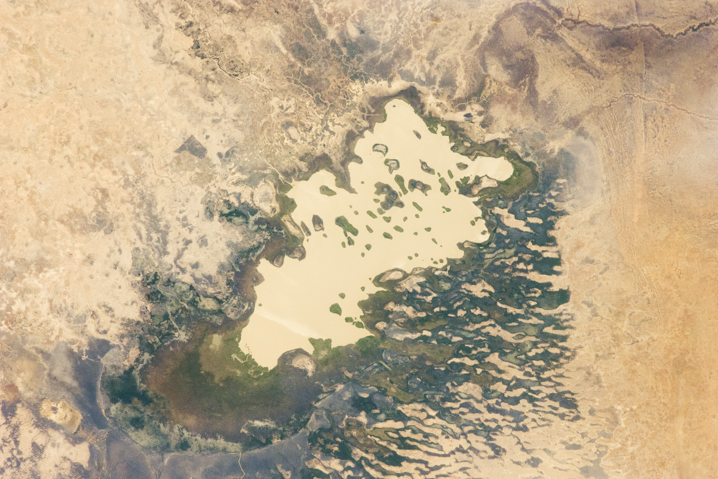
Lake Fitri is an endorheic or “terminal” lake in the southern Sahara Desert. Deserts get so little rainfall that the rivers passing through them often cannot reach the sea, instead ending at depressions in the land surface where they form lakes.
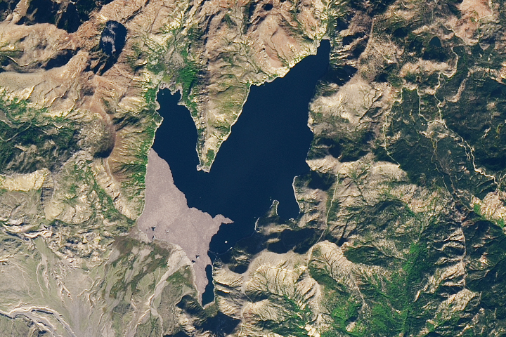
Astronauts on the International Space Station captured this photograph of the area in January 2012. (Note that the image is rotated so north is to the lower left.) Muddy, yellow-brown water marks the center of the basin, with a ring of dark brown muds and burnt vegetation on the exposed lake floor to the north (lower left). The shoreline supports a thin line of reeds and floating grass vegetation, which appears as dark green in the image.
The usually dry Wadi Batha empties into Lake Fitri from the east (image top). Over time, water flow in Wadi Batha has created a large delta, which occupies the entire top left third of the image (for scale, the lake is 23 kilometers long). Lake Fitri and its surroundings have been designated under the Ramsar Convention as a wetland of international importance.
Other features of the image reveal evidence of significant climate change. The dry borders of the lake show that it was many times larger in years past. Numerous sweeping curves of ancient beaches are now situated many kilometers from the modern shoreline; those past shorelines also sit at higher altitudes. Inland lakes are highly sensitive to the equilibrium between the amount of inflow from contributing rivers (like Wadi Batha) and evaporation. Each beach ridge therefore shows a different lake level and thus a different balance in the lake-river-climate system. A smaller river enters from the south (top right) and cuts through the beach reaches on its way to the lake.
The irregular, elongated tan patches to the west (lower right) are linear dunes aligned parallel to the dominant winds, which blow from the northeast. The dunes have all formed on the downwind side (southwest) of the lake; the lake bed and delta provide the sands. The dunes indicate that the lake has been almost or completely dry on repeated occasions during past climatic phases—often enough for these great dunes (many kilometers long and several meters high) to form even in the lowest parts of the lake. The islands visible in the center of the lake are remnants of dunes, though smaller than those on the lake margin presumably because waves from the lake have eroded them. Villages occupy the points of some major dunes and of some islands, where fishermen can gain easy access to the lake.
Astronaut photograph ISS030-E-59398 was acquired on January 19, 2012, with a Nikon D2Xs digital camera using a 180 mm lens, and is provided by the ISS Crew Earth Observations experiment and Image Science & Analysis Laboratory, Johnson Space Center. The image was taken by the Expedition 30 crew. The image has been cropped and enhanced to improve contrast, and lens artifacts have been removed. The International Space Station Program supports the laboratory as part of the ISS National Lab to help astronauts take pictures of Earth that will be of the greatest value to scientists and the public, and to make those images freely available on the Internet. Additional images taken by astronauts and cosmonauts can be viewed at the NASA/JSC Gateway to Astronaut Photography of Earth. Caption by M. Justin Wilkinson, Jacobs Technology/ESCG at NASA-JSC.