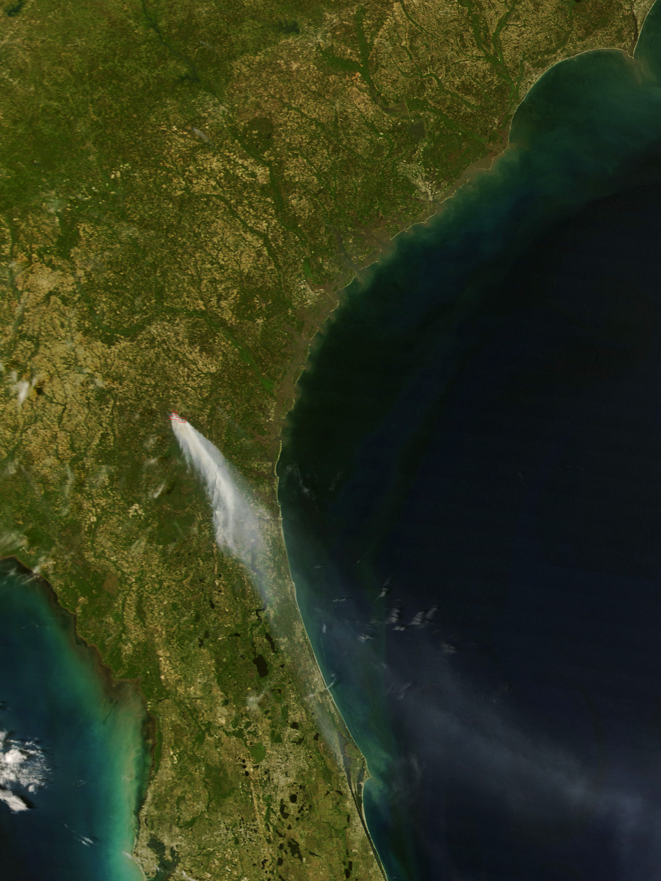
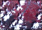
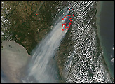
According to reports from the Southern Area Coordination Center, the Sweat Farm Road Fire in southern Georgia exploded from 1,000 acres to more than 20,000 acres in less than 24 hours between April 16 and 17, 2007. Strong winds whipped the blaze into 100-foot flames, while individual trees went up like torches.
This image of the fire was captured by the Moderate Resolution Imaging Spectroradiometer (MODIS) on NASA’s Terra satellite at 11:40 a.m. EST on April 17. The locations where MODIS detected actively burning fires are outlined in red. A huge plume of smoke spreads southeast over the Georgia-Florida state line. Just one day before, the active fire location that MODIS detected was much smaller.
The fire is about 10 miles southwest of the city of Waycross, Georgia, and it has burned into the northeastern part of the Okefenokee Swamp. Officials have had to close major state roads and evacuate hundreds of people. The fire was estimated (as of April 17) to be about 5 percent contained. Weather conditions were dry and windy, and fire management officials expected the fire to remain a threat to the city of Waycross throughout the week. The smoke spread as far south as Daytona Beach.
The large image provided above has a spatial resolution (level of detail) of 250 meters per pixel. The MODIS Rapid Response Team provides twice-daily images of the region in additional resolutions and formats.
NASA image courtesy the MODIS Rapid Response Team, Goddard Space Flight Center


