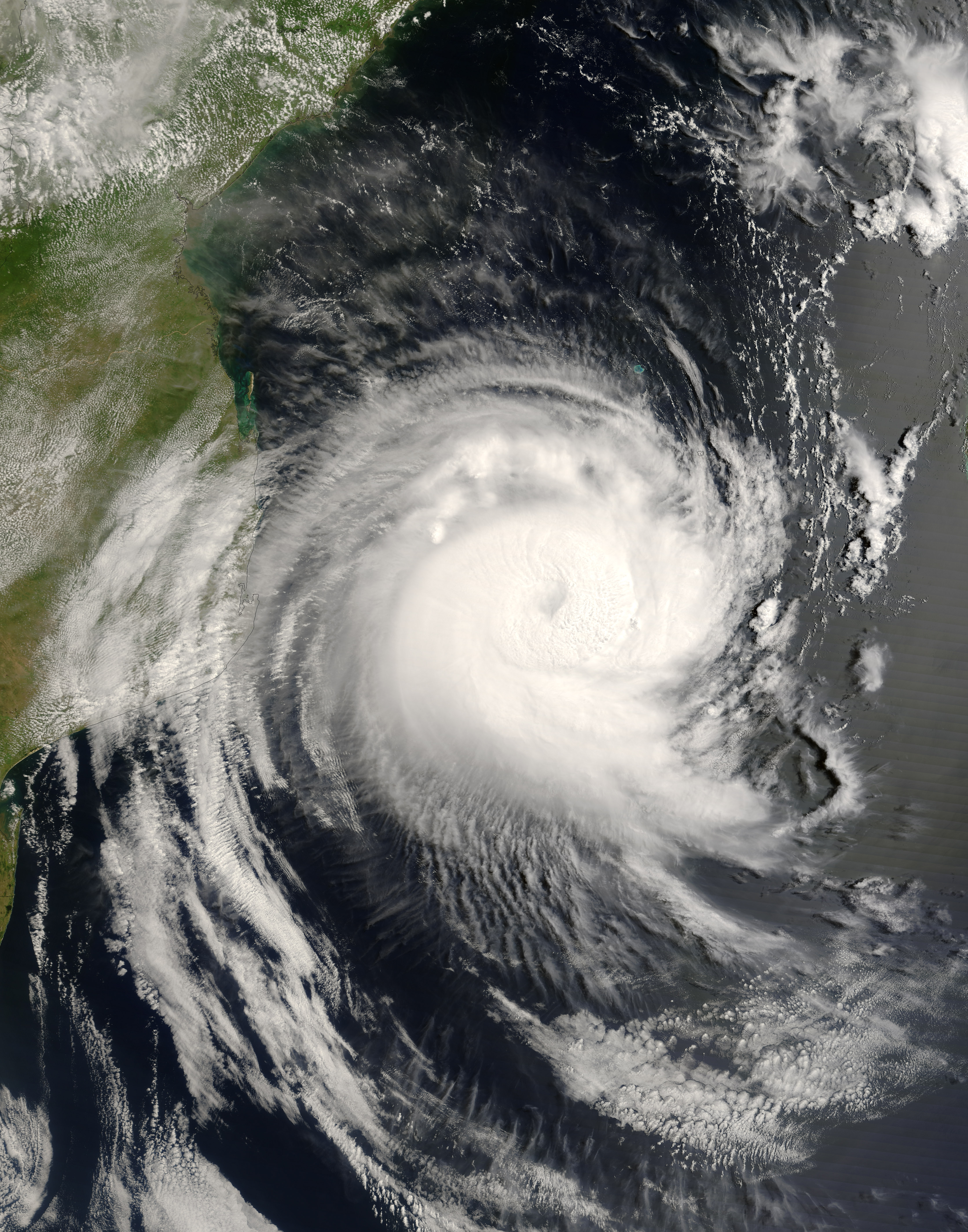
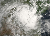
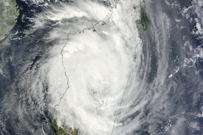
Category 4-strength Cyclone Favio was closing the gap between Madagascar and mainland Africa on February 21, 2007, preparing to strike Mozambique in coming days. This image from the Moderate Resolution Imaging Spectroradiometer (MODIS) on NASA’s Terra satellite shows Favio stretched across the Mozambique Channel at 9:35 a.m. (local time) Wednesday morning. The outermost bands of clouds on the western side of the storm were already brushing the coast of Inhambane province in southern Mozambique. A thick ring of “boiling” clouds surrounds the eye of the storm.
Favio had weakened slightly to a Category 3 storm between the time the image was acquired. The Joint Typhoon Warning Center forecast issued at 12:00 UTC (2:00 p.m. Mozambique local time) on February 21 indicated that Favio had sustained wind speeds of 100 knots (about 185 kilometers/hour, 115 miles/hour), with gusts up to 125 knots (about 232 kilometers/hour; 144 miles/hour). The forecast called for the storm to weaken before making landfall within 24 hours, but the impacts were still expected to be severe. The country was already water-logged from heavy rains associated with the onset of the monsoon, and severe flooding along the Zambezi River in mid-February killed dozens of people and forced more than a hundred thousand people to evacuate, according to reports from the International Federation of Red Cross and Red Crescent Societies posted online by ReliefWeb.
The high-resolution image provided above is at MODIS’ full spatial resolution (level of detail) of 250 meters per pixel. The MODIS Rapid Response System provides this image at additional resolutions.
You can also download a 250-meter-resolution Cyclone Favio KMZ file for use with Google Earth.
NASA image by Jeff Schmaltz, MODIS Rapid Response Team, Goddard Space Flight Center.


