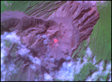
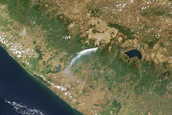
On October 1, 2005, El Salvador’s Santa Ana Volcano, also known as the Ilamatepec Volcano, erupted—it’s first eruption since 1904. In addition to volcanic ash and lava flow, the October 1 eruption reportedly shot out car-sized lava rocks and a flood of boiling mud and water. According to BBC news and ReliefWeb reports, officials initially reported two deaths, several injuries, and the evacuation of approximately 2,000 people. El Salvador’s president warned of the possibility of a second eruption.
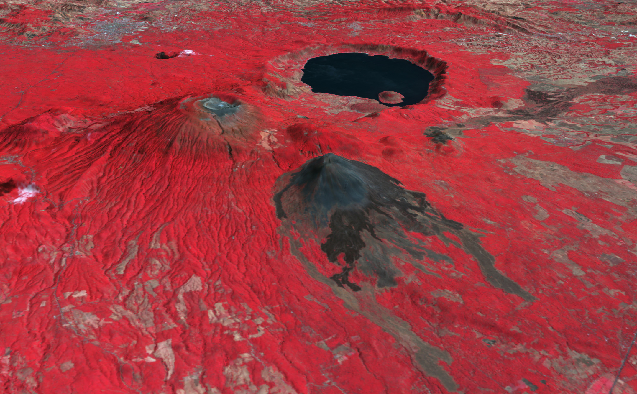
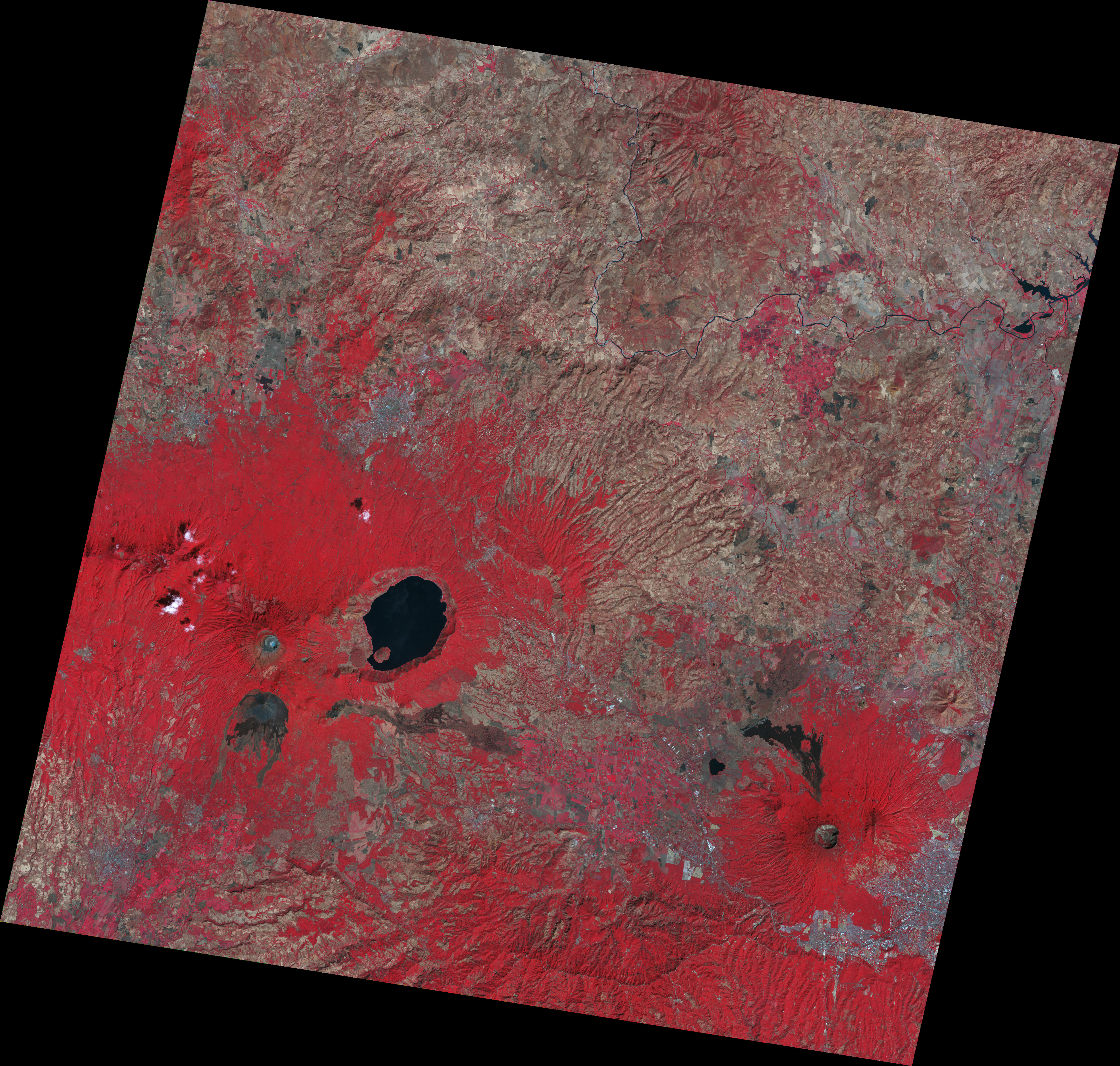
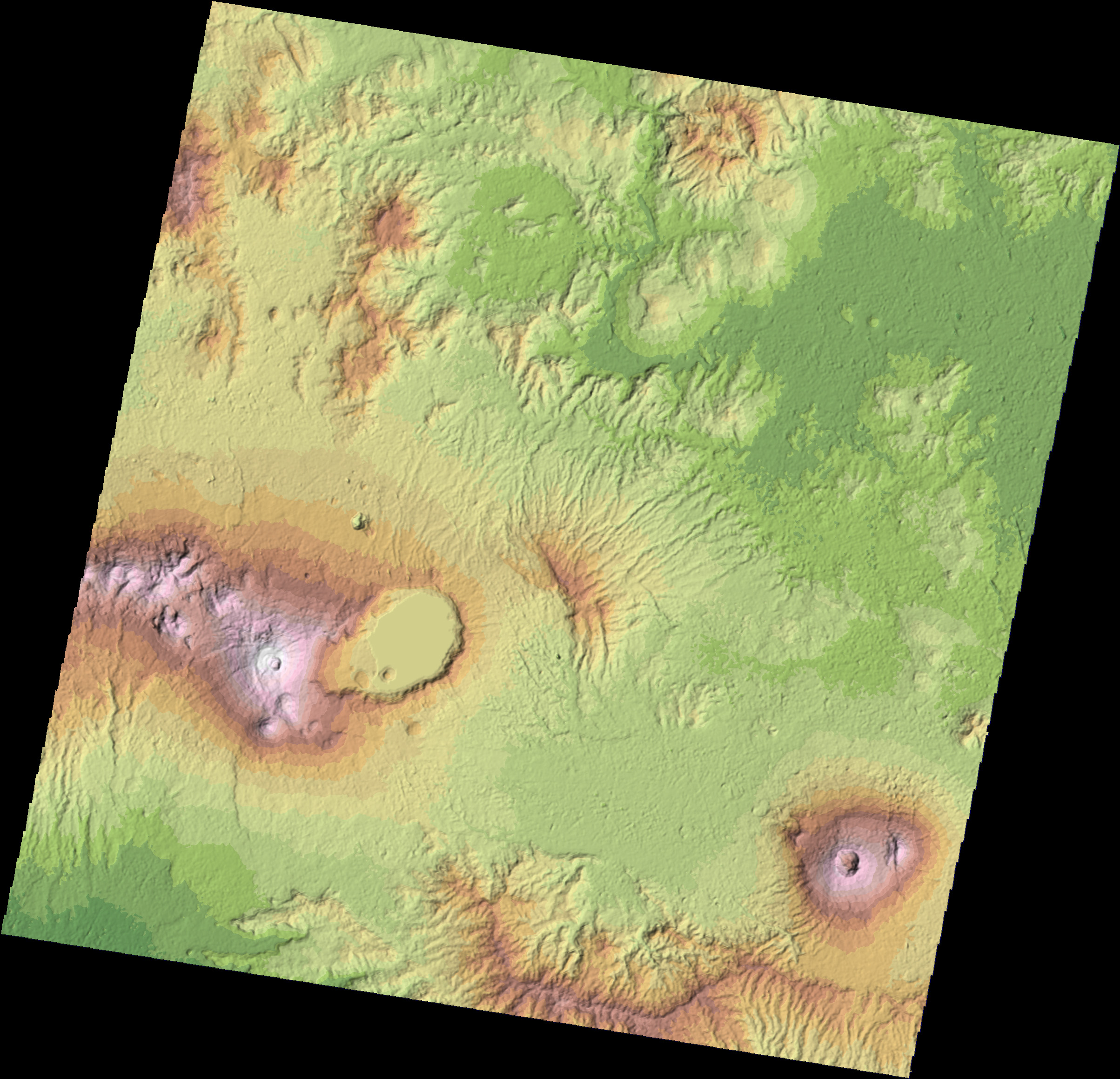
Volcanic activity is not unusual in El Salvador, which sits on the eastern edge of the Pacific Ring of Fire. As this three-dimensional image shows, volcanic activity has defined the geography of the region. This false-color image was made from data collected by the Advanced Spaceborne Thermal Emission and Reflection Radiometer (ASTER) on NASA’s Terra satellite on February 3, 2001, well before the 2005 eruption. The Santa Ana volcano rises on the left side of the image, forming a large flat-topped mound. The volcano sports several crescent-like craters—“nested” craters—at its summit and a 20-kilometer-long system of fissures. A tiny blue spot in the center of the inner-most crater is a crater lake, the likely source of the boiling water flood.
Behind Santa Ana is a large caldera lake inside the Coatepeque Caldera. This caldera was created when a series of volcanoes like Santa Ana collapsed in explosive eruptions between 72,000 and 57,000 years ago. There is no record of historical eruptions of the Coatepue Caldera. In the foreground is El Salvador’s newest volcano, Izalco. Izalco sprang up in 1770 and erupted frequently until 1966. The young volcano isn’t covered in vegetation (red in this image), but remains black with recent lava flows.
Though it may not seem imposing in this image, Santa Ana is the highest point in El Salvador. The volcano is 2,381 meters (7,812 feet) above sea level and sits roughly 65 kilometers (40 miles) west of the country’s capital, San Salvador. A stratovolcano, it is built from alternating layers, or strata, of volcanic materials, such as ash and large chunks of once-molten rock. This volcano’s activity has been documented since the 16th century, and consists mostly of small or moderate explosive eruptions.
For all its destructiveness, volcanic activity makes for fertile soil—and dilemmas. Attracted by the ability to grow good crops, along with the cooler temperatures that come with higher altitude, people often risk volcano hazards. Residents near Santa Ana proved no exception; many of the evacuees from the October 1 Santa Ana eruption had cultivated coffee beans in the region. The human presence in the area can be seen in the city of Santa Ana, the silver sprawl in the upper left corner of the image.
Satellite images such as this one can help emergency planners by providing a detailed overview of the topography of a region. The data for this image was provided by SERVIR, a project set up to help decision makers in Central America access satellite data and online maps.
NASA image by Robert Simmon, based on data provided by Timothy Gubbels and Asad Ullah, SSAI, and the NASA/GSFC/METI/ERSDAC/JAROS, and U.S./Japan ASTER Science Team

