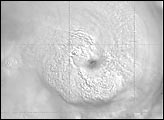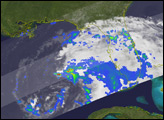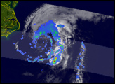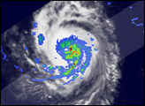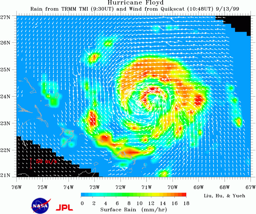
The microwave scatterometer SeaWinds on the newly-launched QuikScat Mission observed the ocean surface winds feeding moisture into Hurricane Floyd. The moisture turns into rain, releases latent heat, and fuels the storm. The surface rain and the vertical rain profiles were observed by the TRMM Microwave Imager (TMI) and the Precipitation Radar (PR) on the Tropical Rain Measuring Mission (TRMM). The close relation between the dynamic and hydrologic parameters is visible in the image as Floyd approaches the Bahamas on 13 September 1999. In the image, wind vectors (white arrows) from SeaWinds are superimposed on the surface precipitation (color image) from TMI along the groundtracks of QuikScat and TRMM, which are approximately 78 minutes apart.
After the image was taken, Hurricane Floyd turned north. Its strength and its proximity to the Atlantic Coast of the U.S. caused the largest evacuation of citizens in U.S. history. Its landfall on September 16 resulted in severe flooding and devastation in the Carolinas. Over the ocean, in situ observations in a tropical cyclone are extremely sparse, and conventional satellite data provide only cloud imagery at the top of the storm. Tropical cyclones are devastating when accompanied by strong winds and heavy rain. QuikSCAT, which was launched in June 1999, and TRMM, which was launched 18 months earlier, provide the opportunity to observe both wind and rain before landfall. The coincident measurements of surface wind and rain reveal the interplay between the dynamics and the hydrologic balances of the storm. These variables are important in understanding the structure of the storm and predicting its path.
The image is part of a paper by Liu, Hu, and Yueh [Eos, Trans. of AGU, 2000, in press]. The paper shows that the surface wind divergence has strong influence in the hydrologic and energy balance in a tropical storm. The high spatial information of the scatterometer improves the estimation of the profile of moisture sink and diabatic heating (a "diabatic" process is a mechanism by which heat is added to or removed from a physical system) in the hurricane, and also the freshwater flux at the surface. Synergistic applications of the two new NASA missions, QuikScat and TRMM, will contribute to our understanding of marine weather systems. Evolving marine weather systems can be monitored through the Seaflux website (http://airsea-www.jpl.nasa.gov/seaflux) which displays both near real time QuikScat winds and TRMM rainfall.
For more information:
QuikScat Fact Sheet
TRMM Fact Sheet
Hurricane Floyd's Lasting Legacy
Image by Liu, Hu, and Yueh, NASA Jet Propulsion Laboratory; Text by W. Timothy Liu, NASA Jet Propulsion Laboratory