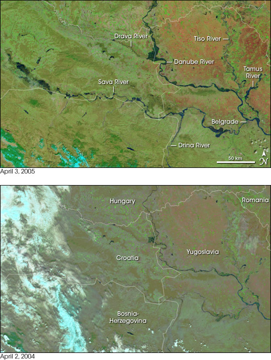
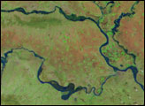
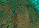
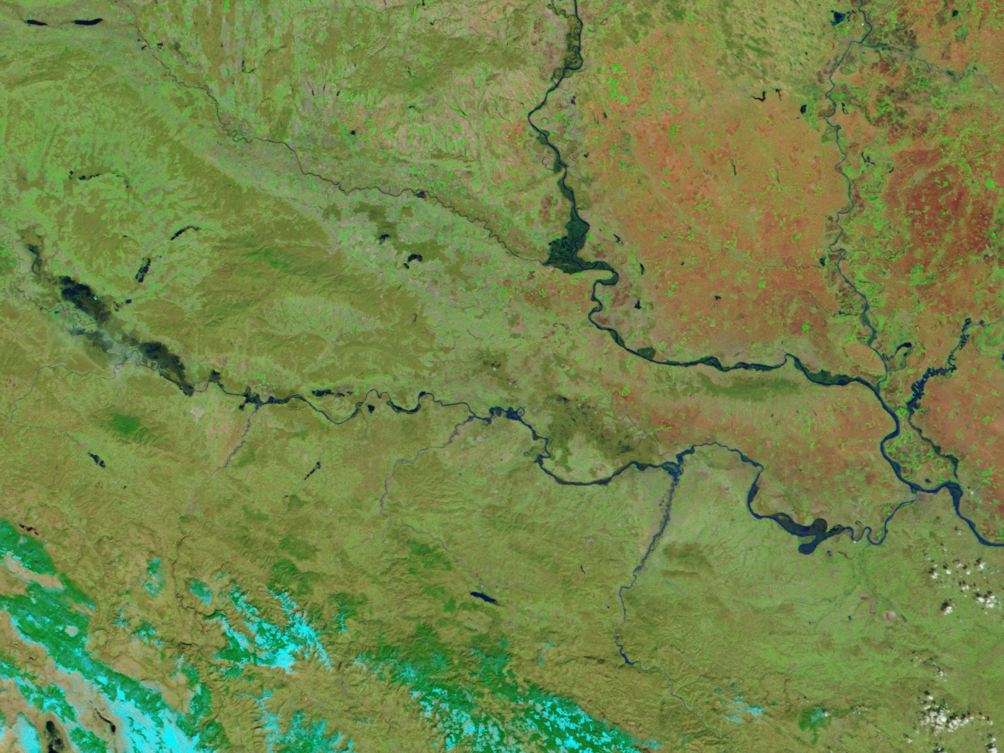
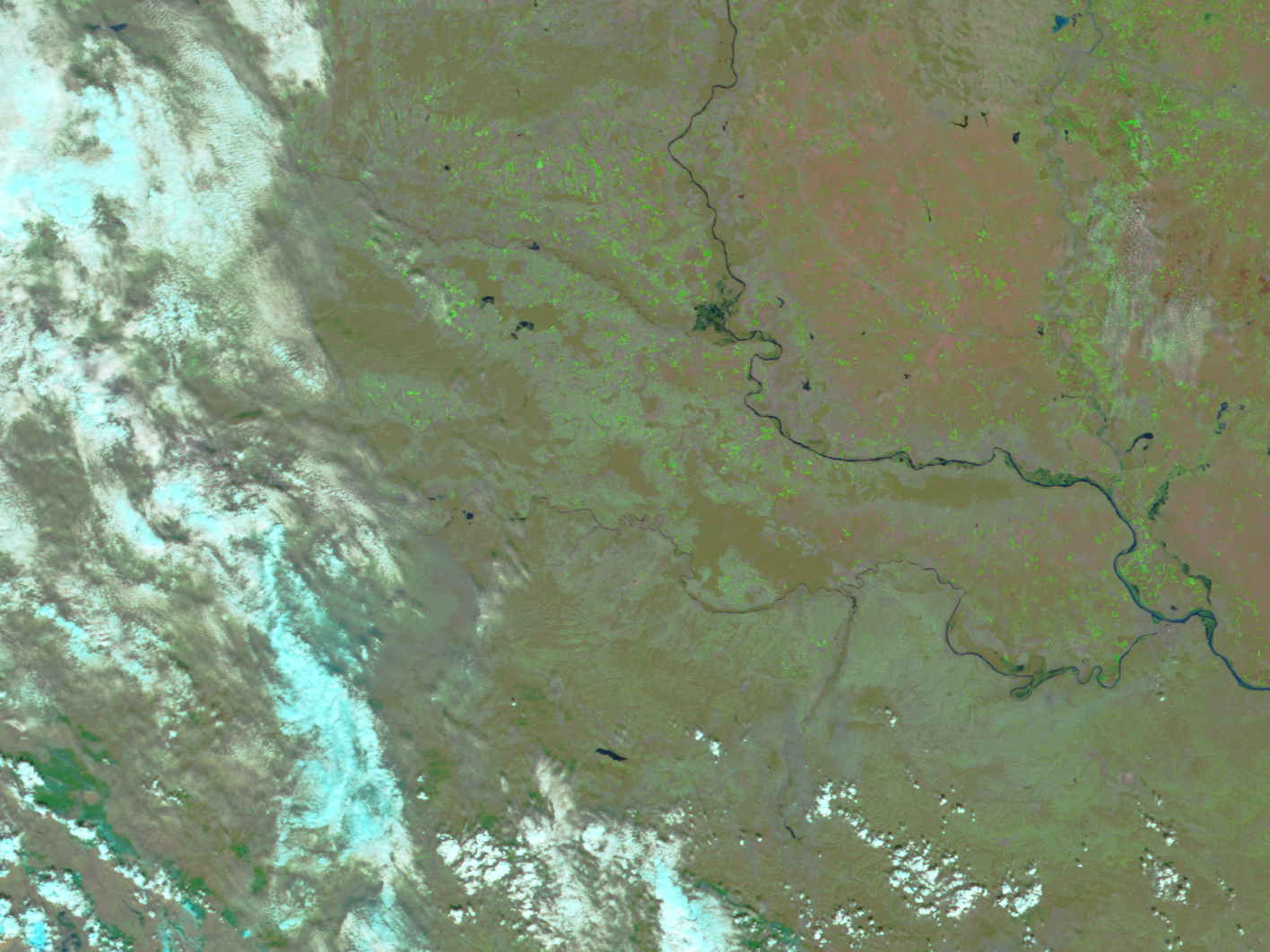
Spring run-off fills the rivers of Central Europe in this Moderate Resolution Imaging Spectroradiometer (MODIS) image, collected by NASA’s Terra satellite on April 3, 2005. Melting snow has swollen the Danube River and its tributaries. In 2005 (top image), the dark blue rivers stretched beyond the lines that defined them in 2004 (lower image) particularly in the meandering loops of the rivers.
Heavy snows blanketed this region for much of the winter. As winter drew to a close in February and March, precipitation totals soared above average and above last year’s totals, which were also slightly above average. Traces of snow, shown in bright blue, remain on the peaks of the Dinaric Alps in the lower left corner of the 2005 image. The flooded rivers reflect the severity of the winter and early spring as does the vegetation. Bright green vegetation covers the 2005 image in place of the light tan ground of 2004.
NASA image created by Jesse Allen, Earth Observatory, using data obtained from the MODIS Rapid Response team and the Goddard Earth Sciences DAAC.


