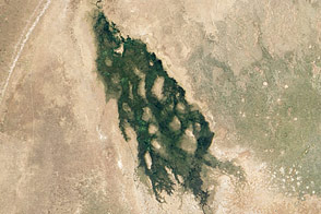
This short focal-length astronaut photograph shows the entire Okavango “delta,” a swampland known in southern Africa as the “Jewel of the Kalahari Desert.” This enormous, pristine wetland almost miraculously appears in a desert where surface water is typically non-existent. The water comes from the Okavango River, which rises in the high-rainfall zone of southern Angola, hundreds of kilometers to the northwest.
The dark-green forested floodplain is about 10 kilometers (6 miles) wide where it enters the view (image left). The Okavango then enters a rift basin, which allows the river to spread out and form the wetland. The width of the rift determines the dimensions of the delta—150 kilometers (90 miles) from the apex to the downstream margin (image right). The apex fault is difficult to discern, but two fault lines define the downstream margin; the faults appear as linear stream channels and vegetation patterns oriented at right angles to the southeast-trending channels at image center.
The channels carry sediment from the Okavango River that is deposited within the rift basin. Over time, a fan-shaped morphology of deposits has developed, leading to characterization of the wetland as the Okavango “delta.”
The greens of denser savanna vegetation in the north give way to browns of the open “thornscrub” savanna to the south, matching the precipitation patterns of higher rainfall in the north and less rainfall in central Botswana. More subtle distinctions also appear: the arms of the delta include tall, permanent riverine forest and seasonal forest (dark green), with grasses and other savanna vegetation (light green) on floodplains.
Linear dunes, built up by constant winds from the east during drier climates, appear as straight lines at image left. The dunes are 10 meters high, and their sands hold enough moisture for some trees to grow on them. Counter-intuitively, the low “streets” between the dunes are treeless because they are dominated by dense, dry white soils known as calcretes.
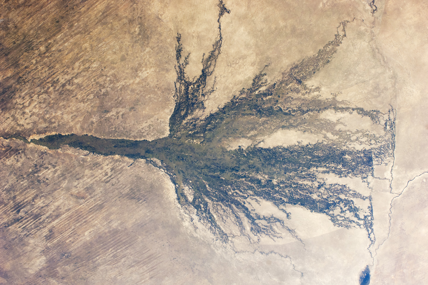
Only 2 to 5 percent of the water that enters the Okavango delta flows out of it. (Compare the small Boteti River (image right), where water flows out of the delta, with the wide Okavango floodplain at image left.) In wetter years, some water reaches Lake Ngami (lower right), where it evaporates. Over the decades, various groups have argued that the 95 percent reduction in water from apex to toe of the delta is a “loss,” and that water from the Okavango might be better used for local, irrigated agriculture. Others have called for moving it via long canals to maintain the diamond mines to the south. Various cities also have proposed to use the water, including Pretoria (South Africa), Gaborone (Botswana), or Windhoek (Namibia).
Such plans have been vigorously fought by conservationists, who have argued that the water is critical for the pristine Okavango wetland. This protected wildlife zone attracts tourists from around the world.
Another feature in the image also suggests modern globalization. The curved line in the southwest part of the delta is the Southern Buffalo Fence, a major installation that separates wild buffalo herds within the wetland from cattle herds, which occupy more populated areas surrounding the delta (image bottom, image right). The fence divides lighter-toned and darker grassland; suggesting that vegetation growth is stronger (greener) on the populated southwest side than within the delta. The fence was erected to control the spread of foot-and-mouth disease from buffalo populations to the domestic cattle herds that are the basis of an expanding beef industry. Wildlife proponents argue that fences have affected the size of wild herds by disrupting migration routes. They also cause deaths by entanglement in the fence cables and by preventing animals from reaching water.
Astronaut photograph ISS028-E-6830 was acquired on June 2, 2011, with a Nikon D2Xs digital camera using a 28 mm lens, and is provided by the ISS Crew Earth Observations experiment and Image Science & Analysis Laboratory, Johnson Space Center. The image was taken by the Expedition 28 crew. The image has been cropped and enhanced to improve contrast. Lens artifacts have been removed. The International Space Station Program supports the laboratory as part of the ISS National Lab to help astronauts take pictures of Earth that will be of the greatest value to scientists and the public, and to make those images freely available on the Internet. Additional images taken by astronauts and cosmonauts can be viewed at the NASA/JSC Gateway to Astronaut Photography of Earth. Caption by M. Justin Wilkinson, Jacobs/ESCG at NASA-JSC.