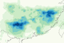

Heavy rains had already pushed many lakes and rivers in the Yangtze Valley close to flooding by early July 2010, and rain kept falling. Global Times reported that 39 people had drowned along the Yangtze between July 8 and 13, and some 810,000 hectares of cropland had been destroyed.
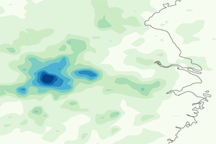
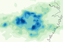
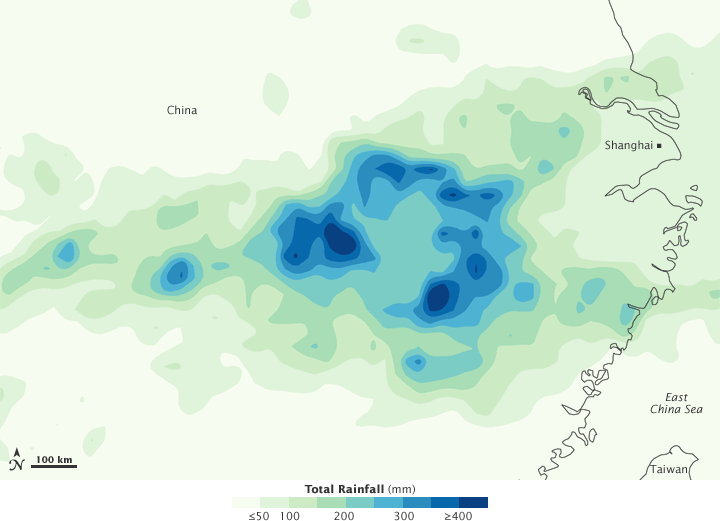
This color-coded image shows rainfall amounts around the city of Shanghai from July 6 to 12, 2010. The heaviest rainfall amounts—400 millimeters or nearly 16 inches—appear in dark blue. The lightest amounts—50 millimeters or less than 2 inches—appear in light green.
The heaviest rainfall amounts occur west-southwest of Shanghai. The Yangtze River empties into the ocean just north of Shanghai, but the river’s route takes it through an area southwest of the city, including the area experiencing heavy rain.
This image is based on data from the Multisatellite Precipitation Analysis produced at Goddard Space Flight Center, which estimates rainfall by combining measurements from many satellites and calibrating them using rainfall measurements from the Tropical Rainfall Measuring Mission (TRMM) satellite.
NASA Earth Observatory image by Jesse Allen, using near-real-time data provided courtesy of TRMM Science Data and Information System at Goddard Space Flight Center. Caption by Michon Scott.