The summer of 1988 was apocalyptic in Yellowstone National Park. For hundreds of miles, a blood-red Sun shone through choking, brown skies as flames consumed vast tracts of forest. The spring had been moist, and grass was abundant. The summer was hot and dry. When the inevitable rainless thunderstorms swept across the park, lightning ignited the dry vegetation. By the end of the summer, 50 wildfires (some of them started by people) had burned 793,000 of the park’s 2,221,800 acres.
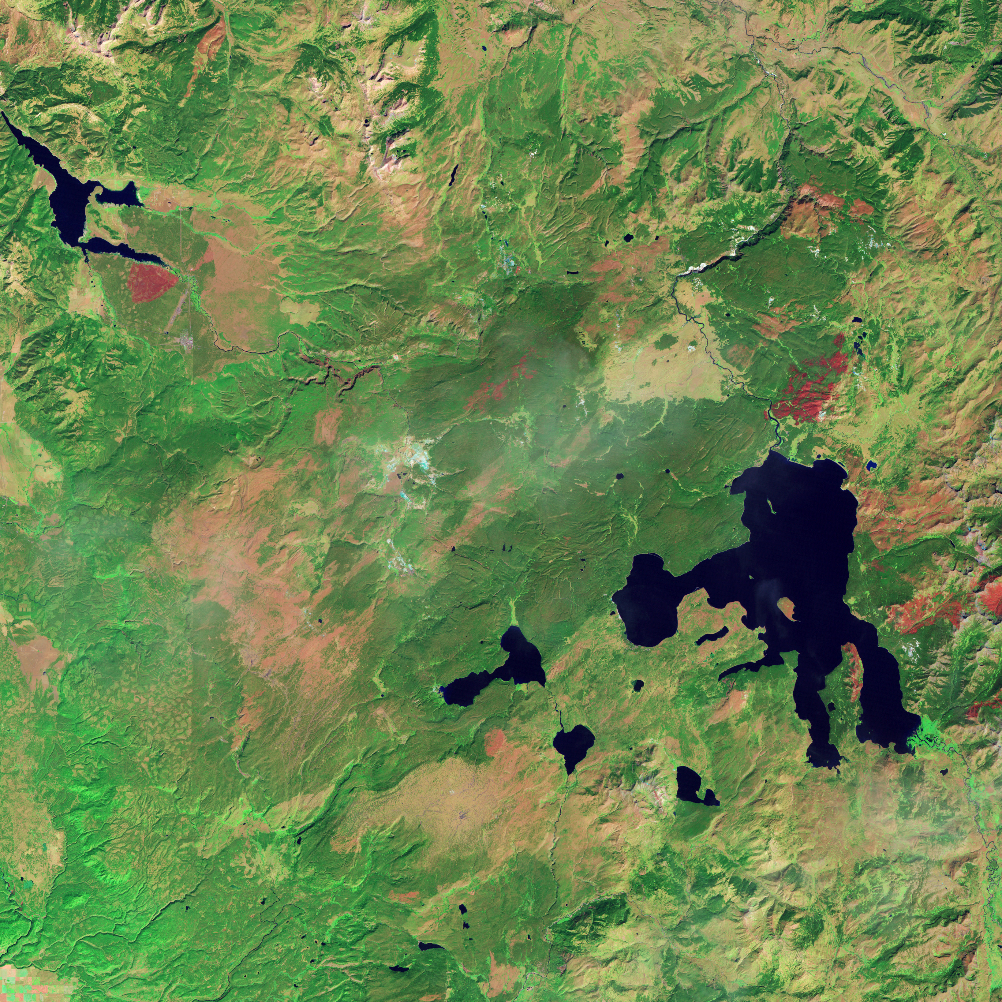
These four images track one fire in western Yellowstone and the landscape’s gradual recovery over a period of twenty years; they are part of a larger collection of images featured in Burn Recovery in Yellowstone, the latest installment in the Earth Observatory’s ongoing World of Change series. The Landsat-5 satellite acquired this series of images between 1987 and 2008. The images were made with a combination of visible and infrared light (green, short-wave infrared, and near infrared) to highlight the burned area and changes in vegetation.
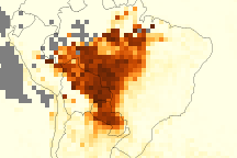
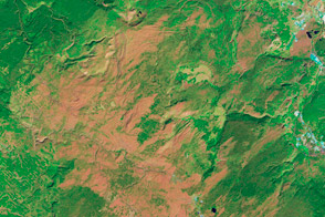
The top image, from 1987, shows the park as it had been for many years. Dense stands of tall, straight pine trees covered the high, volcanic plateau. The old forest is dark green in the image. The summertime forest is broken up by bright green, grassy river meadows and the occasional brush and grass plain, lighter green and tan. Mineral-rich geyser fields are pale blue and white, and lakes are dark blue. Beneath the green vegetation, a pinkish tinge emerges in places, which may indicate old burn scars or simply summer dormant grasses and plants.
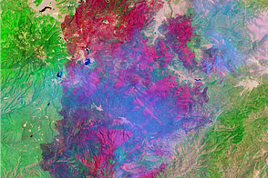
Just one year later, charred trees and grasses replaced the forests and meadows. The freshly burned land is dark red. The fire was still burning when the 1988 image was acquired on August 23. The fires glow bright pink, and a faint pall of smoke hangs over the scene. If the image had been made with visible light, to resemble what a person would see from the air, the smoke would be denser than it is in this infrared image. The smoke is blue in the infrared light.
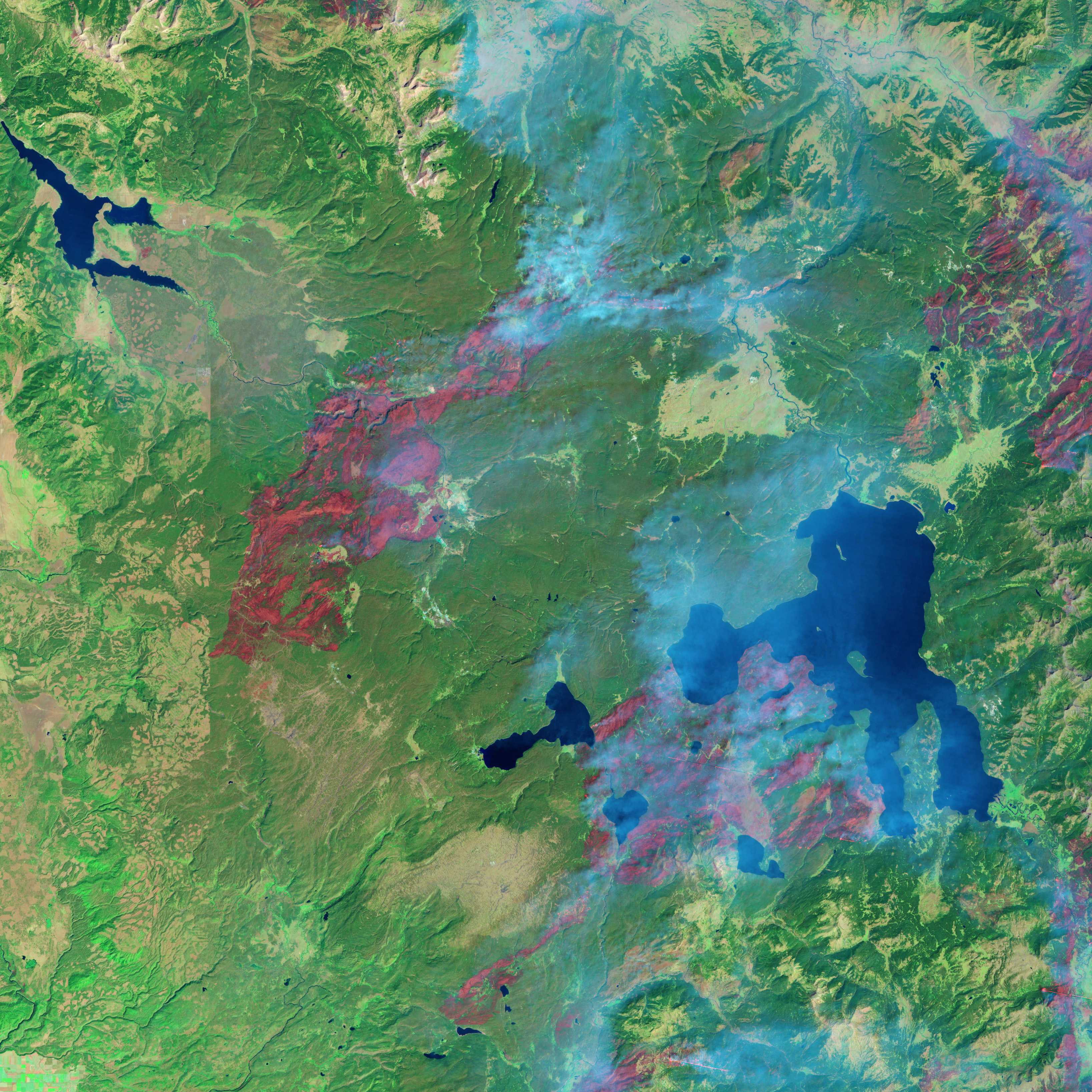
In the 1989 image, the full extent of the fire is revealed. The burned land surrounds Old Faithful and extends throughout western Yellowstone. This satellite view reveals that the fire did not burn everything in a destructive swath. The burned area is patchy, and the severity of the burn varies from place to place. Darker red areas are severe burns, and lighter red areas are less severe.
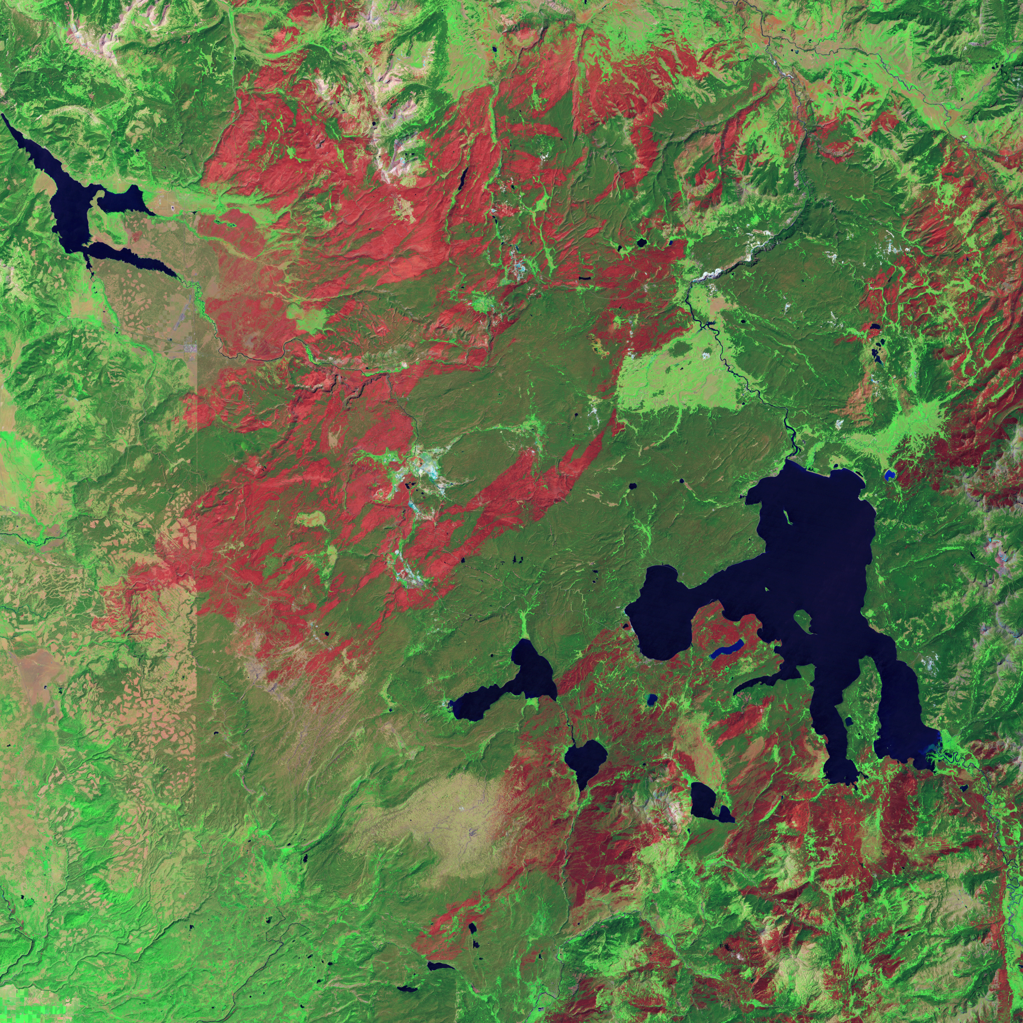
Twenty years after the fire, the burn scar was still evident, though faded to a pale, pinkish tan. By this time, new pine trees had taken root, and the forest had started to return. The new trees grow more quickly (photosynthesize at a faster rate) than older, mature forests. Because they use and reflect sunlight differently than older forests, the new trees are lighter in color in the 2008 image. Fingers of new forest are most evident intruding into the narrow strip of burned land on the right edge of the image. Forests are likely returning elsewhere as well, but the small trees do not produce a dense enough canopy to show up well in the image.
Fire is as much a part of Yellowstone as grizzly bears. Many of the lodgepole pine forests and grassy meadows that cover much of Yellowstone’s high plateau need fire to regenerate. The high-elevation plateau has a short growing season, with hot, dry summers and cold, harsh winters. In such an environment, it will take decades for the forest to reach its former state.
NASA images by Robert Simmon, based on Landsat 5 data from the USGS Global Visualization Viewer. Caption by Holli Riebeek with image interpretation from Carl Key, United States Geological Survey.