animations:
small movie (1.2 MB MPEG)
large movie (3.2 MB QuickTime)
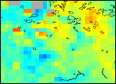
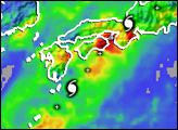
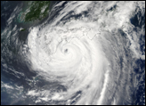
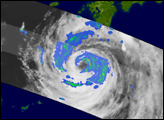
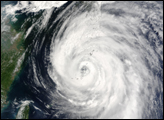
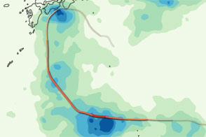
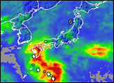
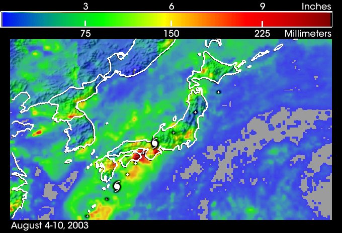
Typhoon Etau severely impacted the nation of Japan over the weekend of August 9-10 as the storm tracked northeastward across the island chain. The storm was ranked a Typhoon 3 (sustained winds of 126 mph) prior to landfall, with reports of gusts to 150 mph and ocean waves in excess of 30 feet. The typhoon produced numerous casualties, disrupted power facilities and shut down Al Nippon, the national airline of Japan. Locally torrential rains, with reports exceeding 12 inches, generated numerous mudslides. This image shows the arc of rainfall produced during the storm's passage over Japan's mountainous islands, from August 4-10. The rainmap was produced using the TRMM-based Multi-Satellite Precipitation Analysis product at the Goddard Space Flight Center. Local rainfall amounts approaching 12 inches (dark red colors) are shown in the analysis.
The Tropical Rainfall Measurement Mission (TRMM) satellite is a joint mission between NASA and the Japanese space agency, NASDA.
Image and movie courtesy Hal Pierce, TRMM Project, NASA Goddard Space Flight Center