When Joshua Tree National Park was first proposed for preservation in the 1930s, the suggested name was “Desert Plants National Park,” because of the 700 plant species, including cacti and succulents, wildflowers, desert palms, and hardy shrubs that manage to survive in the desert climate. The plants support the park’s wildlife, among them 25 species of snakes; mammals such as bighorn sheep, ground squirrels, and coyotes; hundreds of migratory and resident birds; and thousands of species of insects and arthropods, including tarantulas, fairy shrimp, scorpions, and more than 150 species of butterflies and moths.
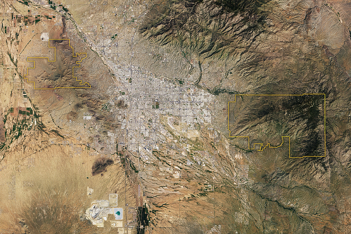
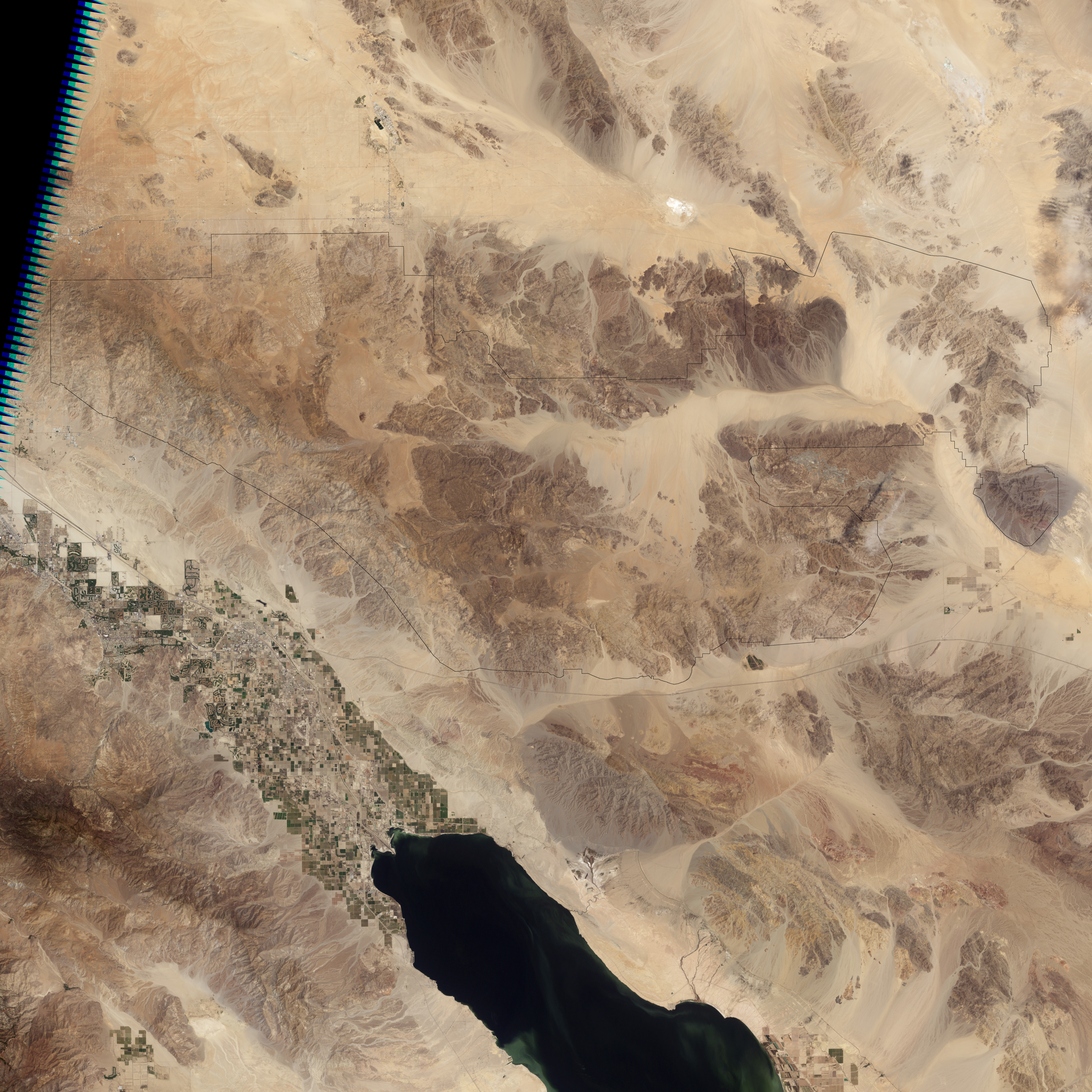
From space, all this biodiversity is far less visible than it is on the ground, but the reason for the diversity is apparent in this Landsat satellite image captured on May 28, 2003. The high levels of biodiversity are the result of the adaptation of plants and animals to three major topographic and climatic zones that meet in the park. The north-northeast part of the park intersects the southern edge of the Mojave Desert, which is higher in elevation and slightly cooler and wetter than the Colorado Desert areas in the eastern and southern parts of the park. A third topographic zone is provided by high altitudes (above 4,000 feet) of the Little San Bernardino Mountains at the far western edge of the park. Natural springs, forced to the surface near geologic faults, also create five rare desert palm oases in the western part of the park.
Ultimately, the park was given the name of its largest, most iconic, plant resident: Yucca brevifolia, nicknamed the “Joshua tree” by European settlers. Rangers have described the plant as the "canteen of the desert" because its tissues hold water during dry spells. Although its spiny leaves and thick bark discourage all but the thirstiest animals, the living tissue of a Joshua tree is often the last source of moisture for animals during times of extreme drought. Ecosystem and climate models suggest that climate-suitable habitat for Joshua trees could dramatically shrink in coming decades as a result of global warming.
NASA image created by Jesse Allen, using park boundary geographic data (GIS) provided the U.S. National Park Service and Innovative Technology Administration's Bureau of Transportation Statistics, and Landsat data from the United States Geological Survey. Caption by Rebecca Lindsey.