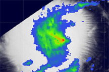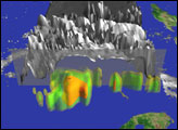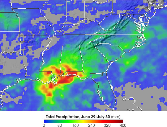
After coming ashore on June 30, 2003, just east of Morgan City, Louisiana, the remnants of Tropical Storm Bill continued to produce heavy rain through the southeastern United States and mid-Atlantic region as the system tracked northeastward across the country. The heaviest rainfall totals were along the Gulf Coast east of where Bill made landfall. Some areas between western Louisiana and the Florida panhandle received upwards of 10 inches of rain according to observations from the Multi-satellite Precipitation Analysis, based on data from the Tropical Rainfall Measuring Mission (TRMM).
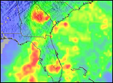
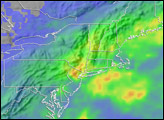
The low-pressure center associated with Bill tracked northeastward across western Louisiana, southern Mississippi, and central Alabama before merging with a stationary front over the western Carolinas. Broad areas of 2-4 inch rainfall amounts were observed from northern Alabama and central Georgia through the Carolinas and into northern Virginia with locally heavier amounts of 4-8 inches. Fortunately, the remnants of Tropical Storm Bill moved steadily across the southeast. This kept rainfall amounts from being even higher. TRMM is a joint mission between NASA and the Japanese space agency NASDA.
Images by Hal Pierce (SSAI/NASA GSFC), text by Steve Lang (SSAI/NASA GSFC)