In southeastern Australia, bushfires are raging out of control. At the border of southeast New South Wales and northeast Victoria in the Great Dividing Range Mountains, dozens of out-of-control fires have destroyed at least 400 homes and killed four people according to local news reports from Tuesday, January 21. The fires are approaching Australia's capital city of Canberra in the Australian Capital Territory (ACT), and residents have been urged to take immediate fire precautions.
Among the devastating losses, more than two dozen farms have been destroyed and hundreds of livestock have perished. Many farmers are being forced to rapidly sell remaining livestock as the fires have destroyed all available pasture.
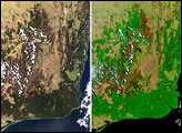
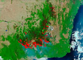
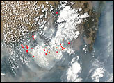
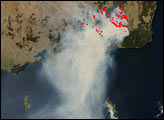
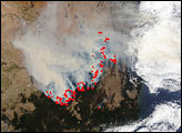
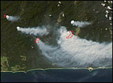
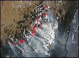
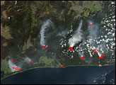
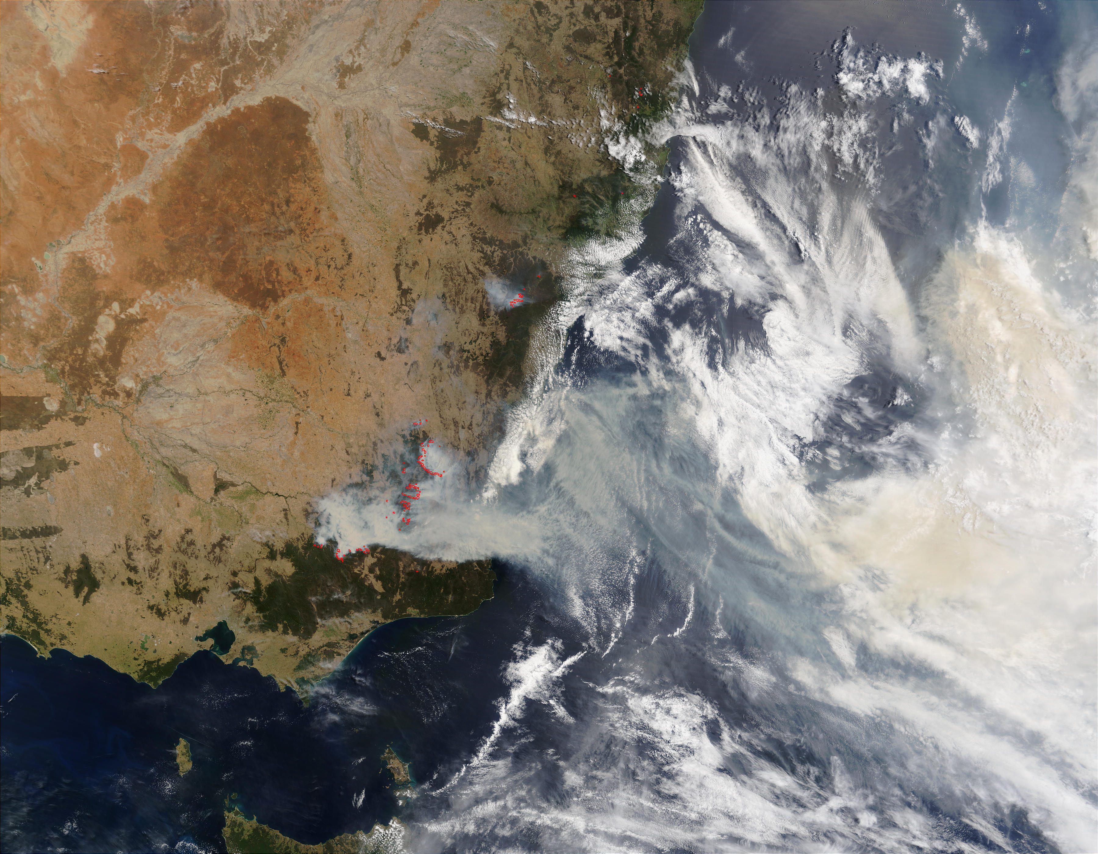
This true-color Moderate Resolution Imaging Spectroradiometer (MODIS) image from the Terra satellite on January 19, 2003, shows the numerous bushfires marked with red dots, as well as the thick, choking smoke. The ACT is almost completely shrouded in smoke from the densest concentrations of fires (left of center). Fires are also burning northwest of Sydney (top center). Conditions are expected to worsen as the week progresses, with high temperatures and winds up to 65 knots (71 miles per hour) whipping the blazes further out of control. More than 900 firefighters are battling the fires, and more continue to pour in from surrounding territories to lend a hand.
The high-resolution image available here is 500 meters per pixel. Visit the MODIS Rapid Response Team, for a copy of this scene at MODIS? full resolution of 250 meters per pixel.
Image courtesy Jacques Descloitres, MODIS Rapid Response Team, NASA GSFC