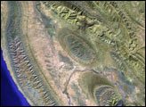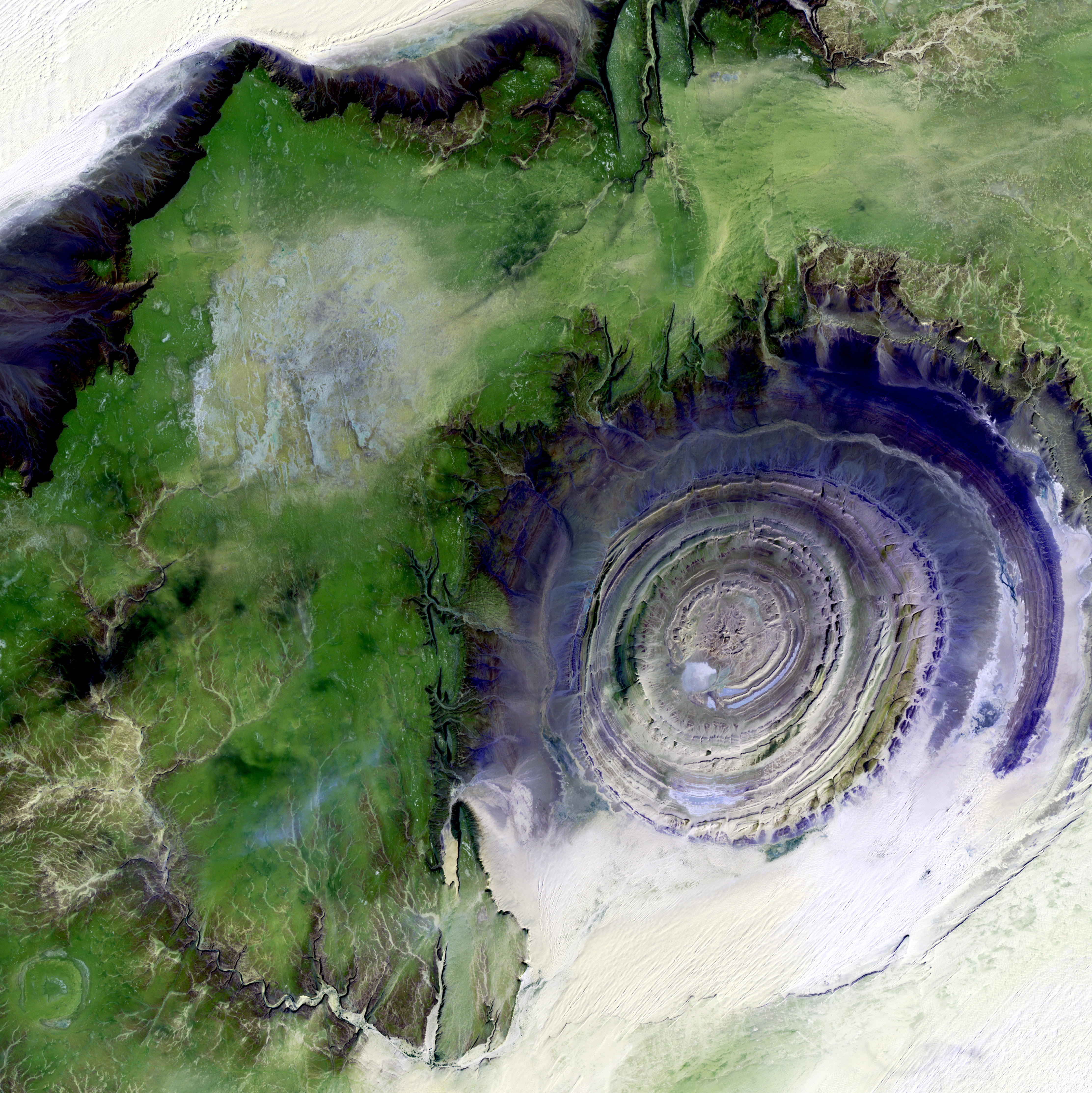
The so-called Richat Structure is a geological formation in the Maur Adrar Desert in the African country of Mauritania. Although it resembles an impact crater, the Richat Structure formed when a volcanic dome hardened and gradually eroded, exposing the onion-like layers of rock.
This image was acquired by Landsat 7's Enhanced Thematic Mapper plus (ETM+) sensor on January 11, 2001. This is a false-color composite image made using shortwave infrared, infrared, and green wavelengths. The image has also been sharpened using the sensor's panchromatic band.
Image provided by the USGS EROS Data Center Satellite Systems Branch. This image is part of the ongoing Landsat Earth as Art series.