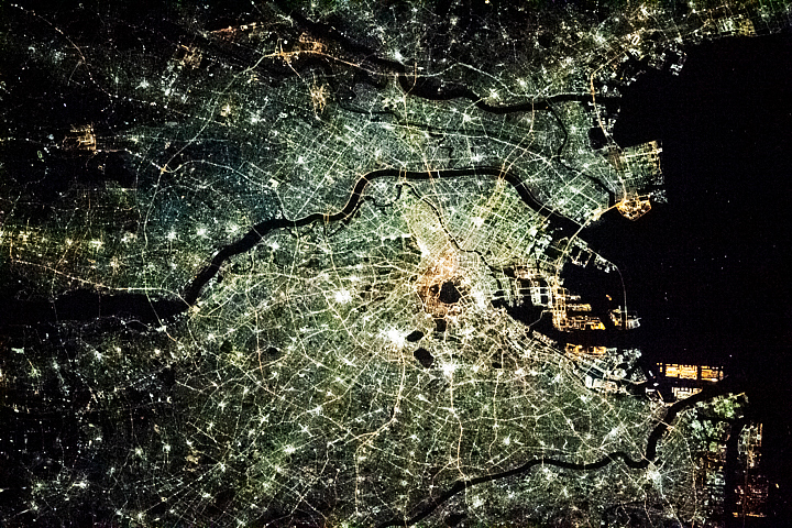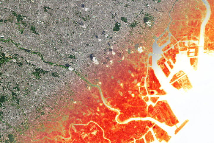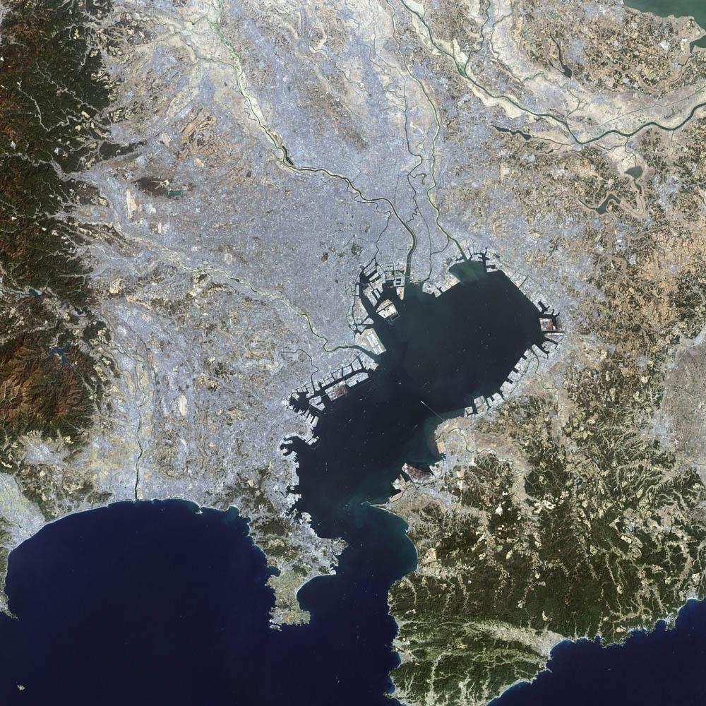
This false-color Landsat 7 image shows the greater Tokyo metropolitan area, situated on the eastern shore of the Japanese island of Honshu. The large Tokyo Bay dominates the center of this scene, and if you look closely you can see boats and their wakes on the water. The greater Tokyo area fans out in a crescent shape around the western, northern, and eastern shores of Tokyo Bay. Greater Tokyo is bordered to the west by rugged mountains and to the east by the vast expanse of the Pacific Ocean.
The greater metropolis area is comprised of Tokyo prefecture, situated on the northwestern shore of Tokyo Bay, and the three neighboring prefectures of Kanagawa to the south, Saitama to the north, and Chiba to the east and southeast across Tokyo Bay. Over the last 400 years, Japan’s National Capital Region has evolved into a large, self-governing unit consisting of 26 cities, 5 towns, and 8 villages. The region is home to some 12 million people (more than a quarter of Japan’s whole population) in an area spanning 2,187 square km.
The city was first known as Edo in 1603 when Tokugawa Ieyasu established a military government there—the Tokugawa Shogunate. The city gradually grew in size and prominence to become Japan’s center, both politically and culturally. Its population swelled to more than 1 million residents by the eighteenth century.
The Edo era lasted for almost 260 years until imperial rule was restored—the Meiji Restoration—in 1868. Although the Tokugawa Shogunate was still seated in Edo during this period, the Emperor resided in Kyoto, which was officially Japan’s capital at the time. Edo was renamed Tokyo when the Tokugawa Shogunate came to an end in 1868. Then, following the Meiji Restoration, the Emperor moved from Kyoto to Tokyo, thus relocating the capital to the latter city.
Image courtesy Ron Beck, USGS Eros Data Center Satellite Systems Branch