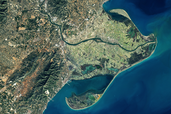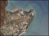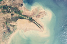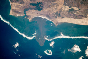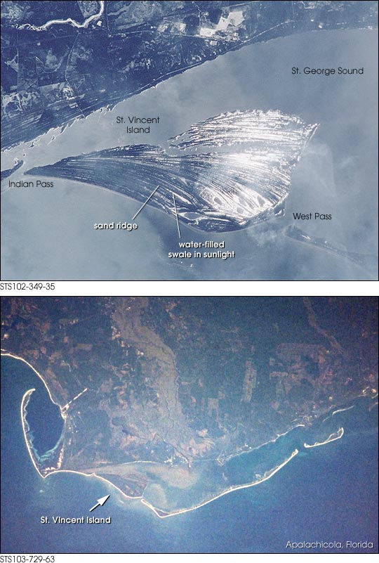
Sand ridges (cheniers) sweep in bands across St. Vincent Island, about 120 km southwest of Tallahassee, Florida. These ridges have accumulated over time in the Apalachicola River delta complex. During high flow, the river delivers abundant sediment to the delta; as flow wanes the stream drops its load of coarser material around the channel mouth, to be redistributed primarily by waves. Variations in sediment supply and wave energy result in alternating bands of sand and mud. The crew of Space Shuttle 102 used the reflection of the sun off water that lies in the swales between ridges to emphasize the variable topography of the cheniers. Similar draping arrays of sand ridges and spits can be seen on the Po and Ebro river deltas of Italy and Spain, respectively.
St. Vincent Island, which lies between Cape San Blas and the town of Apalachicola on the Florida Panhandle, is a national wildlife refuge and an important breeding ground for loggerhead turtles. Sambra deer, a variety of Asian elk that can weigh as much as 700 pounds, roam the marshlands. The deer were introduced in the early 1900s, when the island was a privately owned hunting ground for exotic game.
Images STS102-349-35 and STS103-729-63 were provided by the Earth Sciences and Image Analysis Laboratory at Johnson Space Center. Additional images taken by astronauts and cosmonauts can be viewed at the NASA-JSC Gateway to Astronaut Photography of Earth.