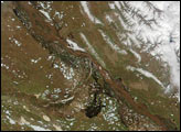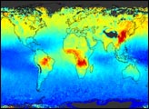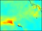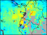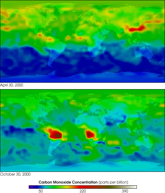
NASA's Terra spacecraft has assembled the most complete view ever of the world's air pollution travelling through the atmosphere, across continents and oceans. For the first time, policymakers and scientists now have a way to identify the major sources of air pollution and to closely track where the pollution goes, anywhere on Earth. The false colors in these images represent levels of carbon monoxide in the lower atmosphere, ranging from about 390 parts per billion (dark brown pixels), to 220 parts per billion (red pixels), to 50 parts per billion (blue pixels).
Carbon monoxide is a gaseous byproduct from the burning of fossil fuels, in industry and automobiles, as well as burning of forests and grasslands. Notice in the April 30, 2000, image that levels of carbon monoxide are much higher in the Northern Hemisphere, where human population and human industry is much greater than in the Southern Hemisphere. However, in the October 30, 2000, image notice the immense plumes of the gas emitted from forest and grassland fires burning in South America and Southern Africa. The movements of carbon monoxide around the globe are particularly striking when viewed as a movie spanning a 10-month period.
The new global air pollution monitor onboard Terra is the innovative Measurements Of Pollution In The Troposphere, or MOPITT sensor, which was contributed to the Terra mission by the Canadian Space Agency. The instrument was developed by Canadian scientists at the University of Toronto and built by COM DEV International of Cambridge, Ontario. The data were processed by a team at the U.S. National Center for Atmospheric Research (NCAR), in Boulder, CO.
For more details, please see this NASA press release, issued May 31, 2001.
Images and animation courtesy NASA GSFC Scientific Visualization Studio, based on data from MOPITT (Canadian Space Agency and University of Toronto.)