A slow-moving storm system pummeled the United Arab Emirates and dropped more than a year’s worth of rain on some cities in April 2024. Heavy rain triggered flash flooding across eastern parts of the country, inundating roads and disrupting transportation.
The system first hit Oman on April 14 and continued to batter the UAE through most of the day on April 16. Michael Mann, a climate scientist at the University of Pennsylvania, told the Associated Press that three low-pressure systems formed a train of storms slowly moving along the jet stream—the river of air that moves weather systems—toward the Persian Gulf. The strong low-pressure system delivered multiple rounds of high winds and heavy rain to the northern and eastern parts of the country.
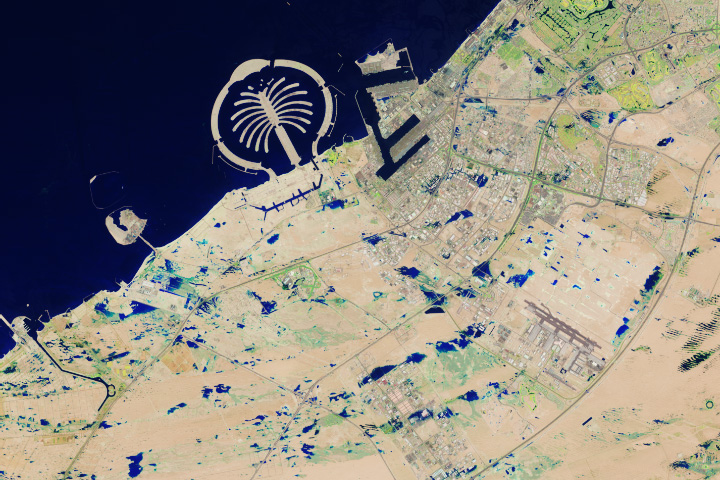
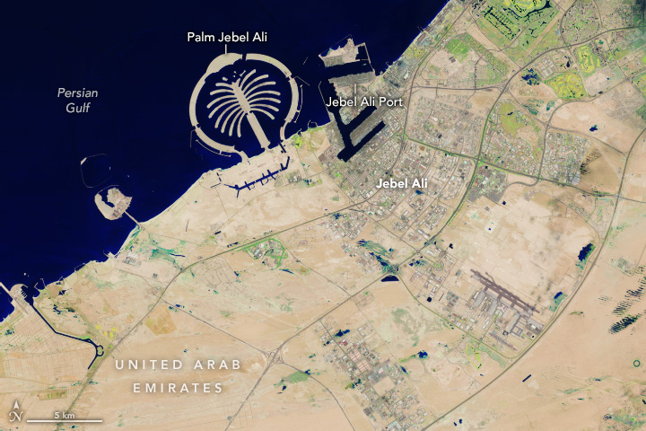
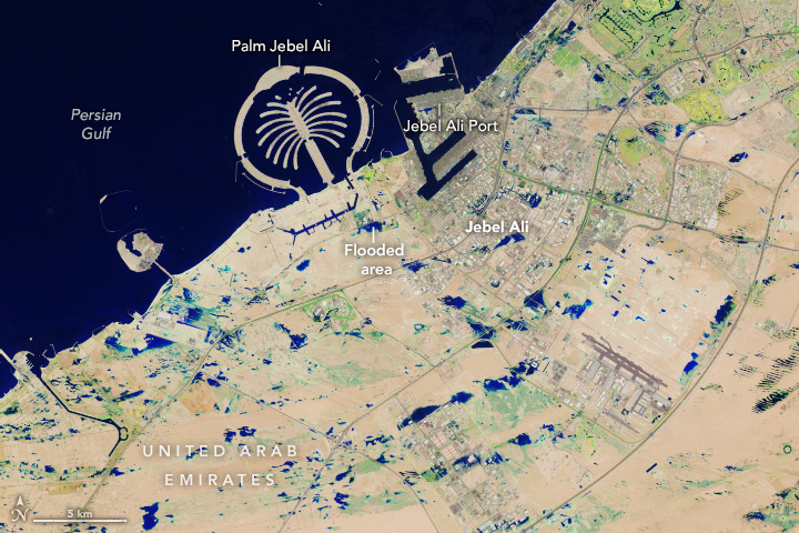
Some areas remained flooded on April 19, when Landsat 9 passed over the region for the first time since the storms. The image above (right), acquired that day with the satellite’s OLI-2 (Operational Land Imager 2), shows flooding in Jebel Ali, a town 35 kilometers (22 miles) southwest of Dubai. The image is false color (bands 6-5-3) to emphasize the presence of water, which appears blue. Flooding can be seen in the industrial area of Jebel Ali just south of the port and near the green resorts and parks south of Palm Jebel Ali.
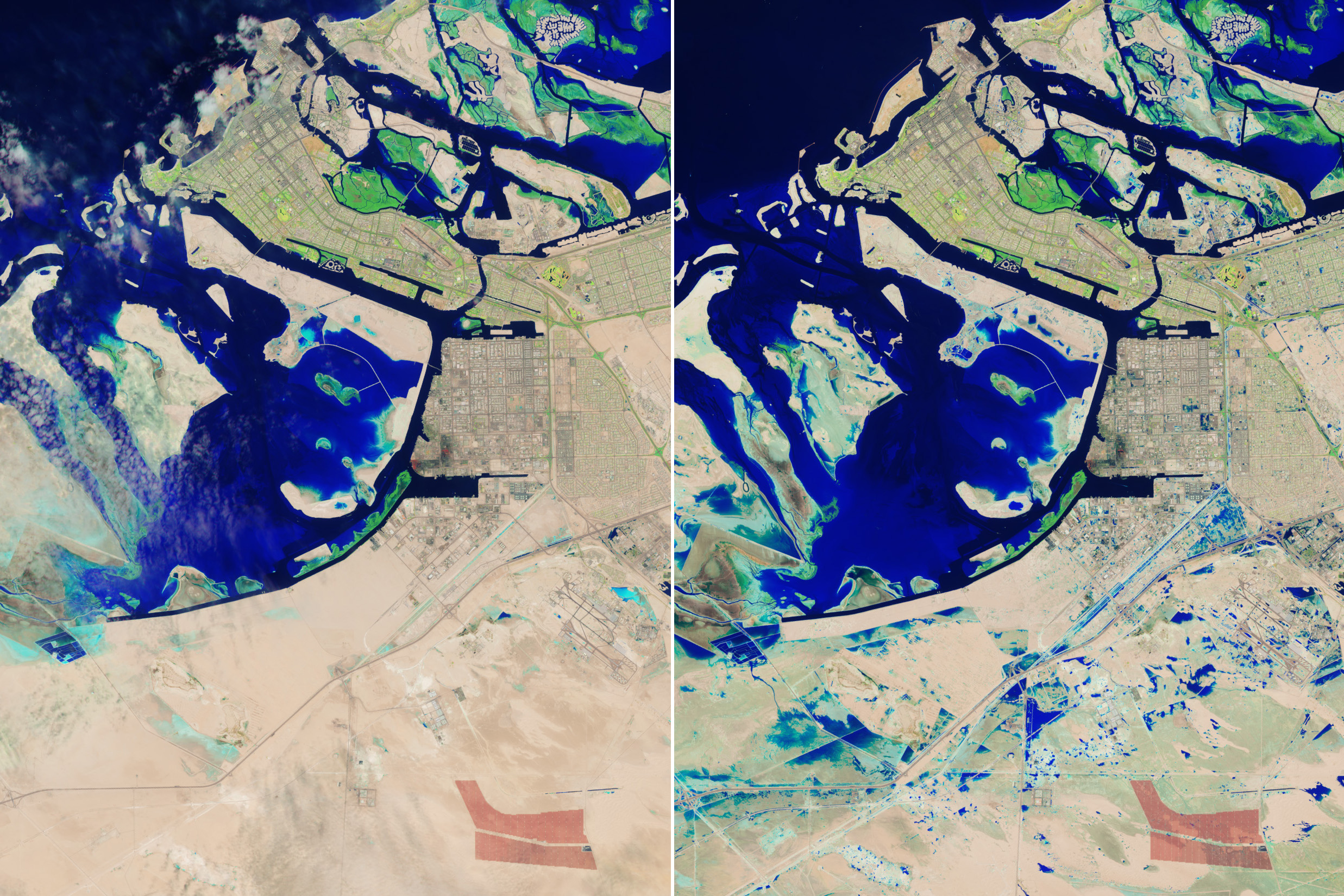
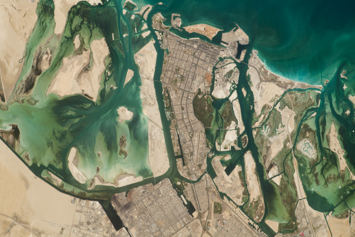
Parts of Abu Dhabi, the UAE’s capital city, were also inundated by the storms. The Landsat 9 images above show the city and surrounding area on April 3 (left) and April 19 (right), before and after the storms. On April 19, water can be seen covering the Sheikh Zayed Road, a major thoroughfare that runs through Dubai and Abu Dhabi. Patches of flooded areas are also visible in Khalifa City and Zayed City, residential areas southeast of Abu Dhabi’s downtown.
The UAE’s National Center for Meteorology reported that eastern parts of the country measured up to 250 millimeters (10 inches) of rain in less than 24 hours. UAE, known for its dry desert climate, receives only about 140 to 200 millimeters (5.5 to 8 inches) of rainfall per year.
Dubai International Airport (northeast of these images) recorded 119 millimeters on April 16, which is 1.5 times its typical annual rainfall. The deluge temporarily halted flights at the airport, which is among the world’s busiest for international travel.
As of April 18, some of the UAE was working to recover from the flooding, according to news reports. Dubai’s international airport was reportedly still experiencing delays.
NASA Earth Observatory images by Wanmei Liang, using Landsat data from the U.S. Geological Survey. Story by Emily Cassidy.