
 |
by Yarrow Axford August 6, 2002 |
||
|
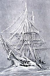
In August 1897, almost two decades before Sir Ernest Shackleton set sail on the ill-fated Endurance, an international group of sailors and scientists left Antwerp, Belgium, bound for Antarctica in a reinforced whaling ship called the Belgica.
|
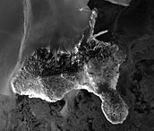
 In the 1890s, the Belgica froze in the Antarctic ice for an entire year. Remarkably, the crew eventually freed the ship and returned to Europe. (Image courtesy of NOAA)   In 1997, the RADARSAT Antarctic Mapping Project provided an unprecedented view of Antarctica, including images of the Fimbul Ice Shelf (top) and Ross Island (bottom). (Images courtesy of Alaska SAR Facility and the National Snow and Ice Data Center) For more information, visit the Alaska SAR Facility DAAC. (A new browser window will open.) |
||
|
The following spring their ship became stuck in the dangerous shifting pack ice. But the skipper, Adrien de Gerlache, hailed the situation as an opportunity. His crew would winter in Antarctica and make the first-ever year-round measurements of Antarctic meteorology. What de Gerlache didn’t predict, however, was that his trusty ship would be trapped for an entire year, set free only after the desperate crew carved a channel through the ice to open water. Having narrowly averted disaster, all but two of the international crew returned safely home in 1899, their ship weighted down with biologic specimens and rock samples. Theirs was the first purely scientific expedition to Antarctica. A century of exploration and research has followed, but much remains unknown about the so-called seventh continent. Today, in response to growing concerns about global warming, attention has focused on Antarctica’s most obvious feature: its ice. The Antarctic ice sheet is the largest mass of ice in the world, storing 70 percent of the Earth’s fresh water — enough to raise global sea level by more than 65 meters, according to a U.S. Geological Survey fact sheet about sea level and climate. If the Antarctic ice sheet is shrinking, it could cause a major rise in sea level. Before the advent of satellite data, scientists had only sparse field measurements for monitoring changes in Antarctica’s ice sheet. Since the 1950s, field parties have pounded stakes into the glaciers that stream from the middle of the ice sheet to the coast, and returned each year to determine the changing locations of the stakes. Antarctica is roughly the size of the United States and Mexico combined, and the challenges of doing fieldwork on the frozen continent severely limit the number of glaciers that can be monitored. But data from recent NASA satellite missions offer scientists new views of Antarctica, and new opportunities to understand how its enormous ice sheet might respond to future climate change. In 1997, exactly a century after the Belgica set sail, the Canadian satellite RADARSAT-1 orbited over Antarctica, collecting radar images of the entire continent in a spirit of international scientific cooperation similar to that of de Gerlache and his crew. In only 18 days, the Antarctic Mapping Mission (AMM-1) generated the first complete high-resolution radar map of Antarctica, giving scientists a first glimpse of the entire Antarctic ice sheet. “The wonderful thing about radar and other satellite observations is that they provide continental-scale context at extremely high resolution, which is really unprecedented,” said Ken Jezek, Professor at the Ohio State University’s Byrd Polar Research Center. Scientists like Jezek further capitalized on RADARSAT-1’s capabilities with the Modified Antarctic Mapping Mission (MAMM) in 2000, a follow-up to AMM-1. Like AMM-1, MAMM was a collaboration between NASA and the Canadian Space Agency (CSA), with help from the Alaska Synthetic Aperture Radar (SAR) Facility, NASA’s Jet Propulsion Laboratory, Goddard Space Flight Center, the Ohio State University, and Vexcel Corporation. MAMM had two ambitious goals: First, the mission generated high-resolution images of Antarctica’s perimeter, to be used for identifying changes in the Antarctic ice sheet since AMM-1 and earlier satellite missions. Second, unique interferometric radar data from MAMM allowed scientists to measure how fast Antarctica’s ice is flowing. The highly publicized disintegration of the Larsen B Ice Shelf earlier this year provided startling evidence that Antarctica’s ice shelves might be undergoing unprecedented retreat. Ice shelves, massive floating sheets of ice that hug Antarctica’s coast, do not contribute directly to rising sea level when they melt, for the same reason that ice cubes melting into a glass of lemonade don’t raise the level of the drink. But the disintegration of an ice shelf might allow the internal ice sheet to flow faster into the ocean, no longer slowed by a mass of floating ice at its margin. “What we don’t know yet, and what we hope MAMM will help us understand, is whether the elimination of coastal ice shelves has an impact on the interior ice sheet,” said Jezek. “If the interior ice sheet starts to slough off into the ocean, then sea level will definitely rise.” This could spell trouble for residents of low-lying regions like New Orleans and the Netherlands. To predict how the ice sheet’s mass balance might change in the future, scientists must understand the current mass balance of the Antarctic ice sheet, along with the factors that influence it. The mass balance of a glacier is a measure of its health, reflecting the balance between the amount of snow that accumulates on the glacier’s surface each year, and the amount of ice that melts or calves from its terminus. When a glacier accumulates more snow and ice than it discharges, it is said to have a positive mass balance, and it grows as it gains mass each year. In contrast, a glacier with a negative mass balance shrinks and, in turn, contributes to global sea level rise. Because it’s difficult to measure the mass balance of the giant ice sheets that cover Greenland and Antarctica, it is unclear whether they are getting smaller. “Mass balance is very complicated, especially trying to predict future mass balance,” said Ian Joughin, a Senior Engineer at NASA’s Jet Propulsion Laboratory (JPL). Joughin is using MAMM data and a recently developed technique called interferometry to estimate how fast Antarctica’s ice streams are transporting ice towards the sea. Interferometry uses extremely sensitive measurements of changes in distance between the satellite and points on the ground to calculate the velocity of slowly moving features on the Earth’s surface. “Believe it or not, we can measure ice movements of just a few centimeters over a 24-day period,” said Jezek. Work by Jezek, Joughin, and colleagues has yielded some remarkable results. “Over the past five years, in part thanks to AMM-1 and MAMM, the idea of ice sheets being slow responders to climate change has been thrown out the window,” said Jezek. In fact, as the sudden breakup of the Larsen B Ice Shelf demonstrated, the face of Antarctica can change dramatically over decades, years, and even months. Research by Joughin and Jezek using MAMM data has revealed that, like the vulnerable floating ice shelves along the continent’s coasts, Antarctica’s fast-moving ice streams are also subject to rapid change. “It’s amazing how much change we’ve seen in less than a decade. Some ice streams appear to be speeding up and others slowing down,” said Joughin.
In a study published in a January 2002 issue of Science, Joughin used interferometry to measure the velocities of several ice streams that feed the enormous Ross Ice Shelf. He discovered that these ice streams are moving more slowly, and discharging less ice, than was previously indicated by field measurements. The ice streams have apparently been losing steam lately, slowing down by as much as 25 percent over the past 25 years. Joughin concluded that the nearby region of the Antarctic ice sheet has a positive mass balance for the time being, which may be good news for residents of New Orleans, but bad news for the Texas-sized Ross Ice Shelf. If the ice streams are carrying less ice to the shelf, it could possibly collapse in the future. Jezek’s work reveals that fluctuations within ice shelves and ice streams are not unusual. Comparing AMM-1 and MAMM images with older data, Jezek has watched ice shelves retreat, advance, and then retreat again. He has also seen ice streams push far out from the coast, and then retreat inexplicably. “The trick is figuring out the significance of observed changes,” said Jezek. To understand how an event like the Larsen B’s disintegration relates to global climate change, scientists must answer two difficult questions: Are the same sorts of changes occurring across Antarctica simultaneously, or does the ice sheet’s behavior vary by region? And, was the Larsen B breakup part of a long-term trend toward the loss of ice shelves, or will it recover and reveal that the Antarctic ice sheet remains stable? Jezek hopes that answers to these questions are finally within reach, thanks to a new era of satellite observation. “We’re approaching a stage where we have several decades of satellite observations. What’s exciting is that we’re getting closer to being able to discriminate between trends and episodic or erratic events,” he said. Joughin, I., and S. Tulaczyk. 2002. Positive mass balance of the Ross Ice Streams, West Antarctica. Science 295: 476-480. |
|||